
Severe storm risk builds in two regions
The cold front will arrive across the shores of Lake Huron and Georgian Bay in the early evening hours, bringing the risk for severe storms to cottage country and the shorelines.
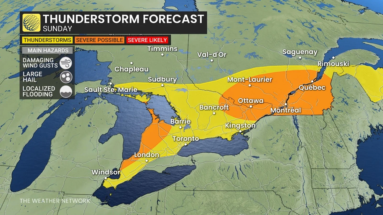
The main concern here will be localized flooding, as well as the risk for large hail and strong wind gusts.
A much more potent setup will build in eastern Ontario and southern Quebec, where a warm front will provide a boost and focus for strong to severe thunderstorms to develop.
Storms here are expected to develop in the afternoon and stretch into the evening hours.
The main risk will be damaging wind gusts of 110 km/h and nickel sized hail. Rotation can’t be ruled out. Localized flooding is possible due to the rich reserve of moisture available for storms to tap into.
Be sure to check back for all the latest forecast information in your area.
Header image submitted by Krista B.
WATCH: How flash floods are influenced by the terrain