Today’s Forecast:
HOUSTON – Winds are breezy as a cold front continues to move away from Texas, we’ll stay cool in the 40s and even some upper 30s through most of Monday morning.
However, a high-pressure system will switch winds back to the SE and give us a 22-degree temperature jump by Thursday.
Tracking your morning lows (Copyright 2025 by KPRC Click2Houston – All rights reserved.)Monday’s Forecast:
Monday bundle up, temperatures only in the 40s across Houston and even colder north of I-10, some communities waking up to the 30s.
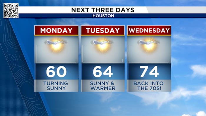
By the late afternoon and evening, daytime highs reach the upper 50s to low 60s, with plenty of sunshine.
Monday chilly start with a pleasant afternoonLooking ahead: Gradual warming by the end of the week
Temperatures will be on a roller coaster as a series of fronts move through this week.
Next Three Days (Copyright 2025 by KPRC Click2Houston – All rights reserved.)
The next real cold snap arrives by next weekend with daytime highs only in the 50s!
Plenty of sunshine with up and down temperatures
Stay up to date with the latest changes using Storm Tracker 2 radar and regular updates from the KPRC 2 Weather Team on Click2Houston.
Copyright 2025 by KPRC Click2Houston – All rights reserved.