I remember riding into Fort Worth as a kid from our sprawling home in Cleburne, pressing against the car window and marveling at the city’s scale. My gaze always settled on the brick patches near the Stockyards, then farther west on Camp Bowie Boulevard. At the time, I thought it odd that these stretches hadn’t been replaced with a smooth blacktop. Now, returning years later, I can say I’m glad they haven’t. Those bricks carry history beneath every tire, every footstep.
A quick glance at historicfortworth.org and campbowiedistrict.com revealed a history of Camp Bowie I’d never stopped to ponder — one that blends urban growth, military legacy, and the everyday life of a city expanding westward. The private, member-funded nonprofit Camp Bowie District has spent the past 25 years revitalizing the boulevard and its surrounding side streets. In a City of Fort Worth newsletter, Lydia Guajardo Rickard, the district’s executive director, said, “In the early 1900s, the whole area from Montgomery Street all the way to the interstate was called Chamberlain Arlington Heights and was a suburb of Fort Worth. Named after a nearby World War I military training camp, Camp Bowie was the original connector to downtown. It was also the original highway connecting the western part of the city to the Central Business District.”
That military camp looms large in the boulevard’s story. In 1917, construction began on Camp Bowie, a tented training facility named after Texas Revolution hero James “Jim” Bowie. Spanning over 2,000 acres, it housed the 36th Division, whose soldiers lived side by side with Fort Worth residents. On April 11, 1918, the division marched through the city in what may have been Fort Worth’s largest public gathering — 225,000 people lining the streets to watch a four-hour procession. After months of training and deployment to France, the camp became a demobilization center, ultimately discharging more than 100,000 soldiers before closing in August 1919. Today, Veterans’ Memorial Park at Camp Bowie and Crestline Rd. commemorates those who trained there, planted by both local and international groups.
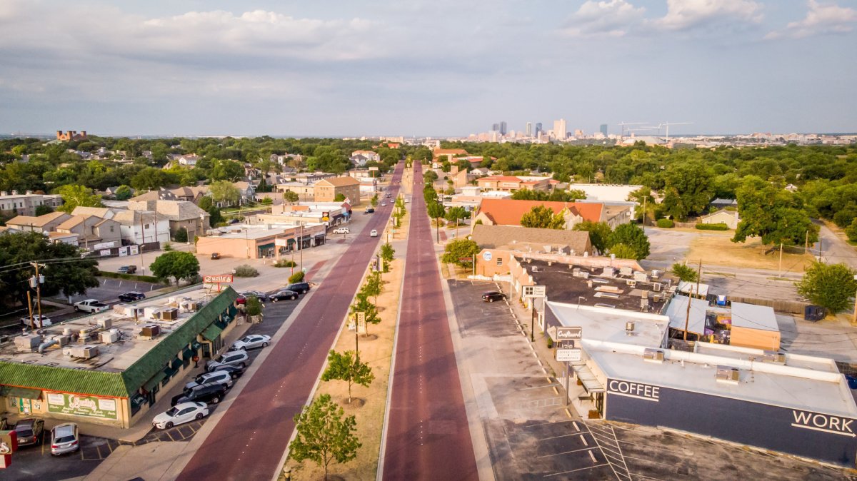
Even before the war, Fort Worth had begun building the infrastructure that would define its westward growth. Vitrified clay bricks — fired at high temperatures for durability and glazed to resist water — paved streets like Camp Bowie Blvd. These bricks weren’t just functional; they symbolized a city carving itself out “where the west begins.” Today, Camp Bowie Boulevard preserves that legacy: a corridor of red Thurber bricks whispering tales of soldiers, trolleys, and neighborhoods over a century old.
The boulevard was initially planned in the 1890s by the Chamberlin brothers — Alfred, Humphrey, and Frederic — with trolley tracks running down the center, linking the city to Lake Como and the surrounding suburbs. By the early 1900s, the street was platted and ready for growth, soon becoming a hub for families moving westward. After the war, middle- and upper-middle-class families filled the former military grounds with bungalows and English-cottage-style homes, and the boulevard became a lively commercial corridor. Landmarks like Arlington Heights Methodist Church, Connell Baptist Church, Fire Station No. 18, and Zeloski’s commercial row sprung up along the boulevard’s lines.
In 1919, the Federation of Women’s Clubs renamed the street Camp Bowie Boulevard to honor the nearby military camp. By 1928, Thurber bricks paved the thoroughfare as we know it today. Beneath the surface, remnants of the streetcar system that once ferried passengers downtown still exist, a hidden testament to a bygone era. Even as asphalt replaced historic brick streets elsewhere, Camp Bowie preserved its red-brick identity — a contributor to the proposed Brick Streets National Register Thematic Group.
Westward expansion continued to shape the boulevard. By the late 1920s, the Ridglea neighborhood emerged, blending residential and commercial development. The Luther brothers introduced Ridglea Village in the 1940s, a mixed-use Mediterranean complex of retail, offices, and homes. Over decades, the corridor extended toward Weatherford, lined with hotels, restaurants, and theaters, cementing its role as a gateway to western Fort Worth.
Today, the historic 3-mile stretch from Montgomery to Hulen streets — affectionately called “The Bricks” by locals — remains a unique combination of original red Thurber bricks and modern Acme replacements. The road is undeniably bumpy and noisy, but that’s part of its charm.
Those bricks have endured a century of heat waves, ice storms, flash floods, even a tornado, plus shifting tree roots. Their durability — along with intentional preservation — has ensured they remain, even though the Thurber Brick Plant closed in 1931.
Maintaining the bricks is a challenge, one many, if not all, Fort Worthians embrace. The roadway tells the story of Fort Worth’s evolution: soldiers marching in formation, families shopping and dining, congregations gathering.
And for anyone who drives its uneven, clattering stretch, the message is clear: these bricks are more than pavement. They are history, resilience, and identity — proof that some roads, no matter how old, never lose their rhythm.