Saturday is your day to prepare for snow. Break out the snow shovel, fill up the gas tank, get some groceries, and fire up the snow blower. Sunday will start with some early snow but it will stop early. The winds and biting cold will also prompt you to get the heavy winter gear out.
Weekend Snow! Our NEXT big weather change
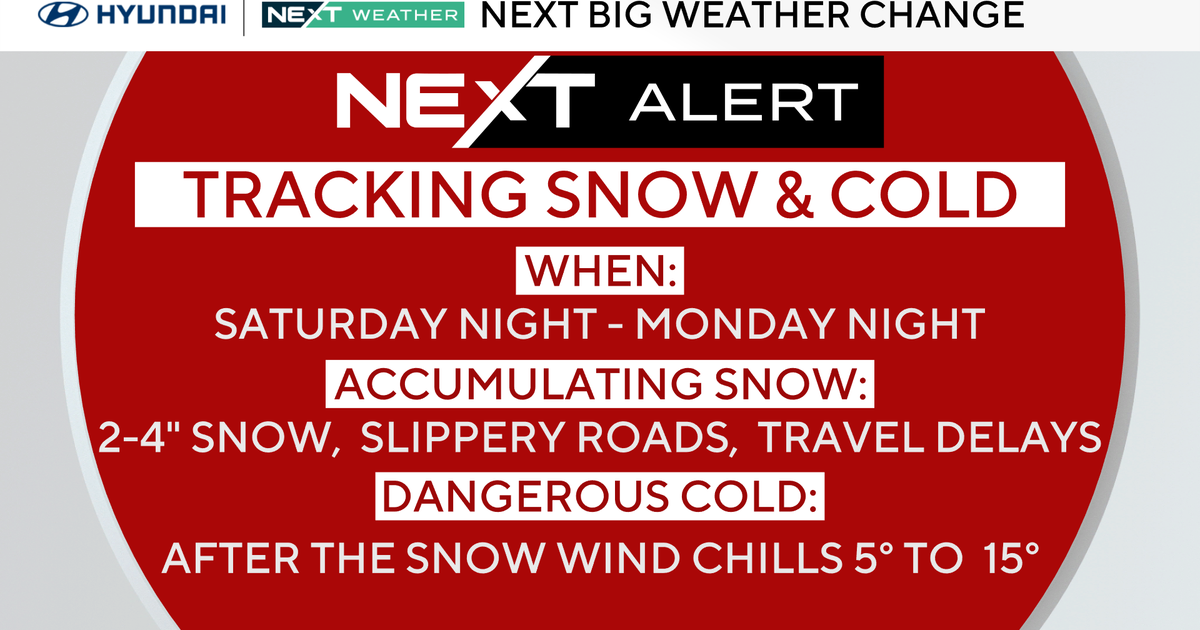
This will be the first measurable snow for most areas. Philadelphia could see anywhere between 2 to 4 inches.
Light snow will begin to develop Saturday after 8 PM. Accumulating snow is likely for the entire area. There may be some cold rain or a mix at the onset, especially at the coast.
The snow increases late Saturday night and tapers off after daybreak Sunday. The final snow amounts will depend on where the low pressure develops.

CBS News Philadelphia
Bonus big change
Our coldest push of Arctic air arrives on NW winds behind the storm on Sunday.
The Eagles game will be bitterly cold by kickoff and getting colder by the final play.
Monday will be the coldest day yet. Temperatures will fall into the 20’s and winds will create a feel-like in the teens and single digits through Monday.

CBS News Philadelphia
Looking ahead
We slowly warm after Monday with the first temperature above average and the first 50’s since before Thanksgiving arriving by Friday.
REMINDER: we are still in fall. It’s not winter yet. The winter solstice begins Dec. 21.
Here’s your 7-day forecast:

CBS News Philadelphia
Saturday: Clouds and snow at night. High 44, Low 25.
Sunday: NEXT Weather Alert for morning snow. High 31, Low 28.
Monday: NEXT Weather Alert for bitter cold. High 31. Low 18.
Tuesday: Bitterly cold. High 36, Low 21.
Wednesday: Slightly bitter. High 45, Low 26.
Thursday: Milder. High 55, Low 32.
Friday: Mild. High 45, Low 42.
More from CBS News