All year we have covered the stories that matter most to San Antonio, at no cost to you or the community. Your support fuels our work.
Will you help us make our $95,000 year-end goal to keep us going?
After years of regulatory filings, public hearings and political pressure, the proposed Guajolote Ranch development — a 2,900-home project with a new wastewater treatment plant in northwest Bexar County — is approaching a critical point.
State regulators face a Dec. 22 deadline to decide whether they will reconsider the project’s wastewater discharge permit, while San Antonio officials prepare to review a new petition to create a municipal utility district that would finance the development’s infrastructure through higher property tax rates.
The two decisions — one at the Texas Commission on Environmental Quality and one at City Hall — will determine whether the project moves forward with construction projected to begin early next year or enters yet another round of legal and procedural challenges.
On Oct. 22, the TCEQ approved a permit allowing Municipal Operations LLC, the wastewater operator for Lennar Corp., the home developer behind Guajolote Ranch, to discharge up to 1 million gallons of treated effluent or wastewater per day into a dry creek bed upstream from the headwaters of Helotes Creek, which flow into the Edwards Aquifer recharge and contributing zones. That permit also allows up to 4 million gallons of treated effluent to be dumped into the creek bed on peak days.
Soon after, opponents of the project filed a 115-page motion for rehearing with TCEQ; at the time of publication they have not received a response.
Guajolote Ranch has become the focus of the long-running dispute. Opponents argue the permit fails to account for how water moves underground in this part of northwest Bexar County, where the Helotes Creek watershed sits atop fractured karst limestone, allowing water — and anything dissolved in it — to move rapidly underground. The area is a part of the Edwards Aquifer recharge zone.
 A rock with visible holes collected downstream from the proposed wastewater discharge site, characteristic of the porous karst terrain in northwest Bexar County. Credit: Diego Medel / San Antonio Report
Although those concerns center on how pollutants might move underground, the TCEQ permit does not evaluate groundwater pathways. Under Texas law, wastewater discharge permits are evaluated under surface-water quality standards and do not require analysis of groundwater flow or subsurface transport.
For residents who live along the corridor, that omission feels deeply personal. Many rely on shallow Trinity Aquifer wells and say the area’s hydrology makes it uniquely vulnerable.

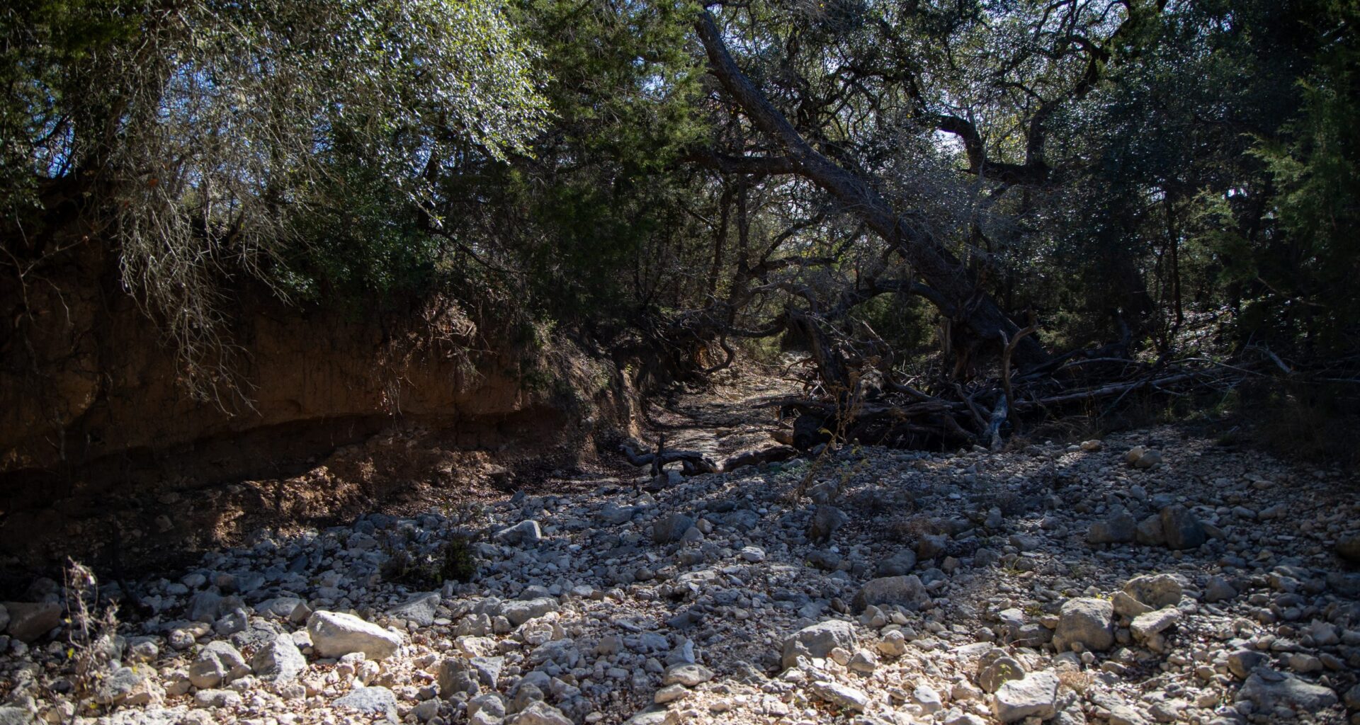
On Wednesday, members of the Scenic Loop–Helotes Creek Alliance walked the dry draw directly downstream from the discharge point. Many families have lived along the corridor for generations and say turning a normally dry channel into a wastewater outlet could permanently alter both the landscape and the groundwater that they depend on.
“This is nothing more than a runoff,” said Lynette Toepperwein Munson, who says her family has lived on adjoining land for more than 140 years. “If it rains, you’ll see the runoff. Once the runoff is done, this creek is dry. There’s never been active water over here.”
Munson said many neighboring properties rely on shallow wells in a highly fractured, porous karst environment where water, and anything dissolved in it, can move rapidly underground.
“We’re on wells out here. Some of them aren’t very deep. Mine’s less than 300 feet — I have no filtration,” she said. “I don’t even have the limestone and sand layers that some of the deeper wells have. Because mine’s so shallow, any groundwater leaching, stuff like that, is going to go straight into my pool sooner than later.”
 Lynette Toepperwein Munson speaks with Grey Forest City Council member Michael Phillips in a dry creek bed on her family’s property downstream from the Guajolote Ranch development in northwest Bexar County on Dec. 10. Credit: Diego Medel / San Antonio Report
During heavy rain, residents say the creek bed can shift from dry to flowing within minutes before draining back underground just as quickly — a pattern consistent with rapid recharge conditions.
Her worries reflect a broader scientific debate that has hovered over the project since its initial phases in 2019: whether discharged wastewater in this part of the Edwards Aquifer contributing zone can move through the fractured limestone beneath the creek bed and reach the Edwards Aquifer — the primary drinking-water source for more than 2 million people and the source for nearly 50% of the water used by San Antonio Water Systems (SAWS).
Opponents of the development, which was proposed in 2021, frequently point to a 2020 study conducted by the Southwest Research Institute to evaluate the impact of wastewater systems on Edwards Aquifer. In the press release for the study Dr. Ronald Green, SwRI technical advisor and project manager, states that the results, “predicted that installing additional wastewater systems in the region, regardless of type, would increase the amount of wastewater discharged to the environment and significantly degrade the watershed and the quality of water recharging the Edwards Aquifer.”
On Thursday, officials reviewed a Council Consideration Request at the City Council’s Governance Committee on the development’s water contract and the agency’s assessment of risks to the aquifer.
SAWS senior vice president Donovan Burton told council members the utility believes “a lot of the risks have been significantly mitigated” through terms negotiated into the water service contract.
“We don’t see a significant threat to the aquifer. Certainly, we’re not going to say that there can’t be any water at all [that] gets into the Edwards aquifer, and any water is concerning. To some extent,” he said. “We’re required to provide good, pure drinking water to our customers, and at this point we don’t see a significant threat from this particular development as it stands today.”
When questioned by Mayor Gina Ortiz Jones over the findings of the SwRI study, Burton cited major differences in what SAWS sees and what the study reports, including the mapping of the underground geology of the aquifers at the Haby fault.
Burton said the area where water could possibly enter would be in the upper Trinity aquifer before going through the fault, if the water did move through the Haby fault it would go into “a very dense area of the Edwards Aquifer.”
”I’m trying to avoid speaking in blanket. I can’t say that there won’t be a drop again that could get over there,” he said.” But we think largely that that water will not cross into the Haby fault, through that dense layer of Edwards to get into that area.”
Burton also addressed dye-tracer work that he said was used in the SwRI study.
“That was done at a time where the particular well that they put dye trace into was drilled into both formations, the Trinity and the Edwards Aquifer, and so there was dye found in both of these aquifers. They assumed they were mixing, but actually they weren’t blocked off,” he said. “they were [later] blocked off from the various layers, and so that water going into the well wouldn’t give into both aquifers.”
Opponents of the project dispute that interpretation. In multiple filings — including the rehearing request submitted last month — the Greater Edwards Aquifer Alliance, the City of Grey Forest, the Scenic Loop–Helotes Creek Alliance and State Sen. Donna Campbell (R–New Braunfels) point to the SwRI study and other hydrological research as evidence that the subsurface beneath Helotes Creek is more interconnected than SAWS contends.
Campbell, whose Senate district includes the proposed development, wrote in a Dec. 2 letter supporting the rehearing request that the SwRI findings “have not been refuted,” citing what she described as “well-documented hydrological connectivity between the Trinity Glen Rose and Edwards aquifers.”
On the ground, Munson echoed that sentiment as one of her biggest frustrations that she continues to deal with as proceedings unfold.
“I don’t have a great answer, because nobody’s given us a great answer, why are we discounting the science. The City of San Antonio commissioned that study from Southwest Research. So why, all of a sudden, is the science no longer good? It was good five years ago and it was a two-year study,” she said. “There’s somebody up there saying, ‘Nope, it’s not going to do this.’ Well, where’s the science? We have the science that says, don’t do this.”
Beyond questions about groundwater movement, opponents have also raised concerns about how wastewater plants operate in practice — pointing to compliance records they say undercut claims that the proposed facilities pose little risk.
In an Oct. 19 interview on The Source on Texas Public Radio, David Grove, Lennar’s regional president for Texas, said there are already wastewater treatment plants operating “safely and effectively today within the contributing zone” of the Edwards Aquifer, where Guajolote Ranch is located.
Members of the Scenic Loop–Helotes Creek Alliance reviewed federal Enforcement and Compliance History Online (ECHO) records maintained by the U.S. Environmental Protection Agency for wastewater treatment plants in the contributing zone that Lennar and its representatives have cited as examples. The San Antonio Report independently verified those records.
Of the 14 facilities for which EPA compliance data was available, seven had at least one quarter within the past three reporting years classified as “violations identified” under the federal Clean Water Act, according to the ECHO database.
The documented violations included exceeding the amount of pollutants — E. coli, ammonia, nitrogen, phosphorus and total suspended solids — that opponents argue carry heightened risk in areas where surface water can rapidly move underground.
Opponents also point to SAWS own regulatory history as evidence that compliance issues are not hypothetical. In 2013, the U.S. Department of Justice and the Environmental Protection Agency reached a settlement with SAWS over Clean Water $1.1 billion in system upgrades and to pay a $2.6 million civil penalty.
The complaint alleged that between 2006 and 2012, SAWS had approximately 2,200 illegal overflows from its sanitary sewer system that discharged approximately 23 million gallons of raw sewage into local waterways in violation of its CWA discharge permit.
Michael Phillips, a council member for the City of Grey Forest, which sits downstream from the proposed development, said the settlement and complaint against SAWS inspires little confidence in their promise of mitigating risks.
“For them to say, ‘don’t worry, this is not going to be a big deal.’ It’s laughable,” Phillips said.
 A banner with the name of the developer for the proposed Guajolote Ranch project crossed out outside the City of Grey Forest in northwest Bexar County. Credit: Diego Medel / San Antonio Report
As the Dec. 22 deadline for the Texas Commission on Environmental Quality to grant a rehearing or allow the wastewater permit to stand approaches, a separate decision-making process is unfolding at City Hall.
Although Guajolote Ranch lies outside of San Antonio’s city limits, the project is located within the city’s extraterritorial jurisdiction, or ETJ, which is the unincorporated land surrounding the city where San Antonio has limited authority over development that could affect public services, infrastructure and environmental quality within city boundaries.
That authority now places the project before the council.
In November, the developer submitted a petition seeking the city’s consent to create a municipal utility district, or MUD, to finance infrastructure for the development, including the wastewater treatment plant. MUDs are special-purpose governmental entities that can issue bonds to pay for infrastructure, with the debt repaid through higher property taxes assessed on future residents within the district.
Under state law, the city has 90 days to act on the petition. City staff told council members this week at the governance meeting that the item must be considered by early February, with a tentative council vote scheduled for Feb. 5.
If City Council approves the petition, the MUD would move forward to additional state approvals. If the city denies the request or takes no action, the developer could seek alternative service arrangements or pursue approval through the state — potentially triggering another round of negotiations or legal challenges.
At a Nov. 25 Southern Edwards Plateau Habitat Conservation Plan Coordinating Committee meeting, a representative from Lennar Corps. told committee members they plan to begin clearing land for the first phase of development in January or February.
Meanwhile, Philips said the alliance is prepared to take the permit to the Travis County district courts if the rehearing request is not approved.
“Once that date passes, if they then say ‘boom, that’s the final say on the matter,’ then that’s our signal to file a motion in the district courts.”
Are you doing your part?
You’ve read unlimited of unlimited articles this month. That’s right — we’re committed to providing free, fair journalism for all.
But without donor support, our nonprofit newsroom can’t do its job to inform and empower your community.
Are you in? Your donation of any amount will help keep articles like this one accessible to all San Antonians.