Use the extra time of a holiday weekend for a quick jaunt in Leucadia — one that offers coastal views and a couple tough uphill climbs.
This roughly 1-mile moderate loop near the northern end of Indian Head Canyon only took me about half an hour, but there is a larger 6.5-mile network of trails within the canyon to be explored next time. It felt like an ideal workout to squeeze in after work — and though there was a bit of marine layer impacting my view of the ocean, I can imagine it would be a quintessential San Diego scene on a clear day.
According to signage at the trail, the canyon got its named in the 1940s from school children who searched for arrowheads there. The Kumeyaay people lived in the region for thousands of years before Spanish colonizers arrived, and used both stone and wood arrowheads to hunt.
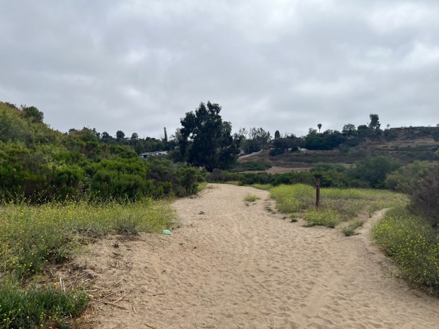 Hikers begin by heading southwest on a sandy path. (Maura Fox / The San Diego Union-Tribune)
There are a few different trailheads to begin your hike in the canyon. I began by parking at the trailhead on Quail Hollow Drive, just east of Saxony Road. Only street parking is available, but I didn’t have any trouble finding a spot for my mid-week evening hike.
The trail is marked with an informational sign, and there are also some benches and a gazebo near the trailhead, which would make for a nice spot to hang out for a snack before or after the hike.
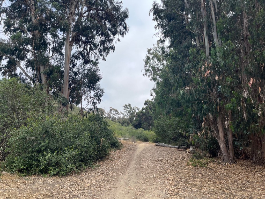
I chose to begin hiking southwest on the wide, sandy trail. It’s always tougher to hike through sand, so I was relieved that this section lasted only a short while before the trail hardened up and headed toward shady eucalyptus trees.
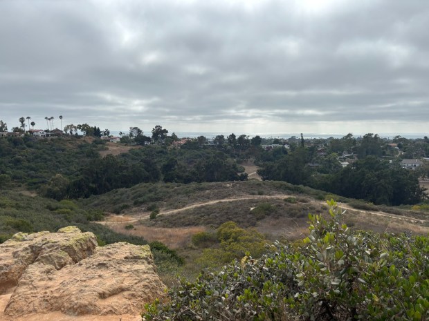 The view from the summit in Indian Head Canyon. (Maura Fox / The San Diego Union-Tribune)
At the 0.3-mile mark, the trail starts to incline. Hikers can choose to continue on the wide path as it heads north, which is lined with a wooden fence and provides nice views of the nearby neighborhoods and coast. But I saw an even steeper hill on the righthand side of the trail, going south, so I followed that. While I later learned that both trails connect to the summit, in the moment I thought it was my only chance to get to the viewpoint.
It’s a climb for the next 0.2-miles. I then spotted a narrow path off to the left side of the trail, which required some mild rock scrambling before ultimately reaching the summit.
After taking in the landscape — the Pacific Ocean to the west and Batiquitos Lagoon to the north — I followed the trail off the summit. There is a very steep and slippery descent off the mountain, so it’s important to wear sturdy shoes with good traction on this hike.
It’s a short descent, though, and once at the base, hikers can simply follow the dirt trail west back to where they began.
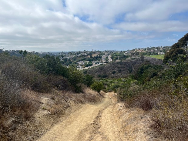 The descent off the mountain top is steep, and hikers should be sure to wear shoes with good traction to not slip. (Maura Fox / The San Diego Union-Tribune)