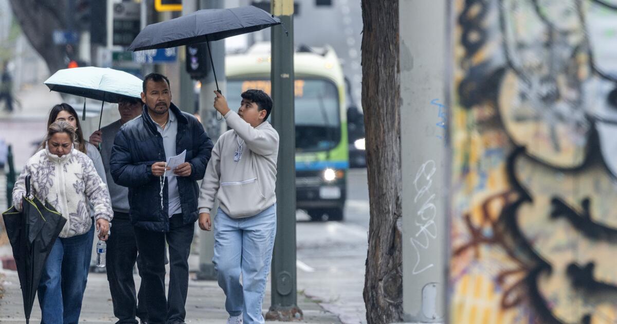
A major atmospheric river storm walloping the state with heavy rains, strong winds and major snow is making its way to Southern California, bringing what forecasters say is likely to become the region’s worst Christmas storm in recent memory.
“This is a long-duration event, so we’re going to be having the cumulative effects of rain,” said Ariel Cohen, a meteorologist at the National Weather Service’s Oxnard office. He said there was a high potential for widespread, life-threatening flooding as well as dangerous rock and mudslides, among other risks.
“It might be best to stay indoors during this event,” Cohen said. “This is a lot of rain that’s going to stack up over multiple days.”
Although rains are expected to intensify throughout the day Tuesday and into the night, concerns over serious flooding are focused on Wednesday — Christmas Eve — as rainfall totals increase, he said. Flooding risks could even stretch through Saturday, as the chance for rain will linger until then.
“It’s going to take less and less rain for there to be more and more impacts as the week progresses,” Cohen said.
The storm already has caused dangerous flooding across Northern California, leading to at least one death, and officials warn that the storm is just getting started.
Most of the state remains under a several-days-long flood watch, and on Tuesday morning, Southern California officials started issuing evacuation warnings and orders for residents near recent burn scars, including from the Palisades, Eaton, Kenneth, Bridge, Agua Dulce, Lidia, Canyon, Sunset and Hurst fires.
Officials across Los Angeles County are working to directly contact residents of almost 400 homes, many near the Palisades and Eaton fire burn scars, to order them to leave immediately due to a heightened threat of debris flows and rock- and mudslides.
“It’s important we stay alert, stay vigilant and keep each other safe,” L.A. County Supervisor Hilda Solis said at a news conference about county preparations Tuesday.
At a public works yard in Altadena, cars lined up at a building as workers in neon high-vision vests loaded sandbags into trucks beds and hatchbacks.
Officials warned residents in the fire-torn community to be ready for flash flooding and debris flows, and emergency personnel were on standby to facilitate evacuations for residents living near the burn scar of January’s Eaton fire.
For those staying put, preparing for disaster has become second nature.
Pasadena resident Jim Seraco grabbed a few bags Tuesday afternoon to line his cellar, which flooded in a storm last month.
“It’s better to be prepared than not,” he said.
Foothill communities always take on some risk of mudslides during a storm, but those risks increase after a wildfire wipes out the plant material that holds the earth in place.
Los Angeles Mayor Karen Bass underscored that message at a separate news conference Tuesday afternoon.
“My message to Angelenos as we go into the Christmas holiday is to stay safe, be prepared and stay informed,” Bass said.
The National Oceanic and Atmospheric Administration’s Weather Prediction Center elevated the flash flood risk to high for Wednesday across a large swath of southwest California, particularly the southern slopes of the Santa Monica, San Gabriel and San Bernardino mountains. Much of the L.A. Basin, as well as Santa Clarita, Thousand Oaks, San Bernardino and Santa Barbara, are included in that high-risk zone, the agency said.
“We could see widespread flash flooding,” said Kristan Lund, a meteorologist with the National Weather Service in Oxnard. She warned that the heavy rains over such a long period probably would cause a slew of hazards, including cars being swept away, structures taking on water, trees being downed and power going out, plus travel delays — both in the air and on the road.
Key Messages for the Atmospheric River affecting California and adjacent areas have been updated. There is a HIGH RISK of flash flooding Wednesday along the southern slopes of the Transverse Range just outside Los Angeles. Find your local forecast at https://t.co/pGx1JRZLBI. pic.twitter.com/9WajjzjReF
— NWS Weather Prediction Center (@NWSWPC) December 22, 2025
On Sunday, one person died in rising waters as flooding overwhelmed parts of Redding, according to city officials. The mayor reported that police officers tried to save a person in a vehicle as the waters rose around them but they did not make it out in time.
In Placer County, a harrowing video has gone viral of officials helping evacuate a family, including a baby in a carseat, from a home near the rapidly rising Yuba River on Monday.
And officials in Shasta County on Monday declared a state of emergency “due to flooding across numerous … communities” and several more days of forecast storms.
More than a foot of snow had already fallen in parts of the northern Sierra by Monday evening, and officials are warning that travel in and around the mountains will become “difficult to impossible.” Up to 5 feet of snow is forecast for some parts of the Sierra Nevada.
Although snow will be less of a concern in the Southern California mountains for the early part of this week, some ski resorts are forecast to see some fresh powder by Christmas Day. By the weekend, though, the San Bernardino and L.A. County mountains could get several inches of snow.
Severe thunderstorms are increasingly possible Wednesday, particularly in the San Francisco Bay Area, Central Coast and Central Valley, where the weather service warned that there’s also a small chance for tornadoes to develop. Thunderstorms will remain a possibility in Southern California through at least Thursday, which could bring locally heavy pockets of rain and high winds.
Much of the state remains under a high-wind warning, with a chance for winds up to 50 to 80 mph across the Southland from Tuesday through Thursday.
What to expect, and when
Southern California’s coastal areas and valleys are forecast to get 4 to 6 inches of rain from Tuesday through Saturday. In the foothills and mountains, totals will reach even higher, up to 10 inches of rain over the five-day period.
Good afternoon!!!!
Strong #SoCal storm over the Christmas holiday.
– Rain Tue-Sat
* Heaviest Tue Night-Wed
– FLOOD WATCH Tue Afternoon-Wed Evening
* All 4 counties
* Debris flows and widespread urban flooding possible
– Gusty SE winds Tue-Wed#CAwx pic.twitter.com/RRR7QfQaiE— NWS Los Angeles (@NWSLosAngeles) December 21, 2025
Tuesday evening into Wednesday morning: This will be the first burst of heavy rainfall with a chance of thunderstorms, though flooding shouldn’t be an immediate concern. High winds and extreme rain rates are possible.
Wednesday during the day: There could be a bit of a lull between bands of heavy rain.
Wednesday evening into Thursday morning: A second belt of heavy rainfall is expected across Southern California, increasing chances for urban flooding, debris flows and mudslides, especially in burn scars but also across many mountain passes.
Thursday: Continued, heavy rainfall is expected, with ongoing concerns about flooding.
Friday and Saturday: There will still be a chance for additional rainfall and showers, adding to already high rain totals. Dropping temperatures are forecast to bring several inches of snow to Southern California mountains.
How to prepare and stay safe
The California Governor’s Office of Emergency Services and local governments are working to predeploy resources, including air and ground vehicles from the California National Guard, for emergency support and rescue operations, according to the governor’s office.
Officials say the best way is to stay safe is to stay home, if possible, and keep off the roadways, especially away from any flood control channels, catch basins, canyons or natural waterways, which can be vulnerable to flooding.
It’s also important to have multiple avenues to receive emergency alerts, including information about evacuation warnings and orders.
Residents in low-lying areas can set up sandbags, which are being distributed across L.A. County on Tuesday at a variety of locations. More details can be found here.
Times staff writer Noah Goldberg contributed to this report.