Let it snow, let it snow …
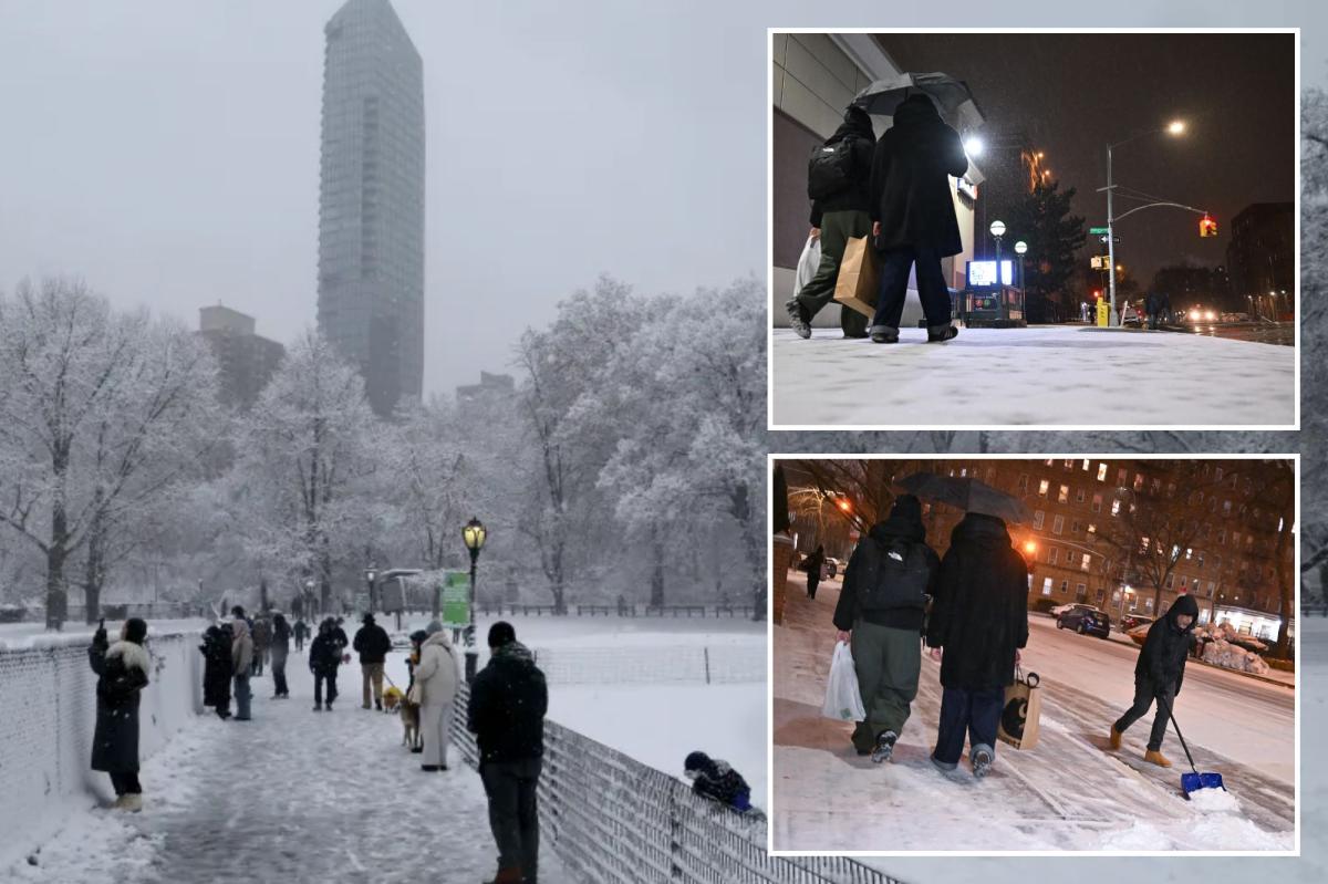
New York will get walloped by its heaviest snowstorm in years — with some parts of the Big Apple expected to see as much as 11 inches, forecasters and officials said.
More than half of the Empire State was placed under a state of emergency as the white stuff started falling just before 5 p.m. on Friday.
New York is expected to get blanketed with up to 10 inches of snow starting later Friday, the most in nearly four years. Luiz C. Ribeiro for NY Post
The storm was then expected to intensify, with more than two inches set to fall per hour at times, according to the New York National Weather Service (NWS) — which issued a weather storm warning for the the city from 4 p.m. Friday through 1 p.m. Saturday.
“New Yorkers should prepare for a significant snow event, beginning this afternoon and continuing into Saturday. Our current forecast is telling us we could get a range of 6 to 9 inches of accumulation citywide, and could be even more in Northeast Queens and northern New York City,” Mayor Eric Adams said Friday.
Should the Big Apple be blanketed with 9 inches, the snowfall would be the most since a whopping 16.8 inches in Central Park across two days in late January into February 2021, Accuweather told The Post.
The last time a storm came close to dropping that much snowfall was back in 2022, when 8.5 inches fell.
The snow is expected to start falling in the city around 5 p.m. in a massive storm that has left more than 60 million Americans facing winter weather alerts a day late for a white Christmas. Paul Martinka
That’s still a far cry from any records, however. The most snowfall New York City has ever seen on Dec. 26 was way back in 1947, when the city was hammered with 26.1 inches.
Northeast Queens was expected to get the biggest dump in Friday’s storm — with as much as 11 inches predicted for the sections of the World’s Borough, Adams said.
Parts of the Bronx could get almost 8 inches, with some of Brooklyn, including Gravesend and Sheepshead Bay, seeing around 6.6 inches, according to the NWS’ precipitation portal.
Fox Weather Centersays that winter weather alerts are in effect across the state of New York. FOX Weather
Upstate could get covered in as much as 10 inches, the NWS said, noting that areas like Kerhonkson in Ulster County were forecast to get some of the storm’s worst.
The impending snow threatened to disrupt post-Christmas travel, with cancellations already slamming Big Apple airports.
John F. Kennedy International Airport and Newark International Airport had the highest number of canceled flights out of any airports in the US on Friday, with 122 and 61, respectively, according to FlightAware.
New York City Emergency Management issued a travel warning ahead of the storm, encouraging New Yorkers to bundle up and stay in. Paul Martinka
LaGuardia International Airport followed closely behind with 41 cancellations, and across all three airports, more than 100 flights had been delayed.
The severe weather warnings — paired with blistering, below-freezing temperatures — prompted Big Apple officials to issue an enhanced code blue for homeless New Yorkers.
“If you see someone in need of help, please call 311 or if it’s an emergency, call 911,” Emergency Management Commissioner Zachary Iscol said.
Weather warnings were also issued for New Jersey, Connecticut, and Pennsylvania. Areas in Long Island, including Glen Cove, Syosset, and Fort Salonga, were also expecting more than 8 inches of snow.
New York City Emergency Management issued a travel warning ahead of the storm, encouraging New Yorkers to bundle up and stay in.
Adams reiterated the message, advising to “use mass transit whenever possible. Wear warm clothing to enjoy the outdoors. Be careful when walking on the sidewalks, as they may be slippery.”
The MTA announced it was taking all-hands-on-deck preparations ahead of the storm.
Articulated buses were taken out of service and replaced by the 40-foot standard buses — 3,628 of which were outfitted with snow chains on their rear wheels.
Bus service could change depending on road conditions, though the MTA planned to launch snow-fighting vehicles on the routes to clear the path.
Crews will also be deployed throughout the city to monitor conditions and to ensure subway switches are working properly and that ice is clear from tracks and platforms, the agency said.
Snowfall across Brooklyn on Dec. 14, 2025. Paul Martinka
Snow covered street in the Kensington section of Brooklyn. Paul Martinka
Access-A-Ride, Long Island Rail Road and Metro-North Railroad service were set to run as regularly scheduled, the MTA said.
Sanitation employees across the city were working extended shifts to prepare for the storm, and began spreading brine on highways Friday morning.
More than 700 salt spreaders, along with snow plows, were on standby for the storm.
Travelers drive in the snow on the Prospect Park Expressway on Dec. 14, 2025. Paul Martinka for NY Post
New Yorkers will be able to track the status of snow plows in the neighborhoods, and bike lanes will be cleared simultaneously with roads.
“Every street is on a route, and unlike in past years, every route can be dispatched at the same time, bringing equity in snow clearance to the entire City,” the Department of Sanitation said in a statement, declaring a “snow alert.”
“New Yorkers should know: DSNY is working to ensure your safety. Do your part both for yourself and for the Strongest by staying off the roads during active precipitation or, if you absolutely must drive, by doing so slowly, safely, and carefully,” the statement read.
If travelling during the storm, New York City Emergency Management recommended packing an emergency kit with blankets, a flashlight, jumper cables, and a shovel.
“New Yorkers should all prepare — avoid driving if possible and give yourself extra travel time with public transit if you do need to travel, stay alert to changing conditions, and sign up for Notify NYC for real-time information updates,” Adams said in a statement.
— Additional reporting by Hannah Fierick