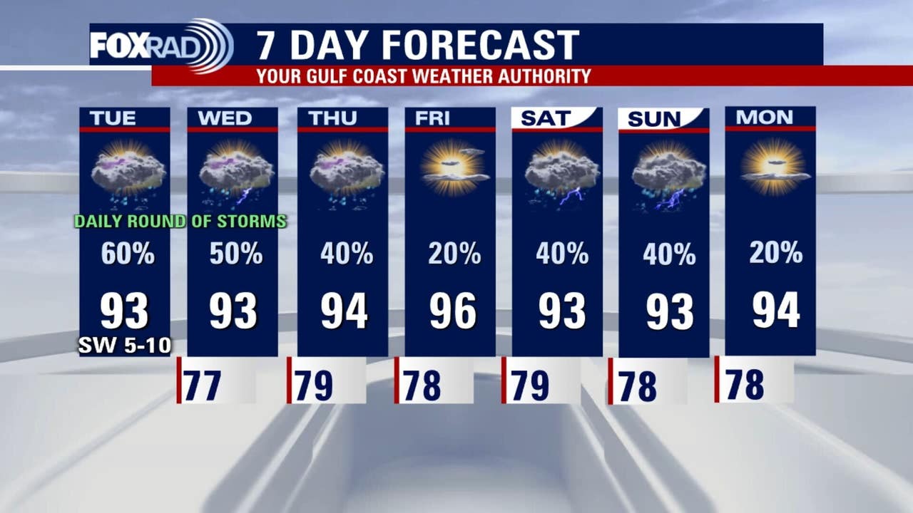
HOUSTON – Prepare for another round of rain in the Houston-area and a warm afternoon in the 90s.
Shower chances for Central Texas
There are no active Flood Watches in Hill Country as of this morning, but the Weather Prediction Center has outlined a 1/4 risk for isolated flooding in Central Texas today. Scattered downpours are possible through this evening for parts of the Texas Hill Country that have been ravaged by extreme flooding over the holiday weekend.
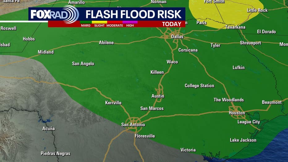
Rivers are now well within their banks and, in fact, most are close to the pre-flood levels, but any more intense rainfall could cause levels to rise again.
Humid, unsettled pattern
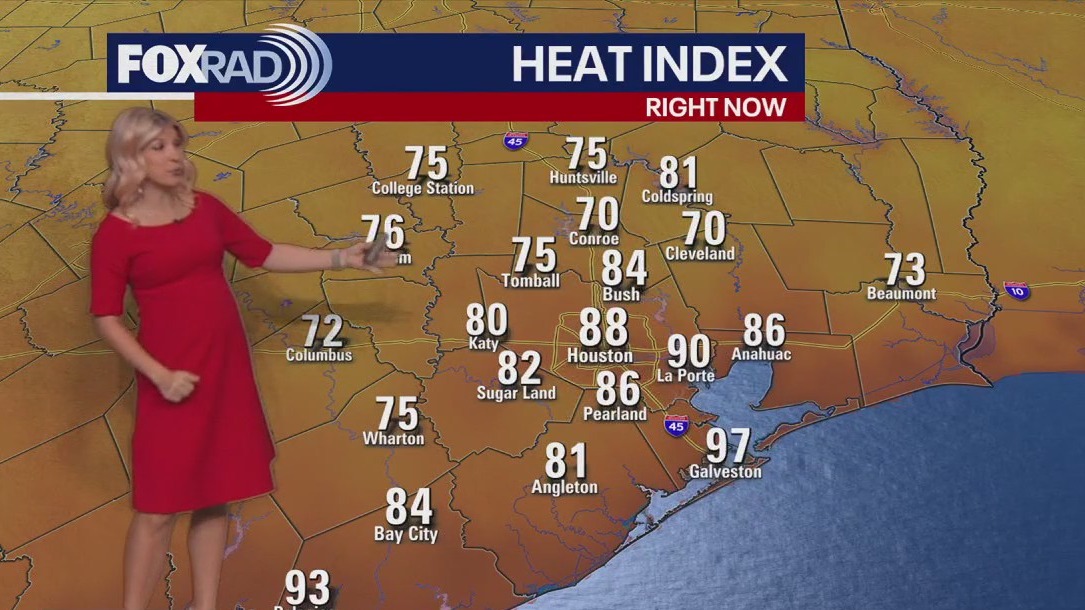
We are expecting a daily scattering of summer downpours in the greater Houston area today and tomorrow. Individual storms could drop a quick 1-2″ of rain each day. Widespread flooding is not expected, but isolated street flooding is possible.
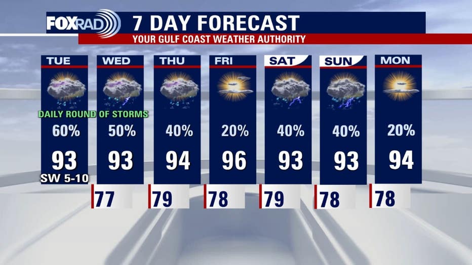
Please be careful and avoid any flooded areas. Late this week, the coverage of rain will decrease Friday and temperatures could rise into the upper 90s before scattered storms return for the weekend.
No tropical threats for now
Chantal is now a post-tropical cyclone and moving into the Atlantic Ocean. Chantal was the first U.S. landfall of the year.
Nothing else urgent is brewing in the tropics as of this evening and models aren’t showing threats for Texas over the next several days.
The Source: Your Gulf Coast Weather Authority