
COLUMBIA, S.C. (WIS) – Quiet conditions expected for the Midlands tonight as Chantal exiting farther to the north.
First Alert Headlines:
- Tracking drier, hotter conditions on Monday.
- The chance of rain and storms trends up later this week.
First Alert Summary:
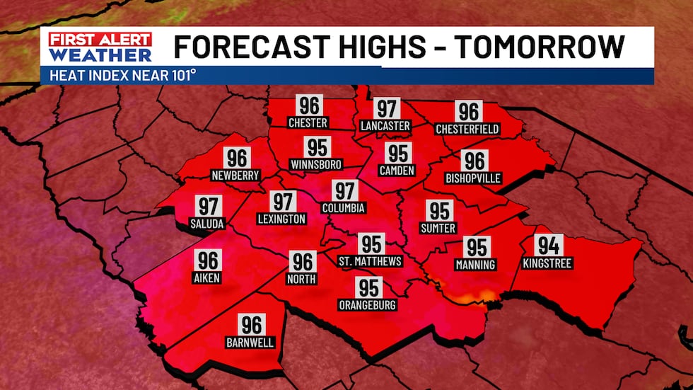
A mostly quiet, but hot start to the new work week is on tap for Monday. Temperatures are forecast to top out in the middle to a few upper 90s with heat index values near 100-degrees. There’s a slight chance of an afternoon shower, but rain chances are slim tomorrow (20%).
 wis(wis)
 wis(wis)
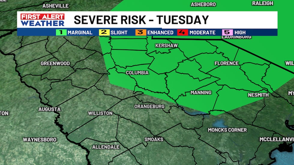
Tuesday will also be a steamy day with a slightly better chance of PM downpours or storms. The Storm Prediction Center has introduced a ‘Marginal 1/5 Risk’ for a portion of the Midlands. There could be a few strong storms Tuesday that could contain wind or hail.
 wis(wis)
Rain chances for the rest of the week will run a tad higher on a daily basis. Scattered showers and thunderstorms will be possible through the end of the week with temperatures closer to normal in the lower 90s.
 wis(wis)
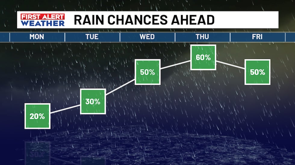 wis(wis)
First Alert Forecast:
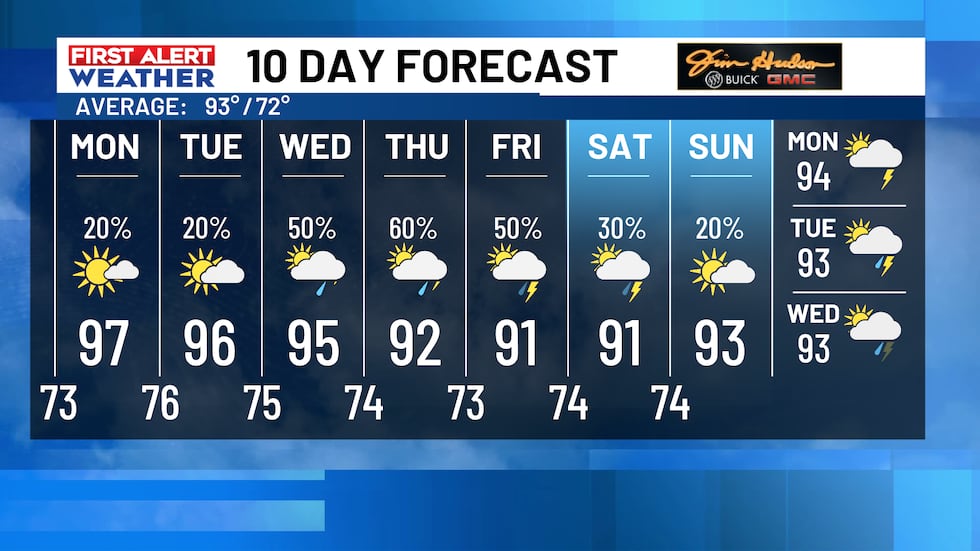
Today: Mostly sunny. High temperatures warming up to the middle to upper 90s. Stray PM shower.
Tuesday: Afternoon scattered showers and storms possible. High temperatures in the middle 90s.
Wednesday: 50% chance of scattered showers and storms. Highs in the middle 90s.
Thursday: 60% chance of scattered showers and storms. Highs in the lower 90s.
Friday: Chance of showers and storms. High temperatures in the lower 90s.
 wis(wis)
Feel more informed, prepared, and connected with WIS. For more free content like this, subscribe to our email newsletter, and download our apps. Have feedback that can help us improve? Click here.
Copyright 2025 WIS. All rights reserved.