Just two days after launch, Europe’s newest Earth observation satellite, Sentinel-1D, transmitted its first radar images, revealing key regions from the Antarctic Peninsula to Tierra del Fuego and the northern German city of Bremen. The satellite’s performance, described as unprecedented by ESA officials, marks a new step forward in rapid-response space monitoring.
The satellite, part of the Copernicus program, lifted off on November 4, 2025, aboard an Ariane 6 rocket from French Guiana. By the night of November 6, it was already capturing its first views over Antarctica, and by the following morning, it had imaged parts of Europe. These early results were presented at the European Space Agency’s Ministerial Council held in Bremen on November 26, highlighting both the technical reliability and environmental relevance of the mission.
Sub-two-day Delivery From Space to Screen
Equipped with a 12-meter synthetic aperture radar (SAR), Sentinel-1D adds high-resolution, all-weather imaging capability to Europe’s growing constellation. The ability to image through cloud and darkness makes it particularly valuable for polar regions. As mentioned by the European Space Agency report, the rapid transmission of these first images signals the shortest turnaround time from launch to data delivery for any ESA radar mission to date.
The Copernicus Sentinel-1D mission achieved full operational imaging capability just 50 hours after launch, a speed that ESA officials describe as “exceptional.” According to Nuno Miranda, Sentinel-1 Mission Manager at ESA, the quality of the images captured in this first acquisition phase is “unprecedented” for a newly launched radar satellite.
“Sentinel-1D achieved this in an even faster time, setting what we believe is a new record for space radar. This remarkable performance reflects the dedication and exceptional preparation of all the teams involved.”
Record-Breaking Turnaround for Space Radar
The satellite’s systems, including SAR and the Automatic Identification System (AIS) for maritime tracking, were activated shortly after orbital insertion. The first radar images were captured over the Antarctic Peninsula, Thwaites Glacier, and Tierra del Fuego on November 6, followed by a scan over Bremen six hours later. The data were then downlinked to the Matera ground station in southern Italy, part of the Copernicus Ground Segment.
ESA noted that even the previous high performer, Sentinel-1B, required two hours post-activation to deliver data, Sentinel-1D’s results arrived faster across all phases of initial operation. ESA’s Ramón Torres, Project Manager for the Sentinel-1 program, described the unveiling of these images as “an incredibly emotional milestone.”
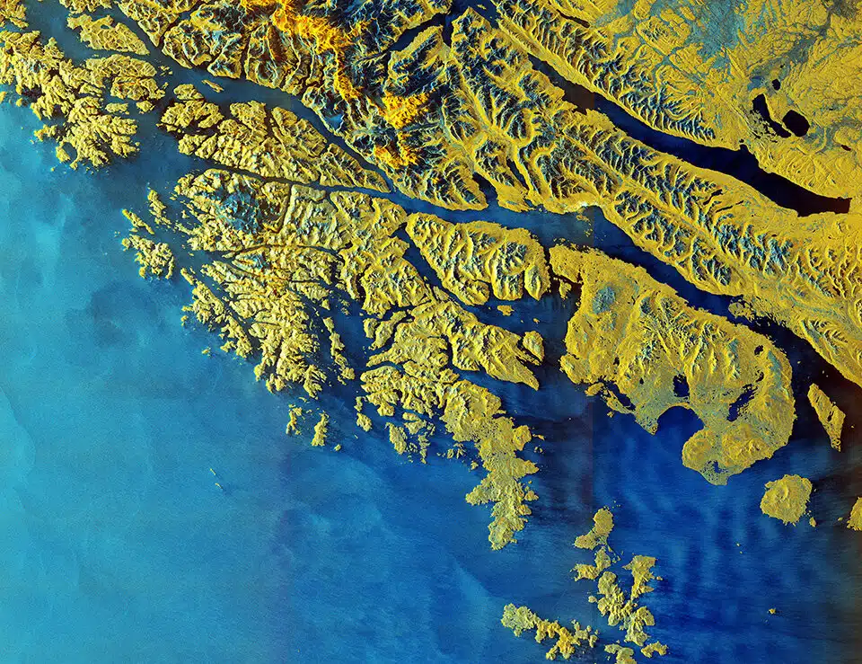 Tierra del Fuego by Sentinel-1D. Credit: ESA
Antarctica’s Images Show How Sensitive the Climate Is
The first images released by Sentinel-1D include sweeping views of the Antarctic Peninsula, a region long identified as particularly sensitive to climate change. The black-and-white radar imagery clearly shows the division between ocean and land, highlighting the peninsula’s ice-covered terrain. As stated by the ESA, the peninsula’s glaciers are smaller than those in East Antarctica but are melting more rapidly due to regional warming.
Sentinel-1D also delivered multi-polarization radar imagery of the Thwaites and Pine Island glaciers, two of the most unstable formations in the West Antarctic region. Thwaites, in particular, has become a focal point in climate monitoring due to its rapid retreat and potential contribution to sea-level rise.
The use of radar polarisations allowed the satellite to distinguish between glacier ice, sea ice, and open water, showing high-contrast tones of white, violet, and purple.
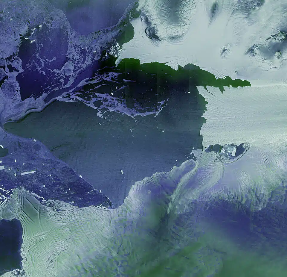 Thwaites and Pine Island glaciers by Sentinel-1D. Credit: ESA
Expanding Surveillance to the Southern Ocean
Sentinel-1D also showed what it can do at sea, using its built-in AIS system to spot ships near Antarctica. Even with clouds and during polar night, the satellite managed to pick up vessels using radar. ESA says this boosts the Copernicus program’s ability to track ship activity and watch for pollution in hard-to-reach areas.
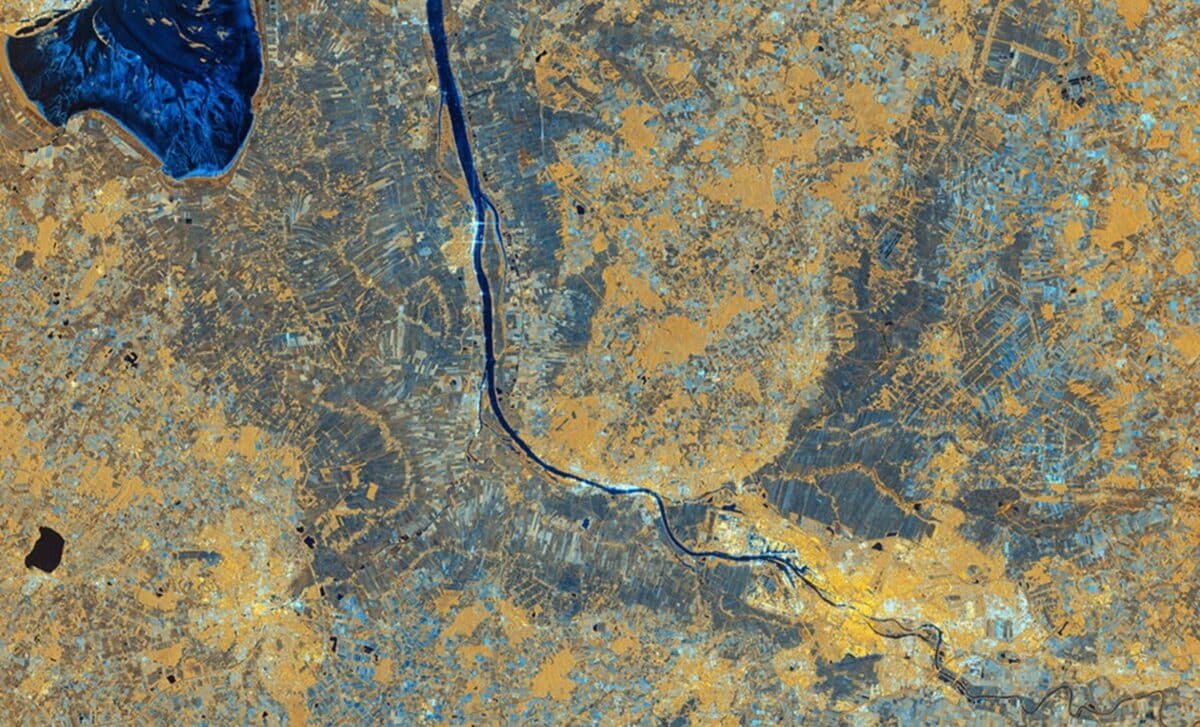
It also snapped a striking radar image of Tierra del Fuego, the southern tip of South America. With snowy mountains showing up in blue and lower lands in yellow, the image reveals sharp contrasts thanks to its advanced polarisation modes. That kind of detail is useful for scientists and navigators alike. ESA’s Simonetta Cheli said these first results really show off the power of their latest missions.
“It really places the data we receive from our innovative missions in the spotlight – it is data that we as a society rely upon as we continue to discuss and take action on climate change, and also data that we need in applications for understanding and studying our planet”.