June 15 may have marked the official start of Arizona’s monsoon season, but meteorologists say the date is more about convenience than clouds.
The booming thunder, flashing lightning and pouring rain can take time to arrive in metro Phoenix, dependent on a variety of atmospheric conditions that need to align to create a storm.
“We have this official season start of June 15,” said Michael Crimmins, a climatologist at the University of Arizona, “but the atmosphere doesn’t know it’s June 15 other than the sun angle.”
Arizonans can’t expect monsoon showers just because the calendar says it’s time. Monsoon conditions typically build more slowly, and all signs suggest we’re entering that window. But while the dew point is high enough, there’s not enough moisture for rain.
Climatologists look for rising dewpoint temperatures — a measure of the moisture in the air — to mark the start of the monsoon. In Phoenix, an average dewpoint temperature of 55 degrees maintained over three days signals the change in conditions.
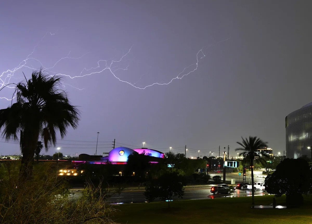
Phoenix saw its first monsoon activity last week. Phoenix Sky Harbor International Airport recorded 0.16 of an inch of rain on July 2 and up to an inch in parts of the West Valley. Higher terrains saw even more activity, and storms and wind gusts stirred up desert dust.
While drought-stricken desert dwellers are always excited to see rain, it wasn’t a dramatic start to the season. So when will it rain, what triggers the monsoon and how could this season perform? Here’s everything to know about the monsoon:
Desert weather: What does Arizona’s monsoon smell like? It’s what everyone wants to know
Phoenix heats up, but significant rain is missing in the forecast
Before Phoenix gets soaked, it gets scorched. Arizona is often dominated by a strong area of high pressure before the monsoon kicks in, sometimes called a subtropical ridge or monsoonal ridge.
This high-pressure system plays a major role in both blocking storms and driving extreme heat.
That ridge is currently parked over Arizona, acting like a giant atmospheric lid creating scorching daytime temperatures and warm nights beneath.
“The high pressure aloft is going to keep a lot of the monsoon activity at bay,” said Matt Salerno, a lead meteorologist for the National Weather Service in Phoenix. “Wednesday is going to be the worst of it. We’re forecasting highs between 114 and 118 in the metro.”
That could be a record-high, surpassing the current record for July 9 of 116 degrees.
Extreme heat: Planes couldn’t fly the day Phoenix hit 122 degrees. Why heat grounded them
The record or near-record heat will continue until July 11, when temperatures will hover closer to 110 degrees through the weekend. The slight dip will occur when the high-pressure system moves west toward California.
There are no storms in the immediate forecast in Phoenix, preventing significant relief from the heat.
“There is going to be some thunderstorm activity surrounding the Valley in the High Country and along the Mogollon Rim and down in southeastern Arizona over the next few days,” Salerno said. “We just don’t have enough moisture in central Arizona right now.”
Salerno predicts there could be thunderstorm activity next week, but chances remain at 10% or less until then.
Is it a date or a temperature reading?
Meteorologists previously used dew-point averages to calculate the start of the monsoon, a better reflection of when sticky, storm-ready air actually arrives. The dew point would have to be at least 55 degrees for three days in a row to signal the monsoon arrived (54 degrees in Tucson).
For public safety and awareness, consistency and data collection, the National Weather Service began relying on June 15 as the official start date in 2008.
But the atmosphere sticks to its own schedule.
“The big monsoon pattern we see at the upper levels of the atmosphere doesn’t fully form until the first week of July climatologically,” Crimmins said.
Summer weather: What is a haboob? Why 2025 could be a big year for dust storms
That’s when a key shift usually occurs: High pressure settles over the Four Corners region, steering moisture northward from the Gulf of California and Mexico, helping storms develop across the state.
Based on the old system, Phoenix’s monsoon began on July 2, the first of three days with average dew-point temperatures over 55 degrees.
How much will it rain this monsoon?
So far, the monsoon is unfolding on schedule.
Crimmins said early signs, like warming sea surface temperatures and storm activity picking up in Mexico, are encouraging. Dew points are rising, hitting that 55-degree threshold across the state.
The next big change will come when the ridge of high pressure finally moves into a better position toward the Four Corners. This opens the door for more widespread moisture and atmospheric activity needed to spark thunderstorms.
“None of the signs point toward drier-than-average conditions over the next four to five weeks,” Crimmins said.
The Climate Prediction Center’s latest forecast shows average to above-average precipitation likely for July.
Phoenix may lag behind higher elevations in storm activity, but the outlook suggests patience will pay off.
Hayleigh Evans writes about extreme weather and related topics for The Arizona Republic and azcentral.com. Email her with story tips at hayleigh.evans@arizonarepublic.com.
This article originally appeared on Arizona Republic: The monsoon has arrived in Phoenix, but the rain is missing