Update: An updated winter weather advisory was issued by the National Weather Service on Friday at 7:38 a.m. in effect until 1 p.m. for Onondaga, Madison and Oneida counties. Additional snow accumulations up to two inches can be expected, according to the weather service. “The steadiest lake effect snow band will continue along the Interstate 90 corridor through mid to late morning. The snow then tapers off to flurries and ends midday or early afternoon.”
Previously: Light lake effect snow will continue across Central New York through Friday morning, according to the latest National Weather Service forecasts.
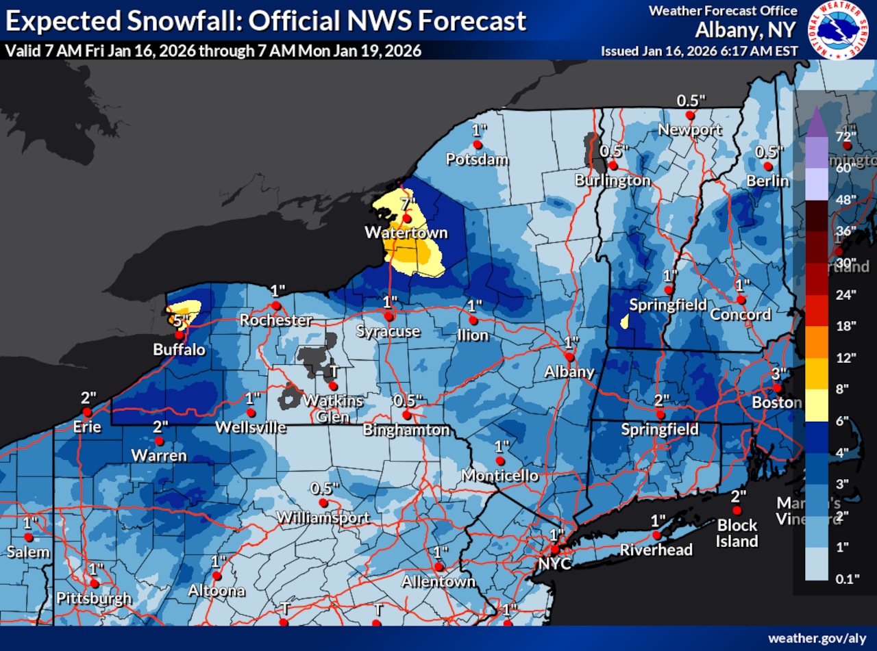
A winter weather advisory remains in effect until 1 p.m. for areas along and near the New York State Thruway corridor, where an additional 1 to 2 inches of accumulation is possible in spots.
In Oswego County, another 2 to 4 inches of snow is possible in the most persistent bands.
Conditions are expected to gradually improve by late morning.
Some areas of Central New York had several inches of snow overnight, and many school districts are operating on a two-hour delay.
The region is also dealing with wind chills below zero. In Syracuse, a high temperature of 27 degrees is expected with chill values as low as minus-3.
Winds could gust as high as 35 mph on Friday.
Several rounds of snow showers are forecast for the weekend as multiple weather systems move through the region.
On Saturday, expect scattered snow showers, particularly in areas east of Interstate 81.
Due to the spotty nature of the precipitation, accumulations will be highly variable, with some locations east of I-81 potentially receiving 1 to 2 inches while most areas see lighter coatings.
Sunday’s snow chances are decreasing as a clipper system tracking into the Great Lakes has trended faster, pushing a coastal low-pressure system farther east. However, a few snow showers remain possible.
Much colder conditions are expected to arrive early next week, with confidence increasing for several very cold days centered on Tuesday. Wind chills could drop below zero during this period.
Additional weak clipper systems will track through Central New York next week, bringing more snow shower chances. Some lake effect snow is possible, though a slight southwest component to the wind direction may limit the potential for significant lake effect snowfall across the region. Any shifts in wind direction could impact the extent of lake effect snow development.