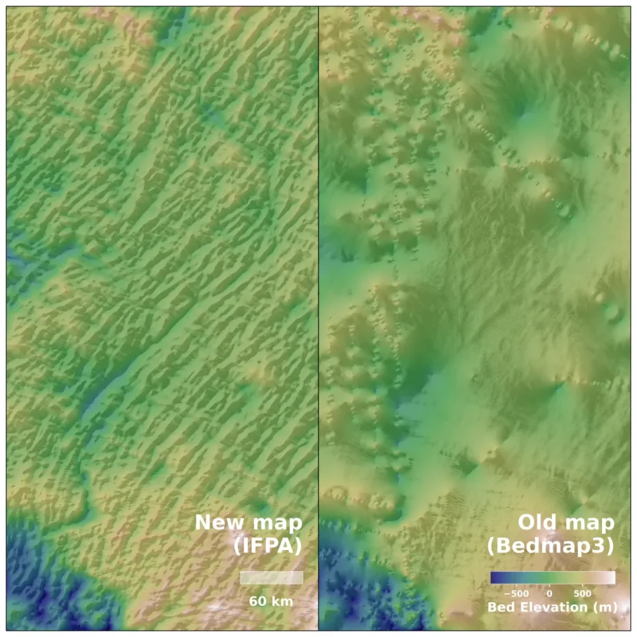
Researchers used satellite data and computer models of glacial movements to create a new map of Antarctica as it rests deep beneath the ice. The high-resolution imagery reveals the frozen continent’s landscape in detail, including “high-relief alpine valleys, scoured lowlands, and deeply eroded ice stream troughs.”
The map was published in the paper Complex mesoscale landscapes beneath Antarctica mapped from space, by Helen Ockenden and others, in the journal Science.
The landscapes are more varied than presumed by earlier site-specific geophysical surveys, and the newly resolved topography will help to refine projections of ice loss and sea level rise
The BBC reports that “traditional measurements” using ground and air radar mapped the continent in lines several kilometers apart, creating a grid of data that required the rest to be extrapolated.
“It’s like before you had a grainy pixel film camera, and now you’ve got a properly zoomed-in digital image of what’s really going on,” lead author Dr Helen Ockenden, a researcher at the University of Grenoble-Alpes, told BBC News.
There doesn’t seem to be new heightmap data available (here’s the “old” one), but surely it’ll show up soon. A note of caution for science-fictional worldbuilders eager to melt the ice: absent all that weight, the land won’t be staying down.
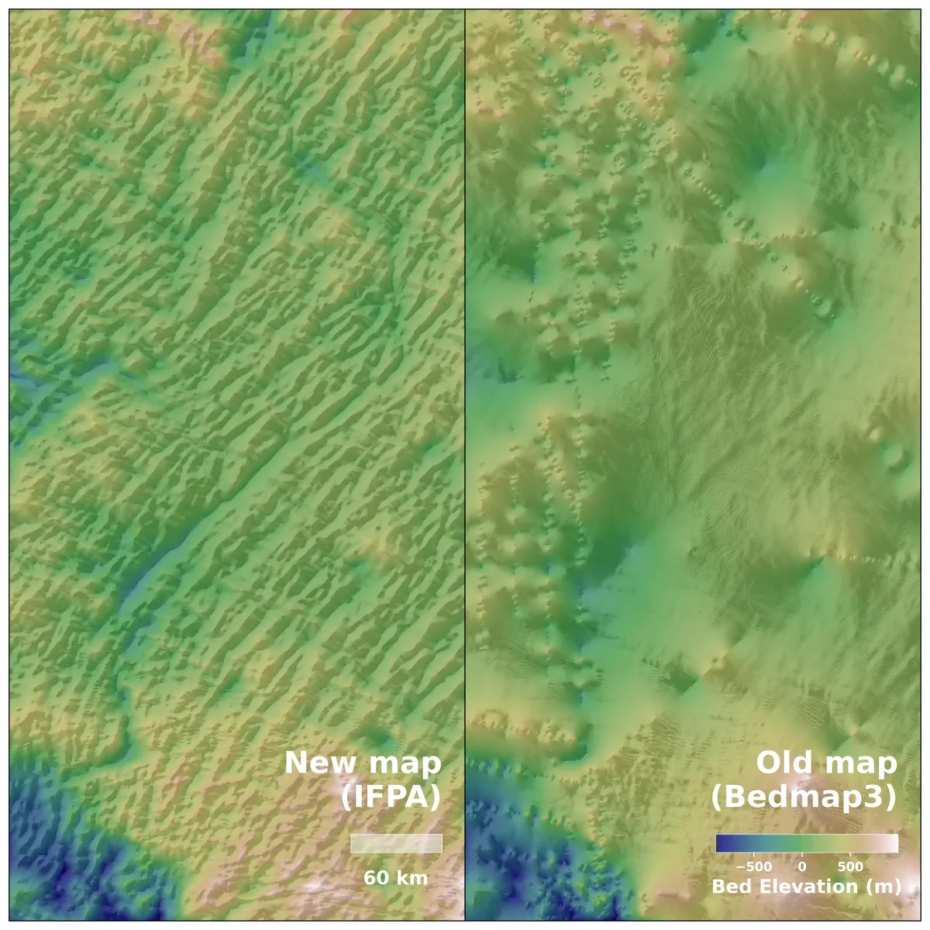 Image: Helen Ockenden
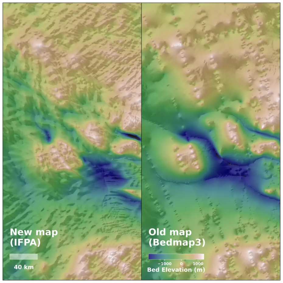 Image: Helen Ockenden