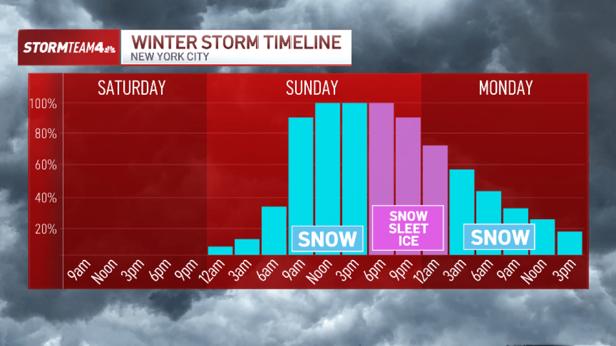
With a winter storm set to hit the New York City area — along with nearly half of the United States — over the weekend, we’re getting a clearer picture on the timing of when we could see snow start to fall, and how long it could last.
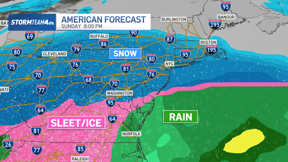
Snow will move in near dawn on Sunday and will continue at full strength until the early evening, becoming heavy at times throughout the day. It will taper off to light scattered snow showers Sunday night and Monday morning before finally moving on by mid morning.

Watch NBC 4 free wherever you are
Light sleet or freezing rain could mix with the snow east and south of NYC early Sunday evening, which would keep snow totals a little lower and create big problems on the roads. That sleet/freezing rain line could creep up to near the city as well, which would impact snow totals.
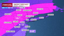
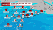
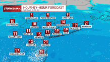
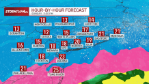
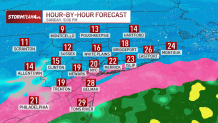
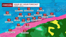
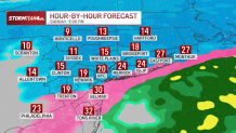
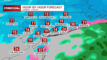
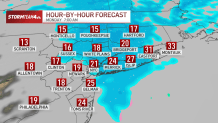
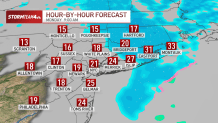
See below for an hourly radar breakdown of what the storm will look like where you are:
7 a.m. Sunday
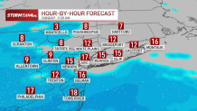
9 a.m. Sunday
11 a.m. Sunday
1 p.m. Sunday
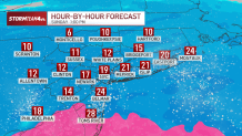
3 p.m. Sunday
5 p.m. Sunday
7 p.m. Sunday
9 p.m. Sunday
11 p.m. Sunday
7 a.m. Monday
9 a.m. Monday
Weather Stories
Jan 22
Why are snow totals so hard to predict for this weekend’s winter storm?

Jan 22
Will NYC have a traditional snow day Monday? Mamdani says, ‘It depends’