What to Know
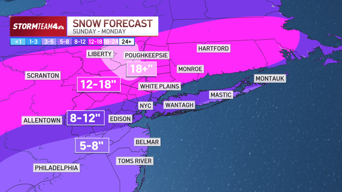
- A foot or more of snow could blanket the NYC area today into Monday, as much of the U.S. faces a crippling winter storm. Parts of the tri-state area, like Poughkeepsie, could see 18+ inches.
- Snowfall rates could reach 2 inches an hour at times. Travel may be nearly impossible, with near-blizzard conditions expected at times, minus the wind.
- The snow begins Sunday morning, and will continue through the rest of the day. States of emergency are in effect for what could be one of the biggest storms in years.
- Once the precipitation moves out, dangerous cold remains through at least next week. That means whatever snow falls will stick around.
The monster winter storm that has impacted nearly half of the United States is descending on the tri-state area, threatening near-blizzard conditions and power outages as it prepares to dump up to a foot of snow in the New York City area and up to 18 inches in parts of the Hudson Valley.
In the city, 8 to 12 inches looks more likely, but falling snow mix with sleet and freezing rain in the afternoon, which would keep totals down — and make the roads that much more treacherous.
Follow along below for the latest updates from Storm Team 4, and any new information from authorities. Check out our live snow cams — and catch up on what you may have missed yesterday.