Out of the snow globe, and into the freezer.
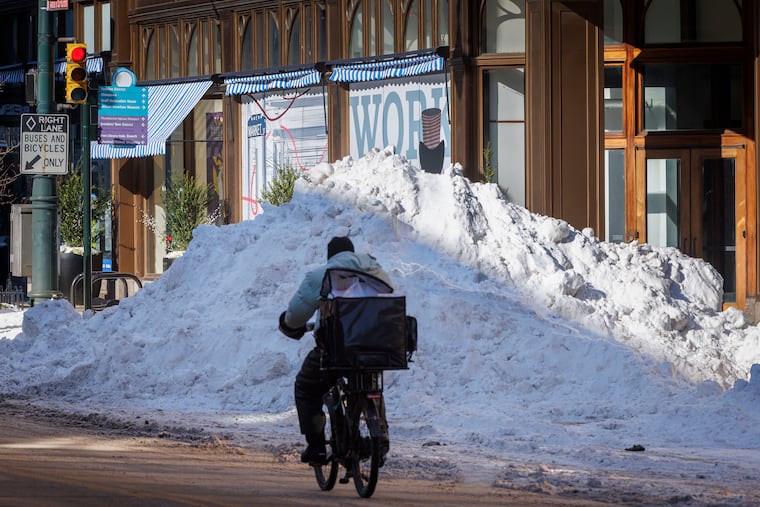
After having experienced its heaviest snowfall in about a decade, the Philadelphia region now faces frigid temperatures that are expected to barely squeak out of the teens until next week. And all while dealing with cleanup from the 9.3 inches of snow that blanketed the city made more complicated by minimal natural melting due to the cold — plus monitoring another potential winter storm for this coming weekend.
But don’t panic just yet. Forecasters at the National Weather Service office in Mount Holly say it’s too early to tell whether mean old Jack Frost will set his sights on us once again in the coming days, and what level of snowfall we could see if he does.
“There will likely be a system somewhere off the eastern seaboard over the weekend,” said weather service meteorologist Joe DeSilva. “But it’s very uncertain at this point.”
Besides, we’ve got enough to worry about already.
It won’t just be cold in the Philadelphia area this week — but dangerously so. On Tuesday, temperatures generally stretched only into the low or mid 20s, a good 5 to 10 degrees lower than what we saw Monday, the weather service said. Lows, meanwhile, stuck stubbornly in the single digits, with wind chills making it feel like at or below zero.
That cold, it seems, will refuse to be shaken until next week. As we move through the final week of January, temps are expected to continue to nosedive, the weather service said.
Daytime highs throughout the week are expected to top out in the mid- or upper-teens in the Philadelphia region, with some spots seeing the off chance of making it into the 20s. Lows are likely to stick in the single digits through Friday. As the weather service put it in one forecast Tuesday update afternoon, this is “bone-chilling” cold that not only has the potential to stress the energy grid — as New Jersey and Philadelphia officials alluded to Monday — but to cause frostbite and hypothermia.
Philadelphia, in fact, has the grim potential of experiencing its first zero-degree day in 32 years sometime in the coming days. We haven’t seen zero at the Philadelphia International Airport since Jan. 19, 1994, but that mercifully long streak could be broken Thursday or Friday, when temperatures are expected to go as low as 2 or 3 degrees, DeSilva said
“We still have three nights before we get there, so lots could change between now and then,” he added.
These lows arrive as Philadelphia continues to dig out from this past weekend’s winter storm, which resulted in a dayslong snow emergency in the city that was only lifted Tuesday amid closures for city offices, courts, and schools. Despite a full-court press by the Streets Department, many smaller streets remained unplowed, and the cold weather threatened to institute a deep freeze that could complicate the cleanup, officials have said.
Unfortunately, no break is imminent. Temperatures are not expected to get above freezing until the early or middle part of next week, and even then perhaps barely so. In its Tuesday afternoon forecast, the weather service called the length and magnitude of the arctic airmass descending upon the area “exceedingly rare,” and urged caution. Normal low temperatures for Monday’s date, for example, stand at about 25 degrees.
“We are running 15 to 20 degrees below average,” DeSilva said.
And then, there’s the possibility of even more snow amid our extended bout of cold — though as of Tuesday afternoon, it remained just that. The weather service noted that it remained unclear where precipitation could fall, and in what amounts, though early models indicated that the storm could spare much of the area away from the coast. Still, DeSilva said, it remained too early Tuesday to tell what to expect.
“If lows track further off the coast, we could see less impact here, but if they’re closer, we may have some moderate impacts,” DeSilva said.