Residents of a small community in north Queensland are waiting to be rescued from rooftops after floodwater surrounded their homes overnight.
About six people have requested evacuation from three properties along the Gilbert River in Einasleigh on Wednesday morning.
Etheridge Shire Council mayor Barry Hughes said dozens of people along the river may be affected.
“We’re just waiting for that air support coming out of Cairns,” he said.
The town of less than 100 people was inundated with floodwater yesterday when rivers hit major and moderate flooding levels.
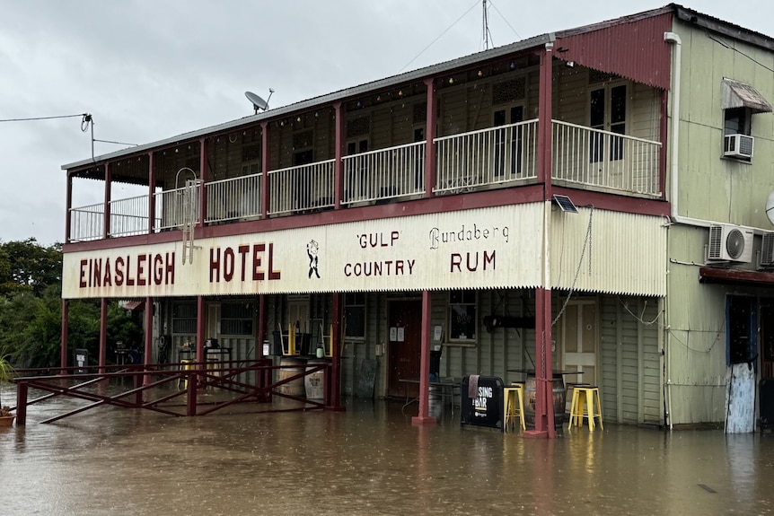
Water has entered the Einasleigh Hotel. (Supplied: Tayla Wellby, Einasleigh Hotel)
Emergency services were also called to three people trapped on flooded cars near the north Queensland town of Greenvale at Expedition Creek.
The group became trapped at about midnight on Wednesday morning and were rescued by the Queensland Fire Department at around 5:30am via an inflatable boat.
The tropical low weather system has dumped heavy rain and caused dangerous flash flooding in North Queensland since Tuesday.
The Bureau of Meteorology (BOM) said Tropical Low 80U was expected to contract and track northwards today, although flooding was likely to continue for at least several days.
A trough is forecast to sit over parts of the north-west tropical coast, potentially bringing more rain to the Cape York Peninsula.
The BOM has several flood warnings across the state, including major flood warnings for the Lower Flinders River and Murray River, and moderate flood warnings for the Upper Flinders River, Herbert River, Cooper Creek and Eyre Creek.
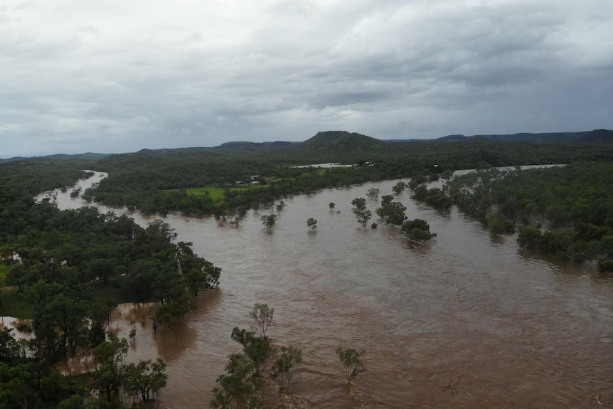
View of the Gilbert River flooding from the verandah of Gilberton Outback Retreat. (Supplied: Gilberton Outback Retreat)
Senior forecaster Felim Hanniffy said major flooding downstream at the Gilbert River was possible today.
“It’s more about what has fallen rather than what will fall. But certainly, the lower parts of the Gilbert River will have a risk of some further localised heavy falls as well,” he said.
“We will see that risk ease as we go through Wednesday, with the focus of the rainfall shifting well away from these areas and further north later in the week.”
Mr Hanniffy said the heavy rain had fallen on already saturated catchments, worsening the situation.
“Much of northern Queensland and the northern interior is saturated,” he said.
“So renewed heavy rainfall resulted in rapid river rises and significant flash flooding.”
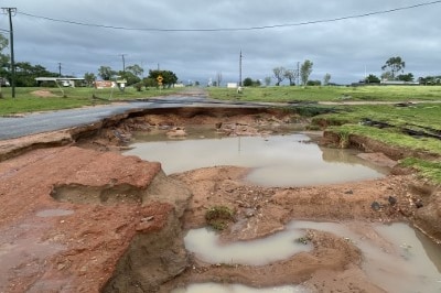
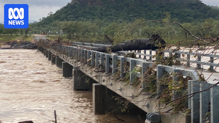
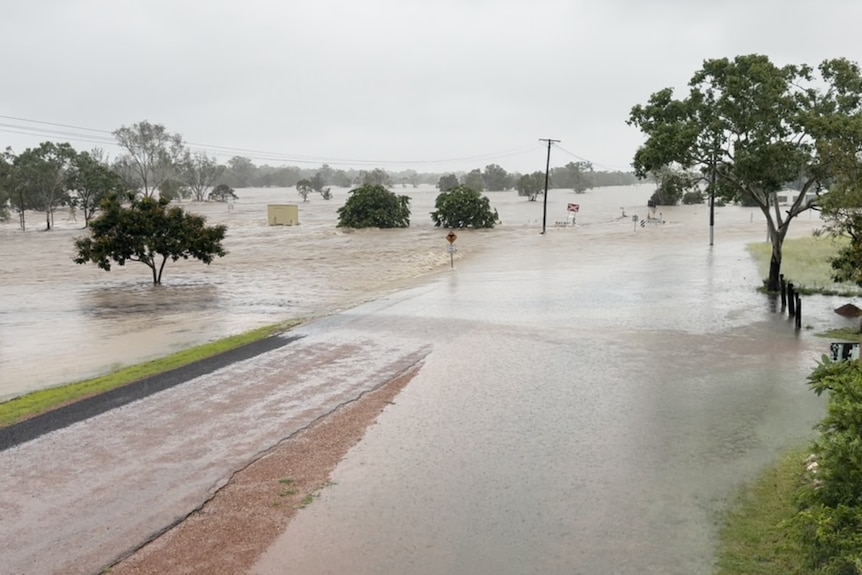
Road closures remain in place around Einasleigh in the Etheridge Shire as floodwater washes away roads and inundates buildings. (Supplied: Nardeen Hayden)
The Etheridge Shire Council also has a flash flood Emergency Warning for Einasleigh, with residents continuing to take shelter as road and air access is limited.
Einasleigh publican Taylor Welby said the situation was “quite scary” and hoped authorities understood the scale of the town’s losses.
“I just hope they realise the extent of what is happening and that a lot of people have lost a lot here,” she said.
“The town is definitely going to need some help.”
A Leave Immediately warning was issued for Einasleigh residents on Tuesday after heavy rainfall caused the Copperfield River to burst its banks. (Supplied: Tayla Wellby, Einasleigh Hotel)
She remains confident her pub — inundated just five days after she bought it — will be back in business soon.
“This is an amazing town and an amazing community. We will definitely reopen the doors and be up and running,” she said.
Charters Tower Regional Shire Mayor Liz Schmidt said people stranded and awaiting at Greenvale rescue did not receive adequate warning about the rising floodwater from the weather bureau.
“Keeping our community safe is the most important thing and the only way for us to do that is to have the information at hand for them before it happens, rather than a kneejerk reaction,” she said.
Heatwave in the south and west
While the north of the state shelters from floods and heavy rain, western and southern Queensland are sweltering through a potentially record-breaking heatwave.
Track temperatures live as heatwave hits multiple states
Yesterday was the hottest day in 12 years for parts of South West Queensland, with St George reaching 45.7 degrees Celsius and Thargomindah hitting 46.6C.
The BOM says a stagnant air mass locked in place for several days has caused the extreme conditions, which are likely to peak in South West Queensland today.
“We will see those temperatures rise even further,” Mr Hanniffy said.
“We could see Thargomindah hitting 48.9C, just shy of 49, which could be an all-time record for that location.
“There is potential for some annual records to be set in parts of the far south-west and southern interior during Wednesday.”
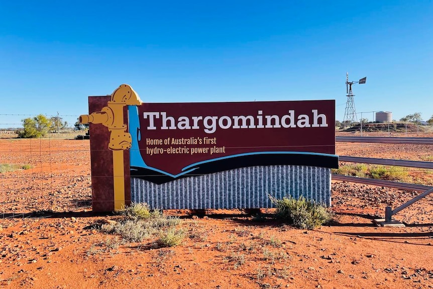
The Bureau of Meterology says the Western Queensland town of Thargomindah could hit 48.9C degrees today. (ABC Western Queensland: Maddelin McCosker)
Mr Hanniffy said overnight minimums were also unusually high.
“Overnight temperatures will hold above 30C in some of these south-western areas,” he said.
“So for areas around Thargomindah and the southern interior, you have daytime maximums in the high 40s and overnight minimums in the low 30s — very little reprieve.”
St George winemaker David Blacket said he and his crew were out from 5am today to pick their remaining grapes before the heat set in.
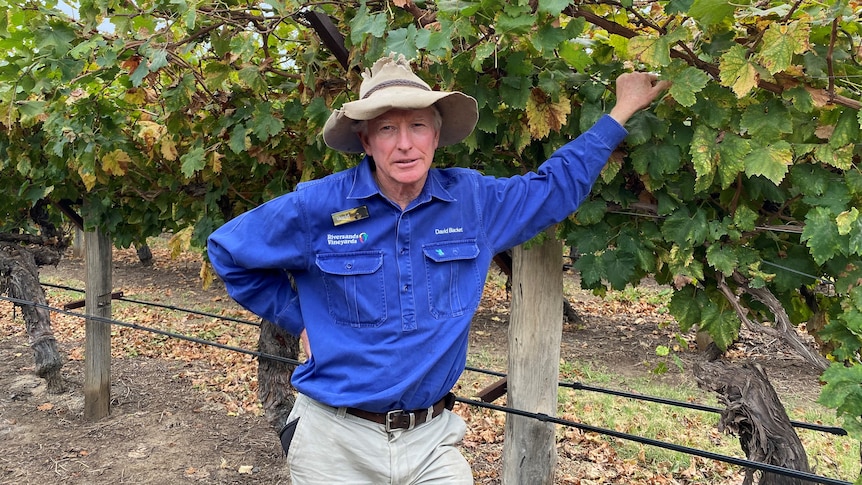
St George wine grower David Blacket says he’s had to offer $1,000 bonuses to attract workers. (ABC Southern Qld: Georgie Hewson)
“We called it quits when the temperature got to about 42 degrees yesterday; everyone was happy to head home quickly,” he said.
“Thankfully, it’s right at the end of our picking period.”
Mr Hanniffy said that although today will be the peak, the abnormal heat is likely to continue until at least the weekend.
“It’s not until later in the weekend or early next week that we see this heat flush out from the southern interior and further east towards the coast.”
He said South East Queensland had escaped the worst of the heat so far.

Chivis the Beagle knows how to beat the heat in south east Queensland by plonking himself in front of the fan in his air-conditioned living room. (Supplied: Beagle Rescue QLD)
“The south-easterlies have come in across the south-east, so we’ve seen a reprieve from the recent very hot conditions,” he said.
“However, the south-east could see another round of hot conditions before a stormier pattern develops across much of the interior and eastern Queensland early next week.”