
Dangerous arctic cold will persist across Central New York through the weekend, with wind chills expected to plunge to 25 to 30 degrees below zero in some areas Friday morning.
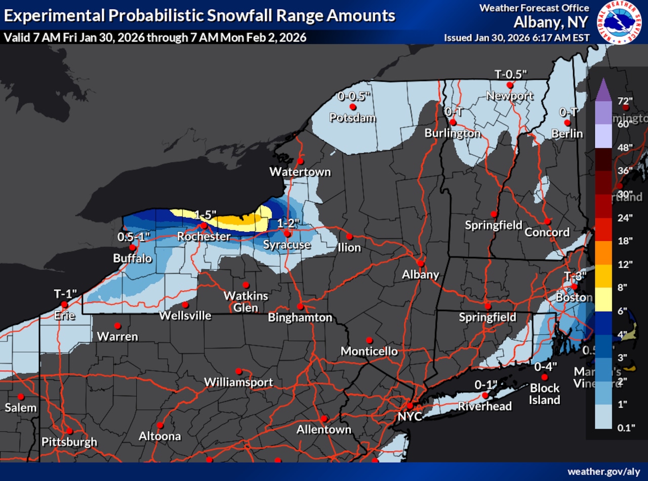
Lake effect snow showers off Lake Ontario will continue to affect the Syracuse area through Saturday, with accumulations of one to three inches expected, and up to four inches possible in northwestern Onondaga County.
A cold weather advisory remains in effect until 9 a.m. Sunday for Onondaga County and surrounding areas of Central New York.
Wind chills across the region range from 15 to 25 degrees below zero, with the coldest readings in northern Oneida County.
The National Weather Service reports that high temperatures on Friday will struggle to reach double digits as an arctic air mass settles over the region. The dangerous cold will be locked in place for several days.
 Winter weatherNational Weather Service
Light lake effect snow showers will extend into Central New York, with the snow bands expected to lift into north central areas during the day on Friday before dropping back south overnight.
The lake effect snow will primarily impact southern Cayuga and Onondaga counties through Saturday morning. Areas slightly south of this zone could see a dusting.
The snow showers are expected to persist through Saturday as the flow off Lake Ontario continues, with the narrow bands occasionally causing reduced visibility to one to three miles at times.
Looking ahead to the extended forecast, the arctic air mass shows no signs of departing quickly. Another surge of cold air could bring wind chills near 20 degrees below zero Saturday night into early Sunday morning, particularly across higher elevations.
Sunday through Tuesday should feature mainly clear skies with very cold temperatures continuing, though conditions will gradually moderate as the weekend progresses into early next week.