City Council member Rebecca Boxall remembers when a near-record breaking storm brought over 7 inches of rain to Arlington in late September 2018.
She still thinks about how the storm took the life of Alan Amaya, a 23-year-old student at the University of Texas at Arlington who drowned after rapid floodwaters swept him into a pipe.
Texans should be aware of the dangers heavy storms can bring and especially vigilant following the catastrophic flood that struck Central Texas on July 4, Boxall said. Fort Worth and Tarrant County officials warn the region has the potential to see a natural disaster of a similar scale, but note they have plans should that happen.
“I think people underestimate how much power water has,” Boxall said.
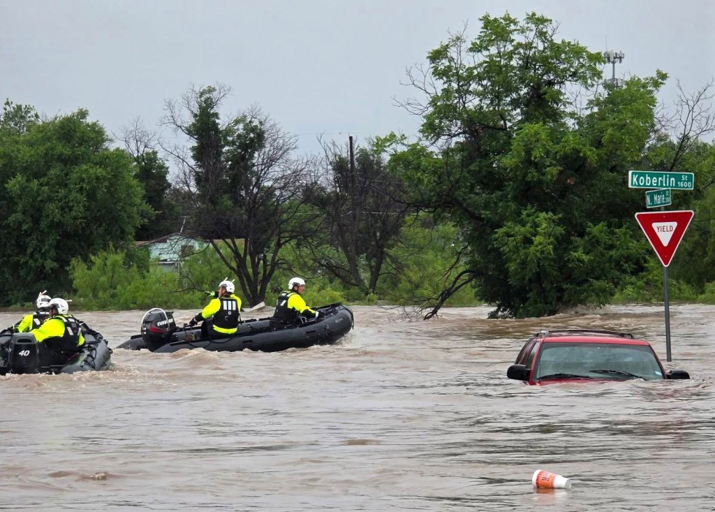
As of July 10, local officials reported over 120 people across six counties were killed by the flood that largely swept the Guadalupe River in Central Texas, with most of those deaths reported in Kerr County. Hill Country responders are searching for over 173 people who are reported missing.
 The Fort Worth Fire Department sent 17 firefighters to Central Texas to help with rescue and recovery efforts. (Courtesy photo | Fort Worth Fire Department)
The search includes efforts to locate missing campers from Camp Mystic, located along the riverfront. The camp’s leaders reported 27 campers and counselors were killed following the flood. At least a dozen North Texans died in the natural disaster, The Dallas Morning News reported.
The climate and geographical makeup of Kerr County and surrounding areas largely contribute to flood risk in Central Texas, said University of Texas at Arlington civil engineering professor Yu Zhang.
Tarrant County faces risks of similar proportions.
Coordination and preparation for a similar natural disaster are of the utmost importance, Zhang said.
“It can happen overnight,” Zhang said.
What is Fort Worth’s protocol on responding to severe flooding?
Responding to weather-related risks in Fort Worth involves coordination from several entities, said Jennifer Dyke, the city’s assistant stormwater management director.
The Fort Worth Emergency Management Department monitors National Weather Service forecasts to assess potential severe weather events and to maintain communication lines, said Sonny Saxton, director of emergency management and communications.
Once a weather risk has been identified, emergency management officials will issue potential weather threats to the public through social media and Fort Worth staff.
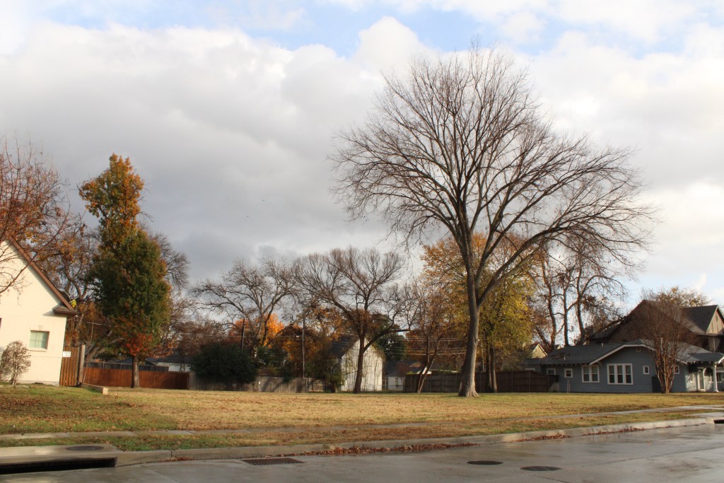 Three homes once sat on Western Avenue where there is now a green space in the Arlington Heights neighborhood. The last of the three homes, located in a flood-prone zone, was demolished in summer 2024. The lot will be maintained by the city as a floodwater-absorbing undeveloped site as required by a federal grant. (Nicole Lopez | Fort Worth Report)
Stormwater staff work closely with emergency management before, during and after a severe weather event, Dyke said.
The stormwater department begins by responding to high-risk areas of flooding in Fort Worth to ensure infrastructure is open and properly working to draw floodwaters away.
How the public can stay informed
Fort Worth officials urge the public to use the CodeRED Mobile Alerts app, a mass emergency alerts system for Fort Worth residents, and the Real-Time Flood Warning map website, which provides live updates on flood statuses across Fort Worth. Through the app, the public receives the following alerts issued by the Office of Emergency Management:
- Severe weather.
- Acts of terrorism.
- Chemical spills.
- Other human-made disasters.
Users can also customize the app to receive optional weather warnings from the National Weather Service. Additional apps and alert systems can be found on the Emergency Management Department website.
The public can refer to the FEMA Flood Map Service Center or Fort Worth’s Flood Risk Viewer to learn more about flood assessments in the city and which areas are prone to flooding.
Those without access to a smartphone can utilize a National Oceanic and Atmospheric Administration weather radio, which broadcasts weather information and forecasts from the National Weather Service.
Fort Worth’s Outdoor Warning System alerts the public to seek shelter due to a potential threat. If sirens are heard, residents are urged to seek sturdy shelter immediately, remain in a room away from windows and exterior walls, and stay updated on weather forecasts through weather radios, mobile applications, social media or through media outlets. Emergency management officials recommend residents to have two to three modes of receiving alerts in addition to the city’s siren system.
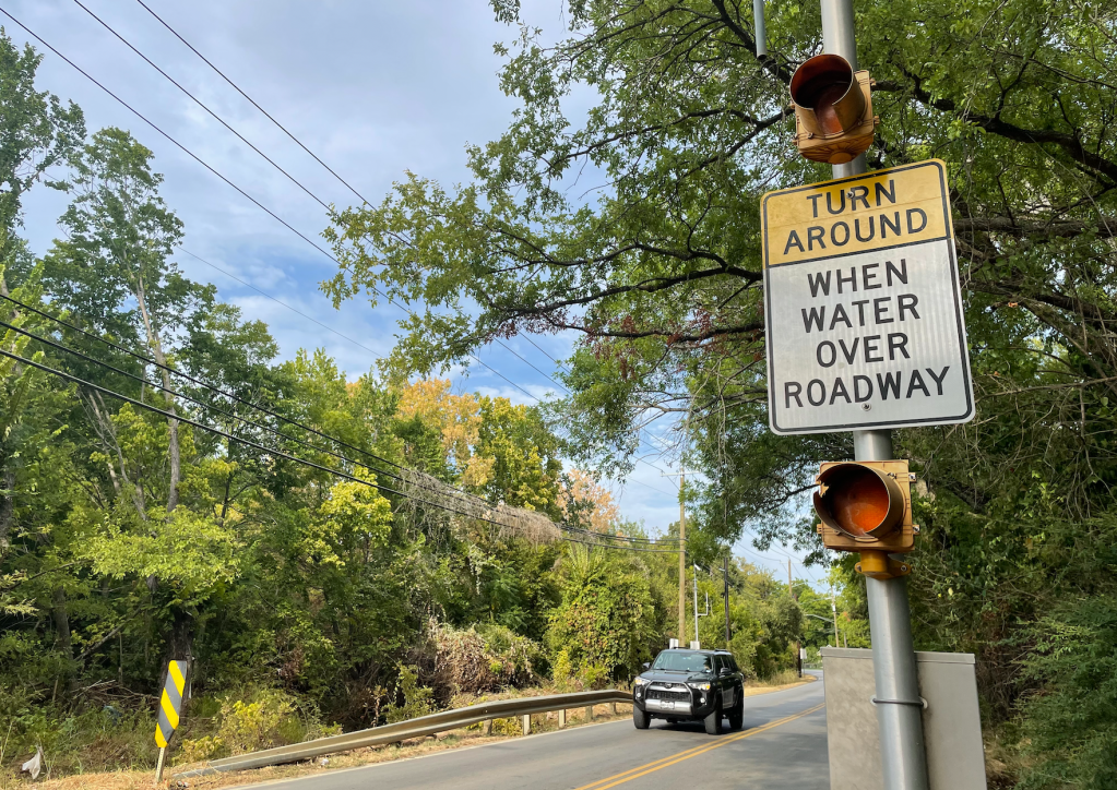
Officials will also check the city’s high-water warning system for any issues so they can notify first responders. The system utilizes data on water levels made at 55 low-water crossings throughout the city. Roadside flashers warn drivers of the flood hazards at flood-prone crossings.
During a torrential downpour, stormwater field operators respond to areas where flood infrastructure is not working. While faulty infrastructure can cause a hiccup, floodwater mitigation issues can sometimes boil down to storage capacity and bandwidth shortfalls, Dyke added.
Which areas of Fort Worth face high risk of flooding?
Drivers should avoid these flood-prone areas during heavy storms:
- Lebow Channel from East Long Avenue to De Ridder Street
- Berry Street and McCart Avenue intersection
- Linwood neighborhood in Near Westside
- Arlington Heights neighborhood
Stormwater staff told city leaders in March the department requires $1.5 billion to fund long-term projects addressing flooding in Fort Worth. The department requested $140.2 million of that total to come from fiscal year 2025-2029 bond programs.
“Of course, when there’s lots of flooding, we can’t be in every place, but trying to go to some of those most critical locations and trying to add some barricades out there, working with emergency management … those are things that can happen,” Dyke said.
Following severe weather and flooding, the stormwater department revisits floodwater pipes and storage to collect data and inspect how infrastructure responded.
 Flashers warn drivers of flood waters on Randol Mill Road near the John T. White neighborhood in east Fort Worth. Fort Worth will invest $10 million into flood mitigation between Randol Mill and Williams roads. (File photo | Fort Worth Report)
“We want to make sure that if (homes or businesses) were damaged, that it would be redeveloped off of the new city criteria and development standards,” Dyke said.
U.S. Army Corps of Engineers plays a key role
Preventative measures are also taken in Fort Worth’s outskirts, particularly in the Benbrook area where the U.S. Army Corps of Engineers maintains floodwater infrastructure, including the Benbrook Lake dam.
If an event as serious as the July 4 flood occurred in Fort Worth, the dam at Benbrook Lake would store floodwater traveling downstream from the Clear Fork of the Trinity River, which largely protects the city.
Mitigation is contingent on the amount of rainfall, where it lands and where flooding occurs, said Brian Phelps, assistant chief of operations at the U.S. Army Corps of Engineers.
“Historically, we’ve seen flash flooding that’s locally isolated on certain creeks or tributaries to the river,” Phelps said. “There are a lot of different variables that play into how bad a flood can be.”
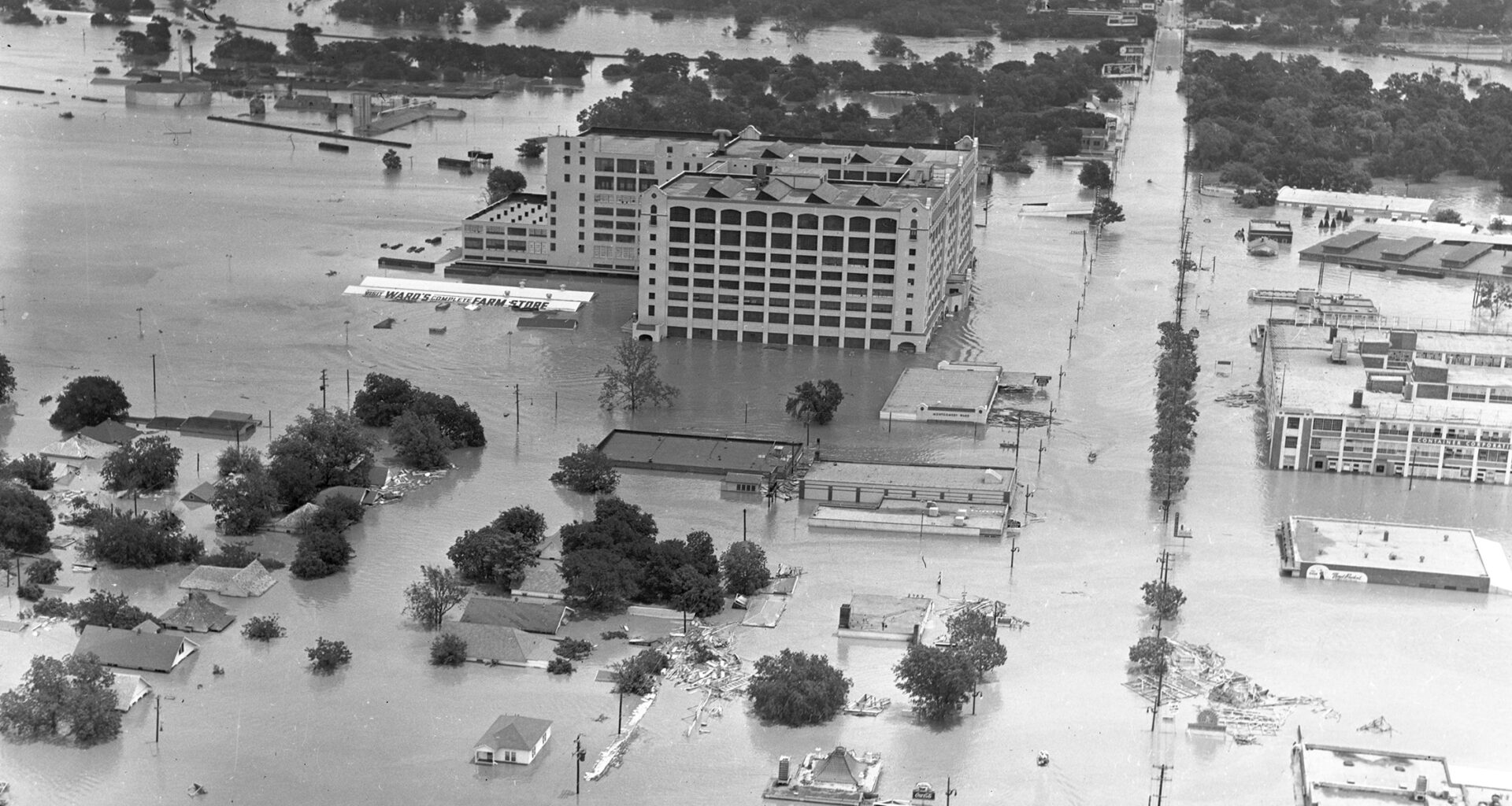
Catastrophic floods in Fort Worth
- The flood of April 22, 1922, inundated downtown Fort Worth, killing 10 people and causing $1 million in damages. The incident led to the creation of the Tarrant Regional Water District in 1924. Flood planning began in 1931, the same year Lake Bridgeport’s dam was constructed. A year later, the water district created the Eagle Mountain Lake dam.
- The U.S. Army Corps of Engineers began work in the Fort Worth area following significant flooding on the Trinity River in 1936. Construction on the Benbrook Lake dam began in 1947. By 1952, the dam was operational and began collecting floodwaters.
- The flood of 1949 led to at least 10 deaths, over $11 million in damages and debilitated the city’s water treatment facility. The creation of Benbrook Lake and the downtown flood system prevented an additional $9.3 million in damages, according to the Corps of Engineers.
- Historic floods in Fort Worth prompted the $1.16 billion federal Central City flood control project. The Corps of Engineers is tasked with constructing both a north and a south bypass channel to reroute floodwaters from the Trinity River into downtown Fort Worth’s floodwater storage. The project is slated for completion by 2032.
In the event of water flowing down into Benbrook Lake, the Corps of Engineers’ protocol involves closing the gates to the dam to capture floodwaters and monitor conditions.
Should floodwaters travel past the dam, the Corps of Engineers notifies Fort Worth and Tarrant County officials about how much water is traveling and how long downstream flows may take place before receding.
The Corps of Engineers’ work in Fort Worth goes beyond responding to flooding and severe weather events.
The Corps of Engineers conducts annual inspections on Fort Worth’s floodwater infrastructure to identify potential concerns and need for maintenance. The goal of those inspections is to prevent impairments to Fort Worth’s 27-mile levee system, which encompasses the path from the Trinity River to Benbrook Lake, Phelps said.
Emergency communication, first responders
Fort Worth is equipped with the technology and resources to successfully respond to catastrophic flooding, Zhang said. But mitigating impact requires a collective effort to issue emergency communications.
“There are a lot of fingers being pointed toward the National Weather Service for emergency response,” the UTA professor said. “This is not a trivial thing. I think it’s a wake-up call to review our doctrine of preparedness across the entire state.”
Monitoring forecasts, using technology, employing local officials and providing a drill for the public to follow can pave the way for a better response, Zhang added.
 Flood waters fill a drainage ditch on North Beach Street in Fort Worth during record rainfall on Aug. 22, 2022. (File photo | Fort Worth Report)
Federal budget cuts and staff shortages impacting the National Weather Service and its research can contribute to emergency and natural disaster response.
“It may not transpire into anything detrimental in the short run, but in the longer run, it really hinders the quality of more robust systems to effectively capture and also better communicate these events to the public,” said Zhang.
Since the July 4 flood, Central Texas and state leaders have undergone scrutiny from the public about a lack of sufficient warning systems and assistance from Hill Country officials and first responders.
Like many catastrophic natural disasters, local officials can only do so much to prevent damage, said Dyke, the city’s assistant stormwater management director. Fort Worth’s standards on flooding and development attests to the city’s commitment to protect the public, she said.
For example, city leaders long debated between either selling homes in the Arlington Heights neighborhood, one of the city’s biggest flood-prone areas, or turning them into a detention pond to capture floodwaters to address resident concerns.
“The city is never going to be able to mitigate all flood risks, unfortunately,” said Dyke. “But what we can do is we can work, and we are working to manage that flood risk.”
Dyke also pointed to Fort Worth’s regulations on protecting development located on floodplains as a valuable measure on flood response.
“We have higher development standards as well than just what FEMA requires,” Dyke said. “We’re really trying to do what we can do to protect our community from those flood risks.”
Nicole Lopez is the environment reporter for the Fort Worth Report. Contact her at nicole.lopez@fortworthreport.org.
At the Fort Worth Report, news decisions are made independently of our board members and financial supporters. Read more about our editorial independence policy here.
This <a target=”_blank” href=”https://fortworthreport.org/2025/07/10/heres-how-fort-worth-area-officials-try-to-prevent-a-central-texas-floodlike-disaster/”>article</a> first appeared on <a target=”_blank” href=”https://fortworthreport.org”>Fort Worth Report</a> and is republished here under a <a target=”_blank” href=”https://creativecommons.org/licenses/by-nd/4.0/”>Creative Commons Attribution-NoDerivatives 4.0 International License</a>.<img src=”https://i0.wp.com/fortworthreport.org/wp-content/uploads/2021/04/cropped-favicon.png?resize=150%2C150&ssl=1″ style=”width:1em;height:1em;margin-left:10px;”><img id=”republication-tracker-tool-source” src=”https://fortworthreport.org/?republication-pixel=true&post=287650&ga4=2820184429″ style=”width:1px;height:1px;”><script> PARSELY = { autotrack: false, onload: function() { PARSELY.beacon.trackPageView({ url: “https://fortworthreport.org/2025/07/10/heres-how-fort-worth-area-officials-try-to-prevent-a-central-texas-floodlike-disaster/”, urlref: window.location.href }); } } </script> <script id=”parsely-cfg” src=”//cdn.parsely.com/keys/fortworthreport.org/p.js”></script>