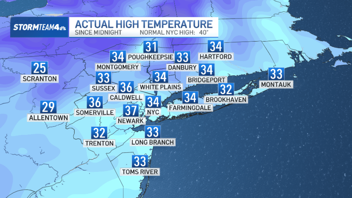
After more than a week, New York City finally broke through the freezing mark on Monday. Though don’t expect any major warmup coming soon.
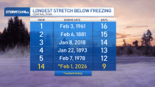
Temperatures reached 34 degrees in Central Park Monday afternoon, breaking the streak of nine days in a row where highs didn’t crack the freezing mark. That is among the longest streaks recorded in NYC history, but doesn’t come close to the record of 16 days set back in 1961, or even the 14 days that occurred in 2018.
Tuesday will once again be cold, but not to the extreme seen last week. Temperatures will be back into the low 30s, and will remain in the upper 20s through Friday. Not exactly Spring-like, but better than it was.
There may be a few snow showers mainly to the south late Tuesday night, and another chance for snow showers late Friday night. Little to no accumulation is expected in either instance, so no need to worry about clearing roads, sidewalks or cars.
Another Arctic blast moves in this weekend, and it stays bitterly cold into early next week. Lows drop back into the single digits overnight Saturday into Sunday, with another frigid cold day on Monday.
The cold does appear to finally start to ease in a more meaningful way around Valentine’s Day weekend.