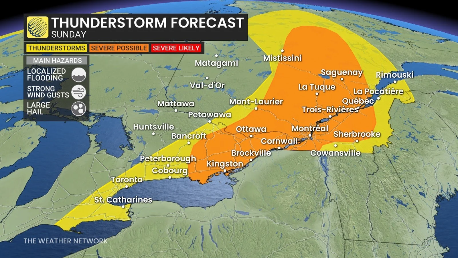
A deep reserve of moisture in the atmosphere will make localized flooding a serious risk. Remember: never attempt to drive across a flooded roadway. It’s impossible to tell how deep the water is until it’s too late, and it only takes a small amount of moving water to lift a vehicle off the roadway.
MUST SEE: How the Great Lakes can trigger storms on a hot summer day
The strongest storms will also be capable of producing strong wind gusts and large hail. Rotating thunderstorms could lead to a tornado risk in some areas, including the Ottawa Valley, and especially west of Trois-Rivières to Quebec City.
Farther south, non-severe thunderstorms are possible across the Greater Toronto Area as a lake breeze blows across the region. These slow-moving storms could produce heavy downpours and lead to ponding on roadways.
Header image created using graphics and imagery from Canva.
WATCH: In a tornado warning? Here’s what you should do