
Non-severe storms may develop from Sault Ste. Marie to Sudbury, tracking east into Quebec. Isolated thunderstorms with heavy rain will be possible in southwestern Ontario–depending on the strength of the lake breezes.
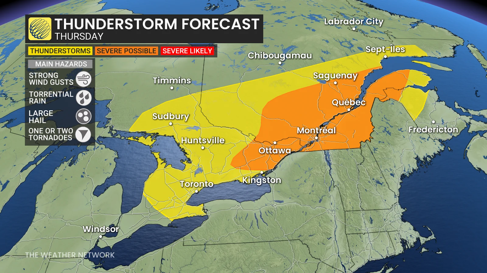
Thursday: Ample thunderstorm energy leads to strong storms, tornado risk
Forecasters are keeping a close eye on Thursday, with a low-pressure system and strong cold front expected to bring more severe weather to eastern Ontario and southern Quebec. The system will track over the Great Lakes Thursday morning and continue eastward through the day.
Ample thunderstorm energy, fuelled by several days of 30°C heat and high humidity, could lead to strong thunderstorms with torrential downpours. Between 50-100 mm of heavy rainfall is possible under storms, increasing the risk of localized flooding.
DON’T MISS: Canada’s fire bans and danger ratings explained
Non-severe thunderstorms are expected to move through the Greater Toronto Area (GTA) before peak afternoon energy develops.
Thunderstorm energy will be abundant by the afternoon hours, with ample moisture, and signs of notable shear will result in strong and severe storm clusters over the Ottawa Valley and southern Quebec.
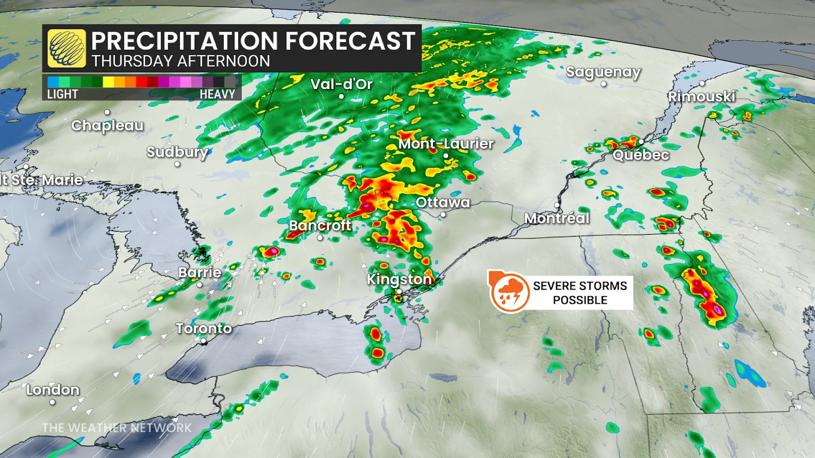
The Ottawa and St. Lawrence valleys will be concerned with flooding potential, while tornado ingredients may be present north of the Ottawa Valley and over the Laurentians, although confidence is still low and conditions are being closely monitored by forecasters.