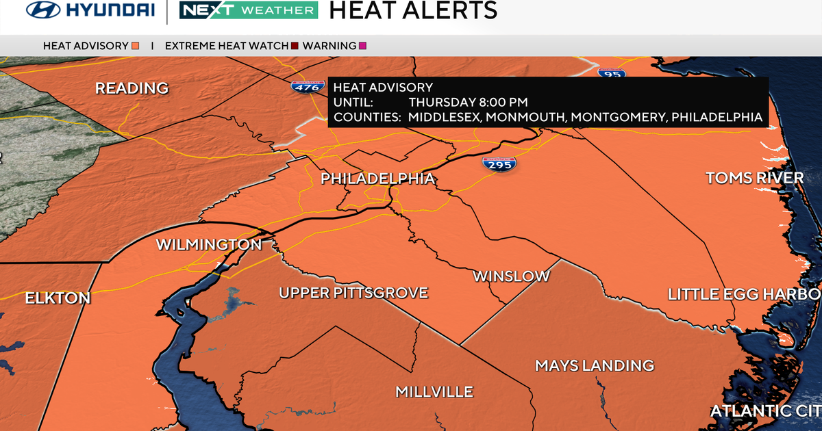
A NEXT Weather Alert is in place Thursday in the Philadelphia area because of feels-like temperatures that will soar to near 105 degrees.
A heat advisory is also in effect for much of the area Thursday until 8 p.m.

CBS News Philadelphia
There will also be a chance for some late-day and evening storms that could be strong and severe. Currently, in addition to heavy rain and the threat of flash flooding, localized areas of damaging winds may also occur in the stronger storms.

CBS News Philadelphia
In fact, we’ll maintain this pattern through Friday, with partly sunny skies and isolated storms each afternoon. Temperatures will also soar to either side of 90 during the day and mid-70s at night. High humidity will lead to heat indices that feel close to 100 degrees. We will be monitoring for any possible heat alerts, and with the very high dewpoints, flooding rain will remain a concern in any thunderstorm.
The best day of the extended forecast looks to be Saturday, with highs in the upper 80s, plenty of sunshine and reasonable humidity levels. Then, it’s back to active weather with showers and storms on Sunday. Your NEXT Weather Team will keep you posted.
Here’s your 7-day forecast:

CBS News Philadelphia
Thursday: NEXT Weather Alert for heat and storms. High 94, Low 76.
Friday: Mostly sunny. High 87, Low 76.
Saturday: Nice day. High 86, Low 69.
Sunday: Showers, storms. High 88, Low 74.
Monday: Mostly sunny. High 85, Low 73.
Tuesday: Partly sunny. High 85, Low 71.
Wednesday: Mostly sunny. High 86, Low 71.