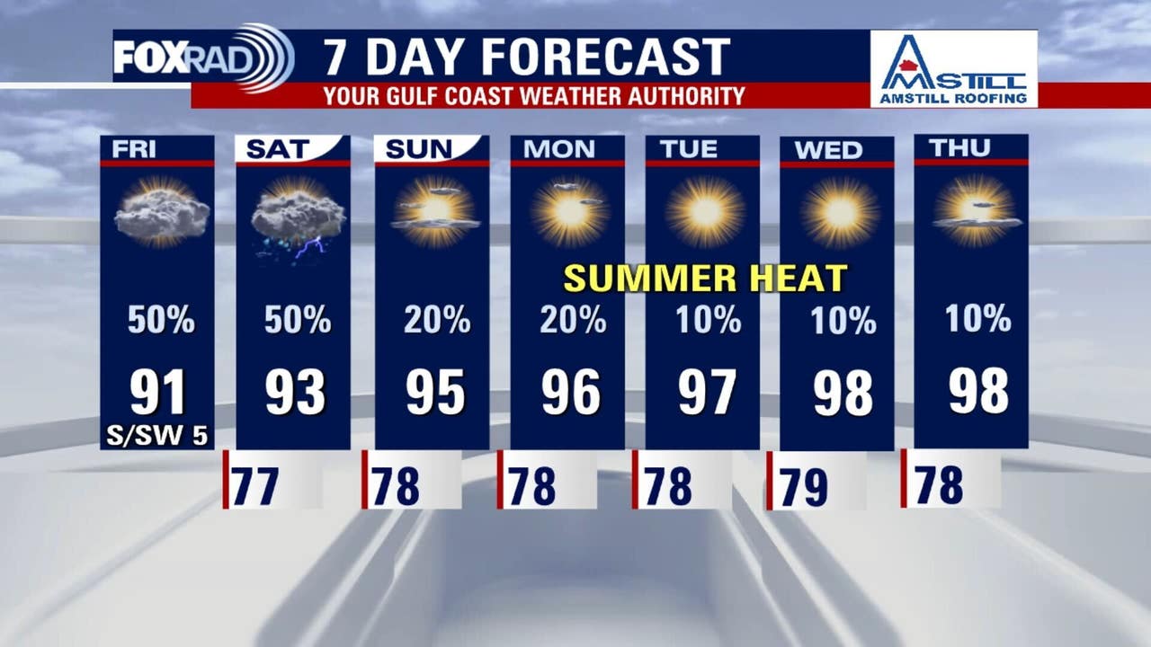
HOUSTON – Tropical moisture moves into the Houston-area, so expect scattered afternoon storms Friday and a few tomorrow as well. Although we may have rain and clouds, the temperature highs will still reach the low 90s.
Tropical disturbance brings rain to Louisiana, Texas
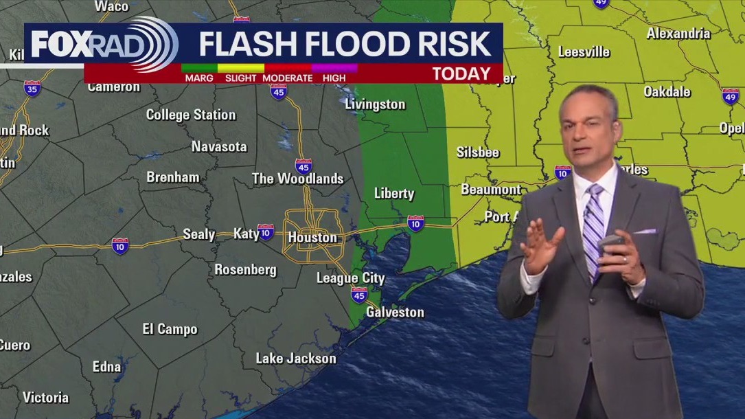
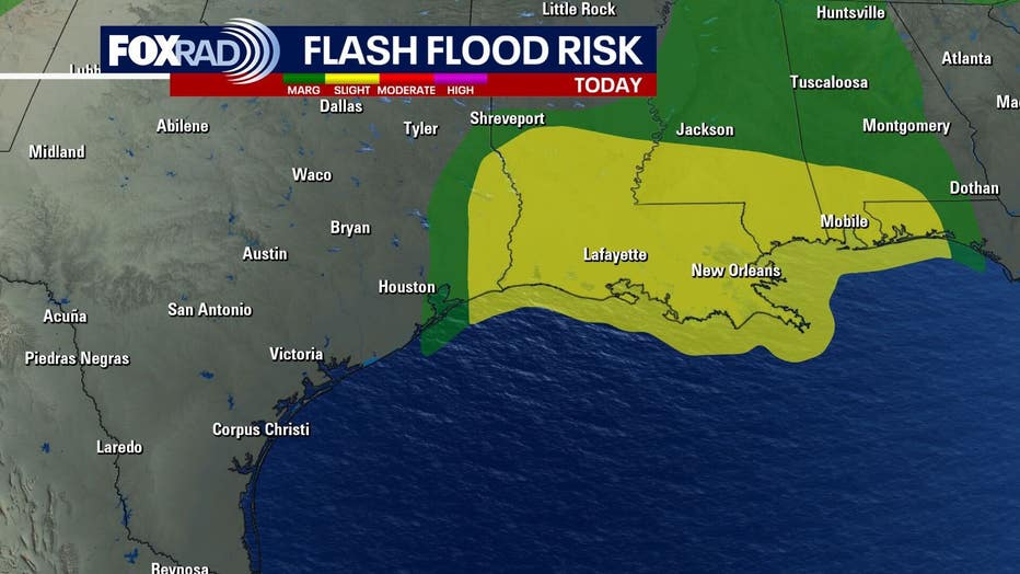
The tropical disturbance that began near Florida on Monday and tracked across the northern Gulf Coast through the week moved into Louisiana yesterday bringing heavy downpours. Leftover moisture and a weak circulation is moving slowly near the Texas-Louisiana State line, so it will most likely help us to see some scattered thunderstorms today.
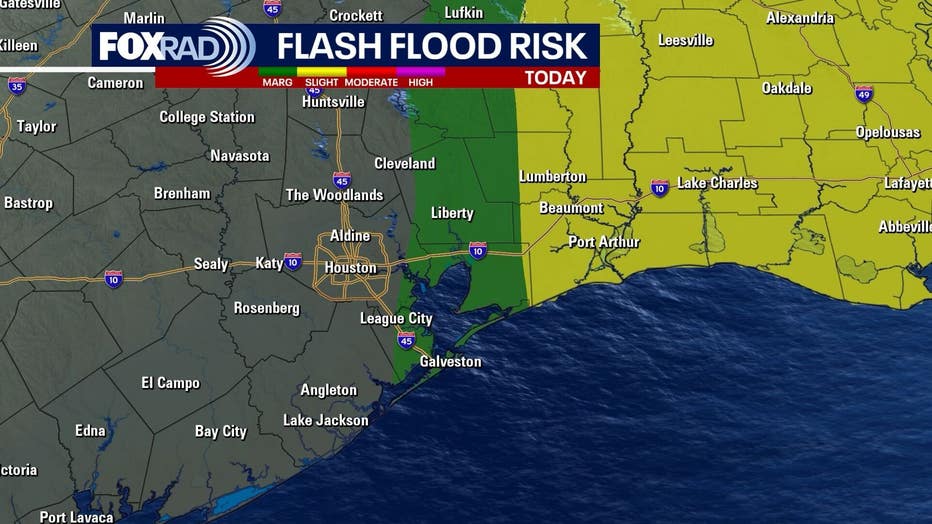
We are not under any sort of flood related advisories and it doesn’t look like it’s going to be a huge deal, but plan on seeing some scattered showers and a few storms today. High temperatures will stay in the low 90s for one more day.
 Heating up for the weekend
This weekend will be a bit of a mixed bag with muggy air and a few scattered storms on Saturday followed by the start of a heat wave on Sunday.
Look for high temperatures in the low 90s on Saturday and in the middle 90s on Sunday when the heat index will rise above 100° for much of the day. The rain chance on Saturday is about 40% and then down to below 20% on Sunday.
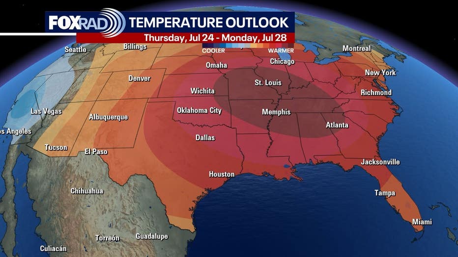
Beyond that next week looks high and dry with lots of sunshine and high temperatures rising into the upper 90s.
Still looking quiet in the tropics
Other than that tropical disturbance we’ve been tracking this week, there’s really nothing else happening across the Gulf, the Caribbean Sea or the Atlantic Ocean, at least not yet. We’re still in a time of the hurricane season where it’s not at all unusual to have little to no activity, but as we head into the month of August, you can expect that activity to pick up quite a bit.
For right now we’re still in Saharan dust mode across the tropics and so not much is expected to happen over the next several days.
The Source: Your Gulf Coast Weather Authority