
CHICAGO – We are keeping an eye on a large storm system that, as of around 7 a.m., is over eastern Iowa.
Fox 32 Meteorologist Mark Strehl has the forecast.
What to Expect:
It is likely that this storm will swing through just southwest of Chicago as we go through the late morning and early afternoon.
The greatest threat would likely be some very high winds and torrential rains, although all threats cannot be ruled out.
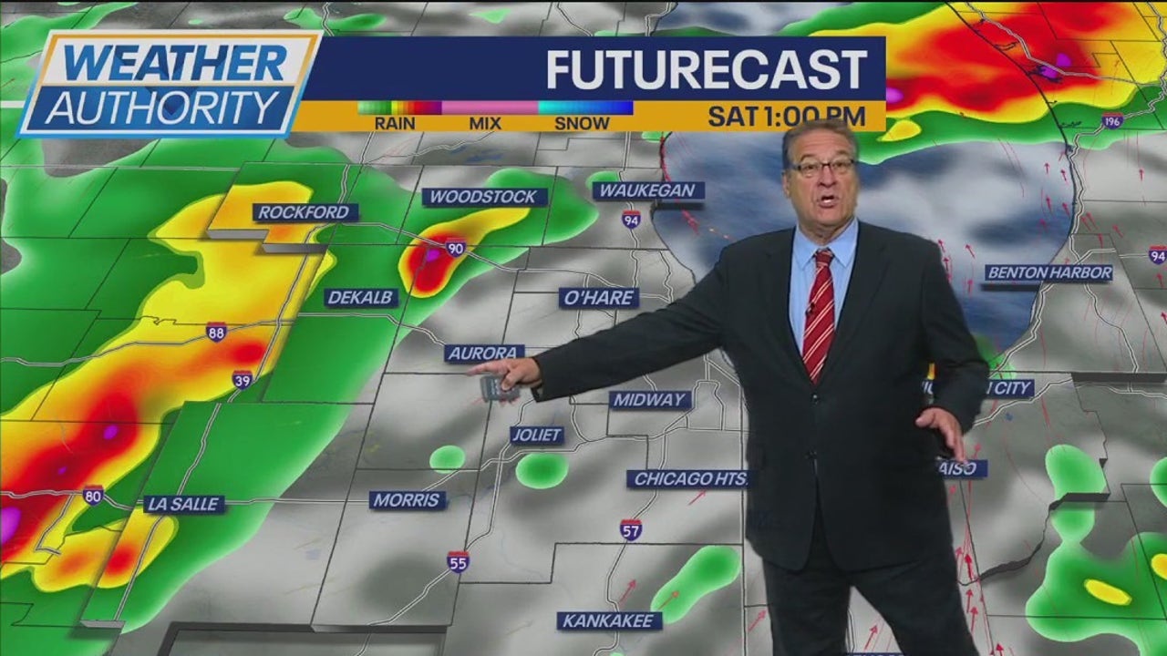
The most likely time for the storms to hit the area are the early to mid-afternoon. Fox 32’s forecast model shows the strongest storms popping up along the I-39 corridor and coming through parts of Grundy and southwest Will counties.
By around 4 p.m., there should be some lingering showers but the bulk of the storms will be out toward the east of the area.
What’s next:
There is yet another risk of heavy rain on Sunday morning, this time, most likely along and south of Interstate 80.
Then the heat sets in late in the week with temps pushing up to near 95 and the heat index near 105 degrees.