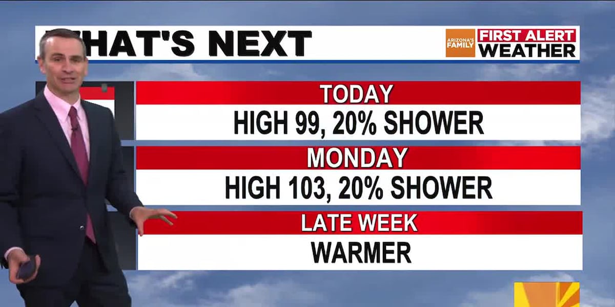
PHOENIX (AZFamily) — The big story for Sunday will be the cooler temperatures. It’s possible that we will stay in the 90s today, as we have a high of 99 degrees in the forecast.
Clouds will move through at times today, and it’s possible a few showers could fall, although most of the Valley will likely remain dry. The higher terrain east of the Valley has a slight chance of a thunderstorm.
A few showers are possible overnight into Monday morning. While there could be a few showers in the west part of the Valley Monday morning, most of the Monday morning commute should be rain-free.
Monday will be a little warmer, but still below normal, with a high of 103 under partly cloudy skies. There is a 20% chance of showers and thunderstorms on Monday afternoon into Monday evening, although most of the activity is expected to remain in the higher terrain east of Phoenix.
After a high of 103 on Tuesday, temperatures will increase into the 105 to 108 range by the middle to the end of the week.
For the high country, scattered showers and thunderstorms will continue at times into Tuesday. There will be the potential for flash flooding along with gusty winds. A drier weather pattern takes over on Wednesday and Thursday as storm chances decrease. That being said, a few isolated showers and storms are still possible.
See a spelling or grammatical error in our story? Please click here to report it.
Do you have a photo or video of a breaking news story? Send it to us here with a brief description.
Copyright 2025 KTVK/KPHO. All rights reserved.