It’s a special thing to have access to some natural places, even with the city built around them.
Inspired by my love for San Diego’s more than 150 named canyons, I put together this list of local options for readers to explore.
Switzer and Juniper Canyons
A short path lets walkers traverse Switzer and Juniper canyons, located within South Park, as well as explore the neighborhood and admire its historical homes. Both canyons are teeming with nature, a welcomed break from the bustling streets above.
This is an ideal option for its central location, near Balboa Park, and it’s easy hiking. The walk takes about 45 minutes to an hour to complete. Walkers will begin at the eastern Switzer Canyon entrance, located off of Burlingame Drive.
Los Penasquitos Canyon Preserve
A roughly 3-mile loop in the Los Peñasquitos Canyon Preserve is a challenging hike leading to a rushing waterfall and surrounding pools. The Peñasquitos Falls Loop via Carmel Valley follows portions of the Los Peñasquitos Canyon Trail on the north and south sides of the creek, marked as North Trail and South Trail.
Park along Evans Wood Way, in a residential neighborhood located off Carmel Mountain Road. The trailhead is at the end of the road.
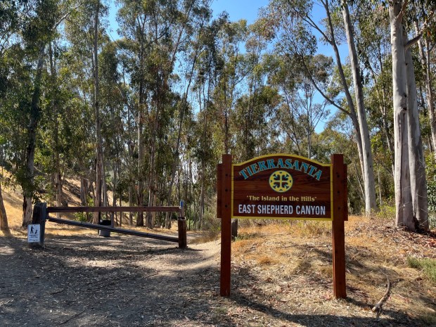 The trailhead located on Via Valarta in Tierrasanta. (Maura Fox / The San Diego Union-Tribune)
East Shepherd Canyon
East Shepherd Canyon in Tierrasanta can be explored along an almost 2.4-mile out-and-back trail that runs through the canyon. The trail offers a mix of shaded forest along with moments to bask in the sun, and it is quiet.
I chose to start at the trailhead located on Via Valarta, northeast of Clairmont Mesa Boulevard. The other trailhead is on Santo Road, just south of Antigua Boulevard.
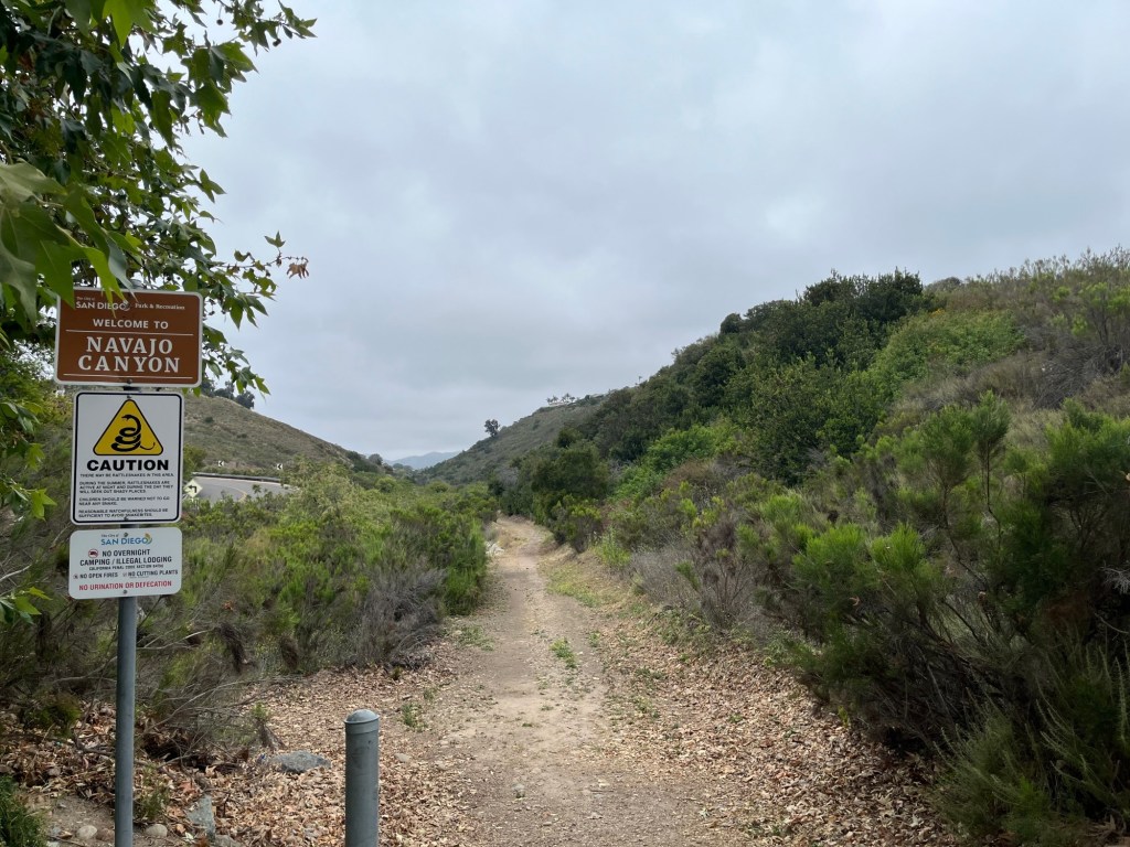
Navajo Canyon
The hike through the Navajo Canyon Open Space offers hikers stream crossings and solitude.
The roughly 2.3-mile easy out-and-back trail that travels through the canyon is lined with healthy vegetation. To begin, park at the canyon’s southern trailhead, located on Adobe Falls Road where it meets Alvarado Canyon Road. Street parking is available, and the trailhead is marked with a few signs and a gate.
Mission Hills Open Space Canyon
This moderately difficult, half-mile trail through the Mission Hills Open Space, is located across from Pioneer Park. Depending on the map you use, it’s called both the Robyn’s Egg Trail and the Monastery Trail.
Despite its short length the canyon trail is rugged, so be sure to wear good hiking shoes and consider bringing a trekking pole. To begin, park on one of the residential streets near the trailhead, which is located directly west of the Mission Hills tennis courts on Washington Place.
Gonzales Canyon
In Gonzales Canyon, an open space park located north of Carmel Valley, there’s a 5.7-mile moderate loop offering views of nearby horse stables and the ocean near the end. There is a mix of terrain, too, which keeps hikers engaged over the course of the roughly two-hour hike.
The hike begins east of the open space. There’s street parking available on Pacific Highlands Ranch Parkway.
Rose Canyon
The easy out-and-back hike through Rose Canyon, located in University City between Interstates 5 and 805 is a roughly 4-mile journey. It’s a simple trail to follow and is located along Rose Creek, within the Rose Creek watershed.
There are a few ways to start this hike, but I chose to begin at the trailhead on Genesee Avenue, just southeast of Centurion Square.
Tecolote Canyon
With about 6.5 miles of trails, Tecolote Canyon Natural Park and Nature Center is located between the communities of Bay Park, Linda Vista and Clairemont.
One option is a nearly 3-mile easy loop, which travels through a section near the northern end of the canyon, starting at a trailhead behind Mt. Etna Park. Along the way, hikers will pass by a few creeks — some dry, others with water — and cross over wooden bridges.
City Heights canyons
The canyons in City Heights — Manzanita, Swan, Hollywood and Olivia — collectively provide a journey through art, open space and community parks.
The Canyonlands organization has created a trail map of the canyons, which I recommend bringing with you on the hike: sdcanyonlands.org/looptrail. The path is mostly easy, but there are several sections where hikers must walk through a rocky wash and up steep hills to exit the canyons.
To begin, park on Thorne Street, near Manzanita Place and the Ocean Discovery Institute Living Lab. There is a trailhead that heads southwest into Manzanita Canyon.