 Houston weather: Steamy Monday ahead in the 90s
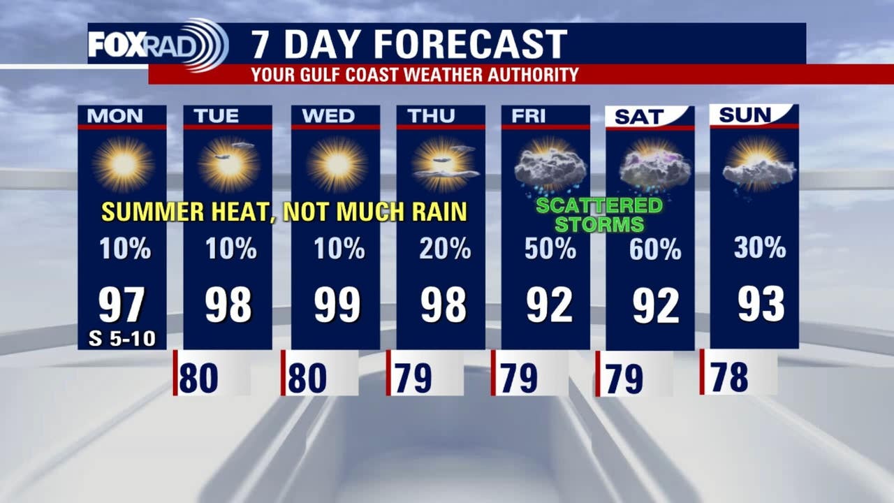
A dreaded heat dome will impact much of the country but here in the Houston-area we are not under any heat advisories. Highs for us are not unusual, so expect sizzling daytime highs in the 90s today through Thursday with heat index values above 100.
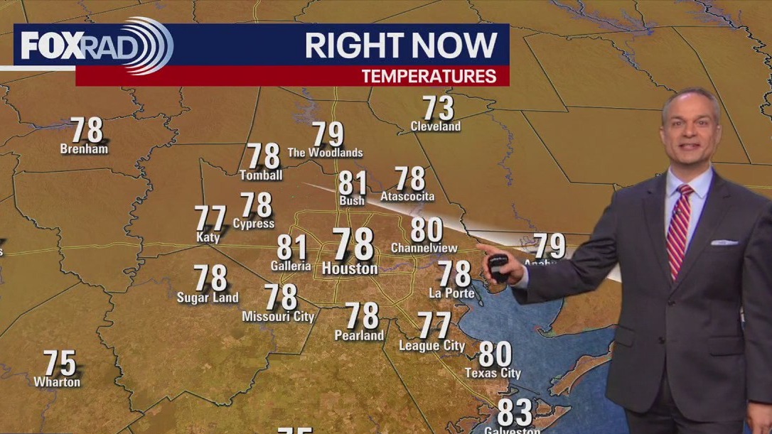
HOUSTON – Muggy this morning, then mostly sunny and hot with highs in the mid to upper 90s.
Intense heat through mid-week
Expect sizzling daytime highs of 97–99 today through Thursday with heat index values above 100.
Morning lows remain steamy. Although no heat advisories are in effect, be careful not to overexert yourself outside, stay hydrated and get in the AC when possible.
Storm chances Friday as Gulf moisture returns 
Moisture from the Gulf—augmented by remnants of last week’s tropical wave—will surge in Thursday night into Friday, boosting rain and storm chances to 50%, especially during afternoon and evening hours.
Tropics remain fairly quiet
The National Hurricane Center confirms no active threats in our vicinity. Meanwhile, a tropical wave, now dubbed “Invest 94L” has at least a 20% chance for development over seven days; it poses no immediate threat to the Gulf.
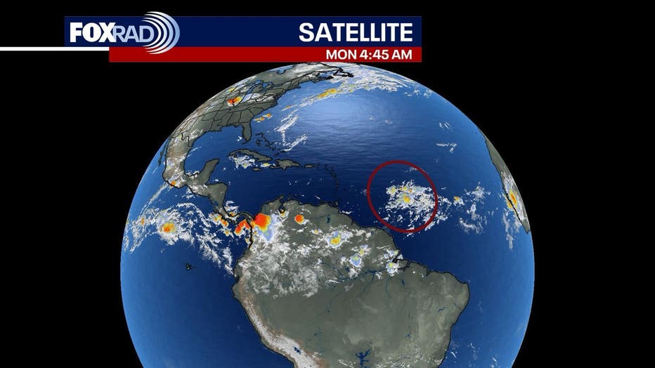
The plume of moisture expected here on Friday has a slight chance of spinning up into a depression, but that is highly uncertain at this point.
The Source: The information in this article comes from the FOX 26 weather team.