CHICAGO – There was a terrific light show in the southern sky during my drive in. Thunderstorms are rumbling mainly south of the Kankakee River Valley.
Chicago weather forecast
What to expect:
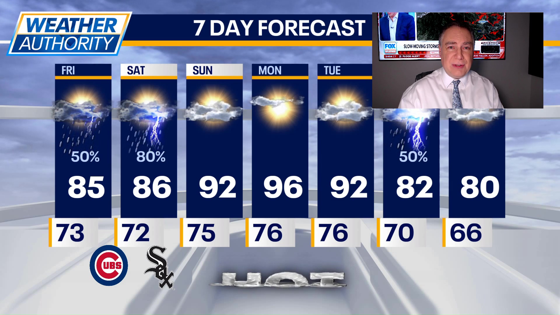
Additional showers and thunderstorms will be possible throughout the day with high temperatures held back in the mid-80s. There will be plenty of humidity though, so while it’s not as hot, I wouldn’t consider it much relief.
Tonight, showers and thunderstorms will likely return after midnight. Those storms will continue through tomorrow morning with a potential for gusty winds and torrential rainfall.
Chicago weekend forecast
What’s next:
Highs tomorrow will once again be held down a little bit due to cloud cover and another round or two of showers and storms. Highs should reach the low to mid 80s.
The break from the heat doesn’t last long with 90s returning Sunday, Monday and Tuesday. There is very little chance of any rainfall during those three days. Monday would likely be the hottest of the three days when highs could be in the mid to upper 90s.
Storms return to the forecast on Wednesday as a cold front sweeps through. That should knock temperatures down quite a bit for the end of next week.
The Source: The information in this report came from FOX 32 Meteorologist Mike Caplan.