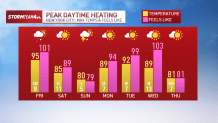
Extreme heat returns to the tri-state area with a vengeance Friday, pumping feels-like temperatures near 110 degrees in parts of New Jersey as the New York City metro area braces for afternoon humidity-fueled storms.
High temperatures are expected to reach near-record levels.

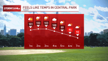
An extreme heat warning has been issued for parts of northeastern and central Jersey, where it could feel like 107 by the afternoon. The rest of the region is under a heat advisory, for temps feeling closer to 104 degrees. Check the latest weather alerts for your neighborhood here.
This level of heat and humidity makes it difficult for our bodies to regulate their temperature and stay cool. Normally, when it is hot, we sweat to cool down. The sweat evaporates, and that evaporative cooling pulls heat from our skin to help lower our body temperature. But when the air becomes increasingly humid, the sweat can’t evaporate and our body temperature can climb quickly. This can lead to severe heat symptoms.
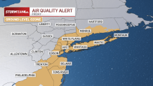
Air quality is also a concern.
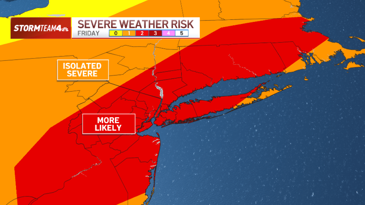
Heat fuels severe weather threat
Not only will Friday’s heat make for dangerous weather in terms of how it feels outside, but it will fuel storms expected to develop by the late afternoon.
An approaching cold front will bring showers and storms in the window of 2 p.m. to 7 p.m., with the storms hitting the NYC metro area on the latter end of that timeline. It won’t be great for the Friday evening commute.
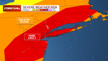
Primary concerns will be brief, heavy rainfall during peak evening travel times, as well as damaging wind gusts. Hail is also possible.

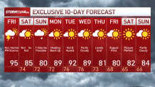
Once these storms clear, we get a quick break on Saturday. Storm chances return Sunday, so make sure you back up for any outdoor plans you may make.
All these showers and storms will help bring our temperatures back into the 80s for the weekend, but they won’t do much to help wipe out the humidity. We’ll be stuck feeling sticky and sweaty straight into the start of next week, as temperatures rebound back into the 90s.