The weather in Philadelphia was a bit cooler on Saturday, with lower humidity, but a huge warmup is coming early next week.
Smoke from the wildfires was visible and can be smelled overnight, but there’s a good chance conditions will improve by the morning.
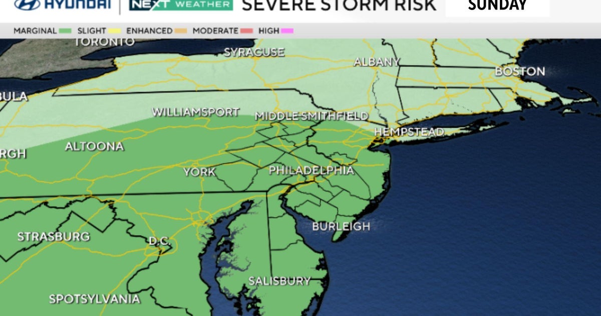
Sunday morning, we have a disturbance rolling past with isolated early showers or storms, but it will be later in the day and evening that we’ll need to keep an eye on the sky.

CBS News Philadelphia
Widespread showers and storms are likely to develop between 3 p.m. and 5 p.m., moving west to east. Tropical downpours with several inches of rain are possible under any thunderstorms, leading to localized flash flooding. There is also a lower-end severe weather threat with any storm, including damaging winds and large hail.
Power outages, downed trees and travel delays are possible.
Another heat wave takes hold Monday through Wednesday with highs in the mid to upper 90s and heat indices 100 and above. Heat alerts are likely early next week.
Thursday, there is a chance of showers and storms, which will end the heat. It is also the start of a cooler-than-average stretch of days between July 31 and Aug. 4.
Stay with the NEXT Weather Team for the latest updates to prepare for any storm, flood and heat threats where you live.
Here’s your 7-day forecast:

CBS News Philadelphia
Sunday: Strong p.m. storms. High 88, Low 73.
Monday: Heat is back. High 95, Low 74.
Tuesday: Very hot. High 97, Low 75.
Wednesday: Very hot. High 98, Low 77.
Thursday: Chance of storms. High 84, Low 77.
Friday: Partly cloudy. High 82, Low 69.
Saturday: Sunny skies. High 84, Low 64.