CHICAGO – We got through Saturday with exactly zero warnings for severe thunderstorms or flooding.
In fact, the vast majority of Chicagoland had little to no rainfall whatsoever.
Fox 32 Meteorologist Mike Caplan has the forecast.
What to Expect:
Once again, there were some isolated heavy-rain producers, this time targeting Northwest Indiana where some minor flooding occurred.
Today, as I drove in, there was a light show in the southern sky.
Thunderstorms with heavy rain are moving through Will County, headed towards Northwest Indiana again, where downpours will be the primary threat along with lightning. Those should fade away shortly after sunrise leaving behind a partly to mostly sunny sky with temperatures rising into the low 90s.
There is a small chance of a spotty t’shower this afternoon.
What’s next:
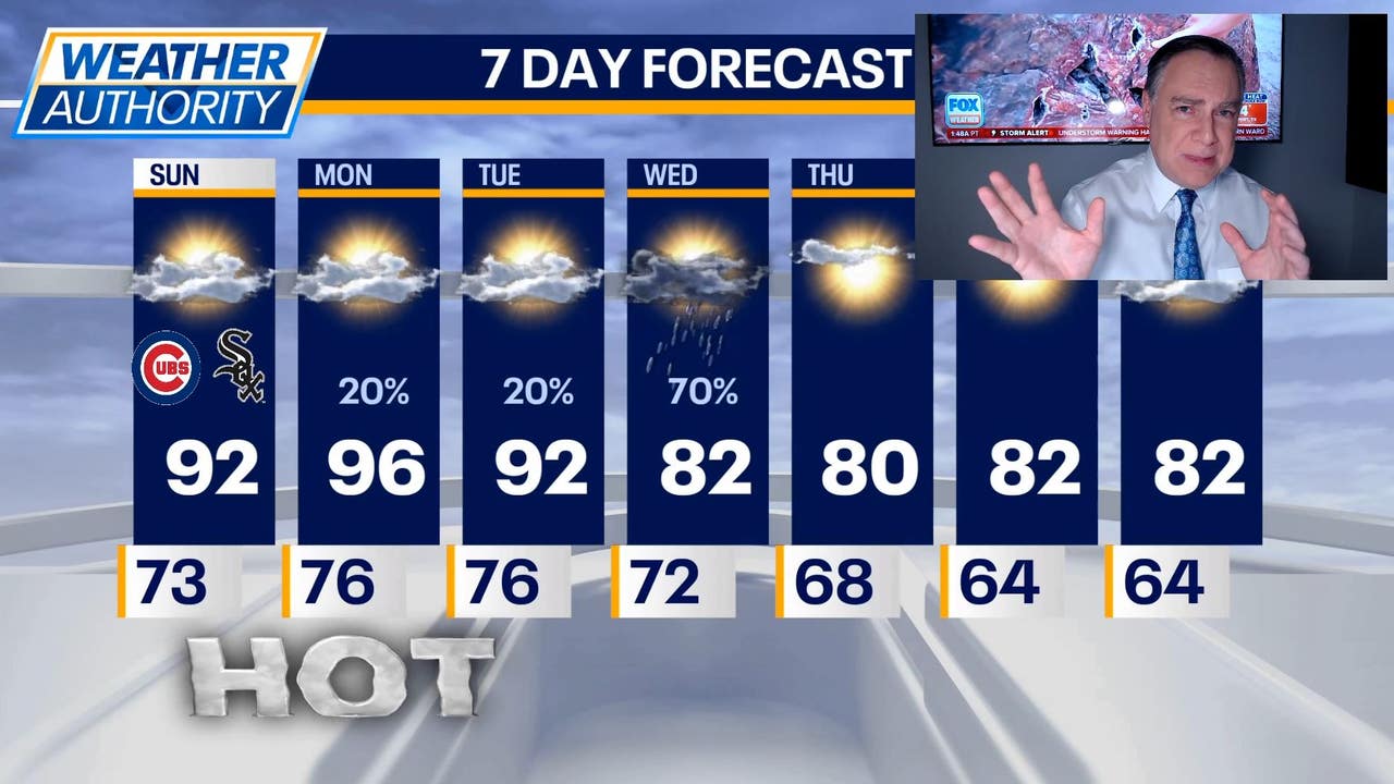
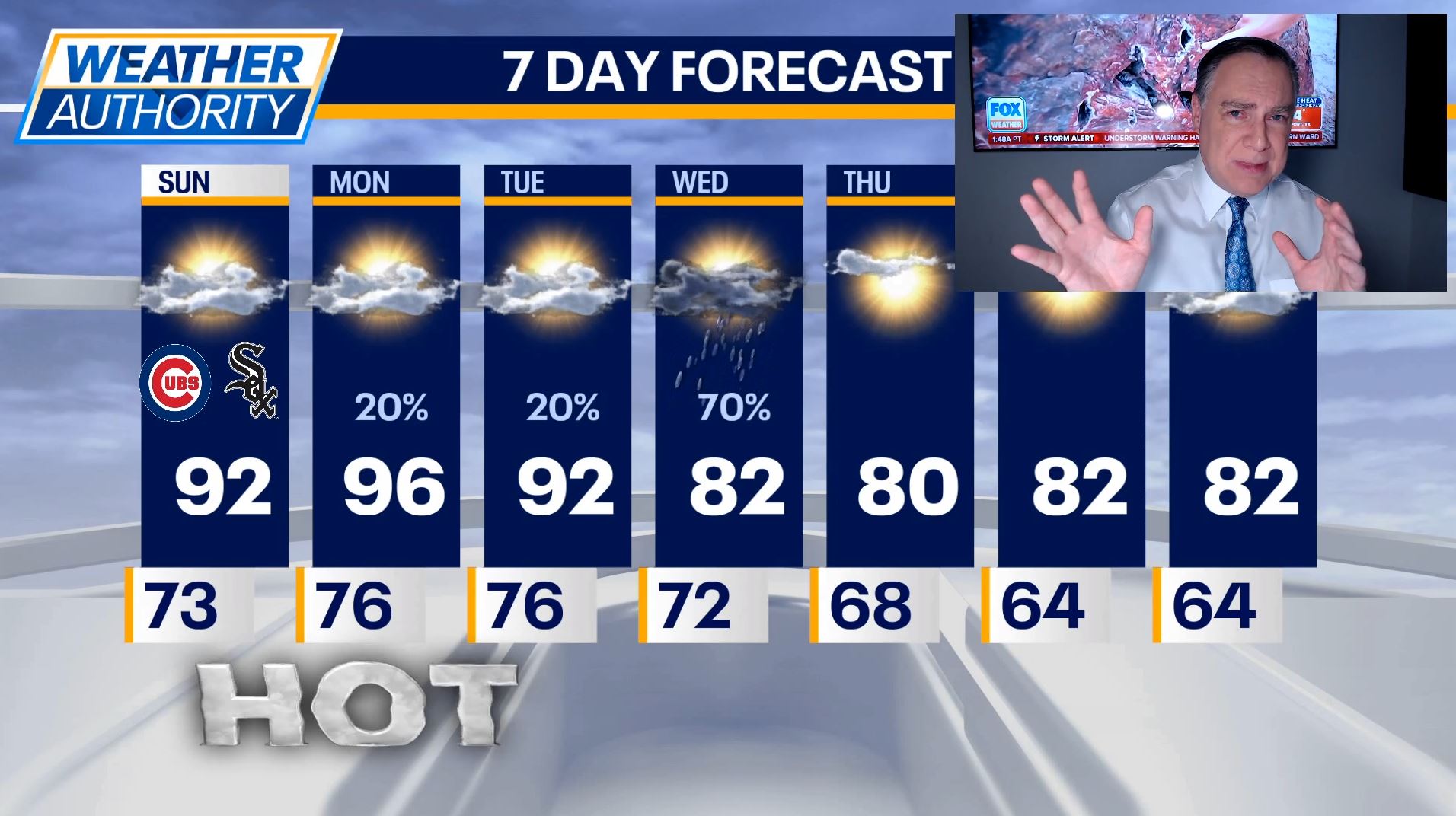
This will be the first of a three-day heat wave reaching its peak tomorrow.
Highs on Monday will be in the mid to upper 90s and may very well end up being the hottest day of the year so far.
On Tuesday, highs will be in the low to possibly mid 90s. While a thunderstorm cannot be ruled out during this period it will more likely stay dry. One period to watch will be toward dawn Monday when a decaying line of storms will approach.
Rain chances go up Tuesday night and Wednesday when a cold front will move into the area. That should spark at least scattered thunderstorms and end the heat.
Humidity values will also be knocked back, providing some real relief from the mugginess we’ve experienced in the past week plus.
Highs Wednesday through Friday will likely be not far from 80 degrees.