
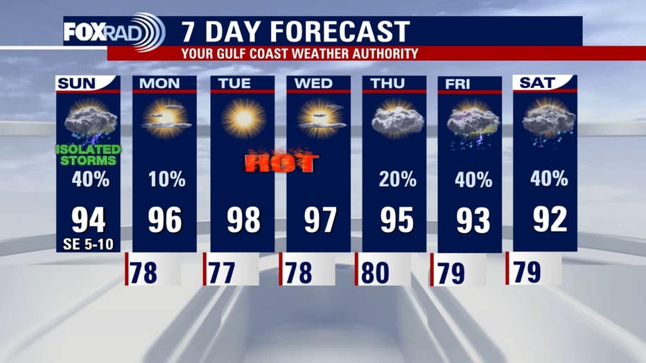
HOUSTON – After a humid Sunday with isolated showers, the Houston area is preparing for a return to scorching temperatures and triple-digit “feels-like” conditions as high pressure moves back into the region next week.
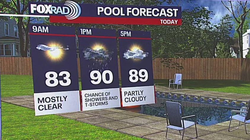
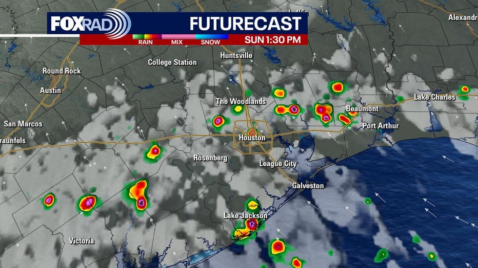
Showers are possible through Sunday afternoon, particularly in areas like Houston, Liberty County, and Fort Bend County, before clearing out by sunset.
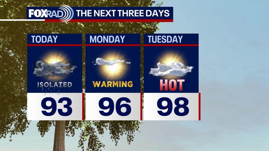
Temperatures this morning are generally in the 70s and low 80s, offering a pleasant start to the day. Highs inland are expected to reach the low 90s today, with a few isolated spots potentially hitting 94 or 95 degrees if they miss any rainfall.
However, residents should prepare for a significant warm-up. There will be a return to temperatures in the upper 90s, with the heat index making it feel well into the triple digits.
 Hurricane Season Update
While the hurricane season has been relatively quiet so far with three named tropical storms, August and September mark the peak of the season. This period typically sees a decrease in dry air and Saharan dust across the Atlantic, coupled with less wind shear and warmer water temperatures, all of which can fuel developing storms.
Currently, there are no immediate threats on the horizon, with quiet conditions expected for at least the next week. Residents are encouraged to monitor local weather updates, particularly through the free FOX local app, for any changes.
The Source: Information in this article is from FOX 26 Houston Meteorologist Allison Gargaro.