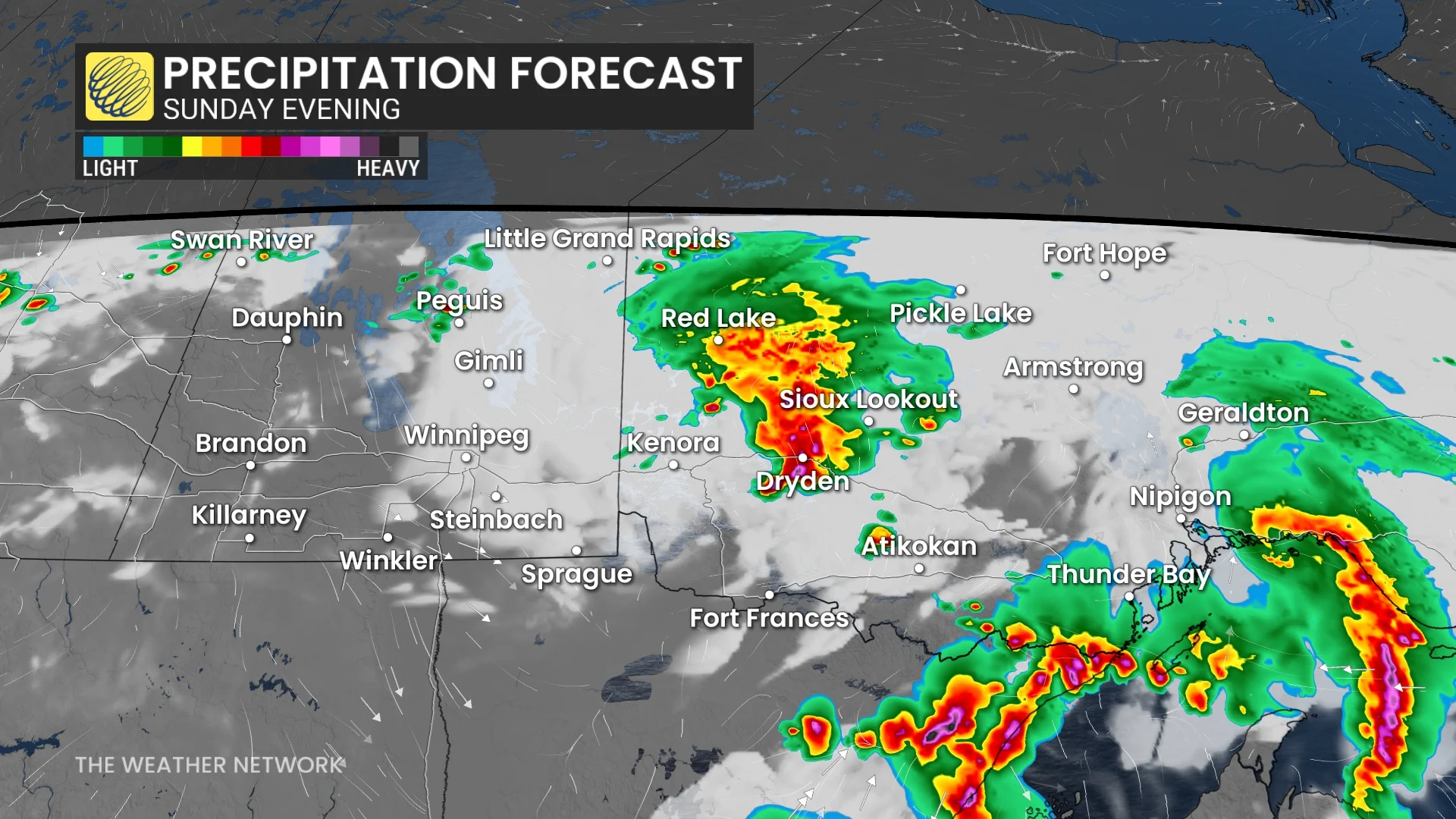
By late afternoon, we will see a low-pressure system from the U.S. push storms into northwestern Ontario by the afternoon. By late afternoon, the storms will push into Thunder Bay.
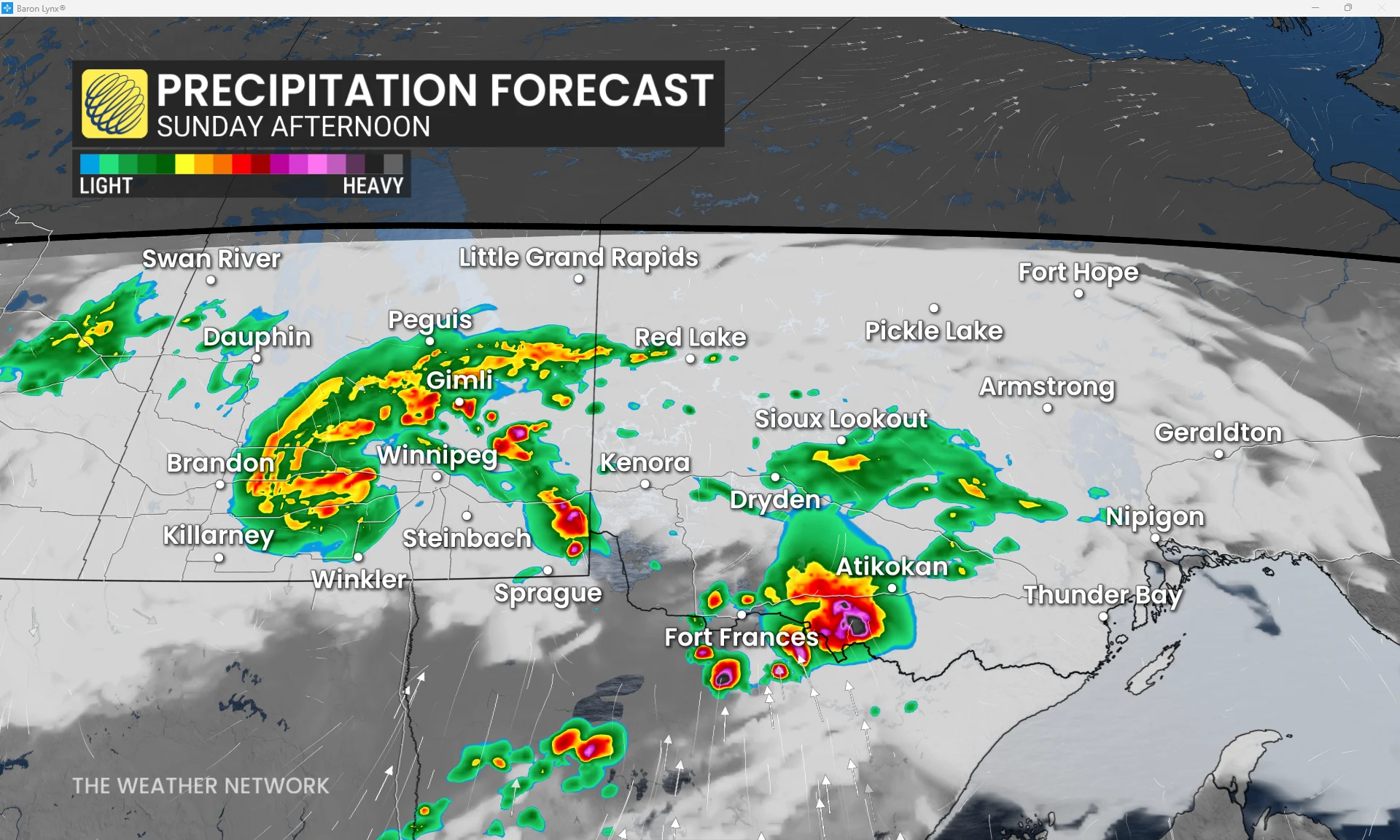
Large hail is expected to be the biggest threat, ranging from the size of a loonie to a ping pong ball-sized hail.
Between the afternoon to evening, multiple rounds of storms will continue to hit northwestern Ontario. Heavy rain will be another threat from these storms, with concerns of localized flooding.
Highway 17 and Highway 11 will see the biggest driving threats, where some areas could see up to 50 mm of rain across all of Sunday.
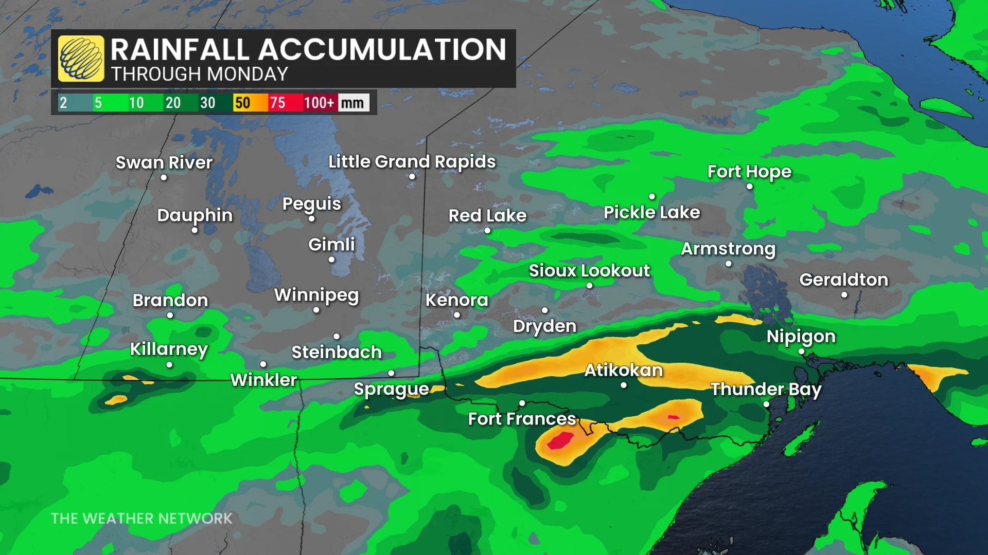
While Fort Frances could see upwards of around 20 mm and Thunder Bay could see anywhere from 10-20 mm of rain across Sunday.
Going into the overnight, these storms will cross Lake Superior, where they are expected to lose a lot of their instability.