 article
DALLAS – North Texas is in for a scorching end to July as high pressure builds, sending heat indexes soaring. But, a significant pattern change in August could bring some much-needed relief.
Monday’s Forecast 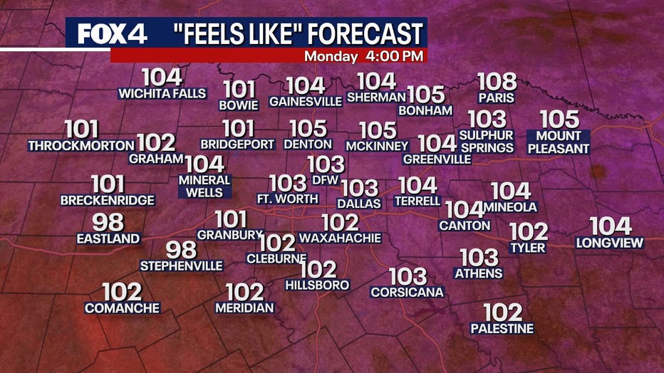
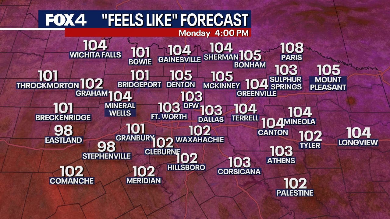
Temperatures are set to crank up Monday, as high pressure settles back over Texas from the east. This pretty much shuts down any chance of showers for a while. Expect sticky, humid air Monday morning before we dry out in the late afternoon. With temperatures climbing into the upper 90s, you’ll feel heat indexes pushing 102 to 105 degrees. The National Weather Service has advisories out, but only a few isolated spots are expected to hit those extreme levels.
Heat Advisory in North Texas
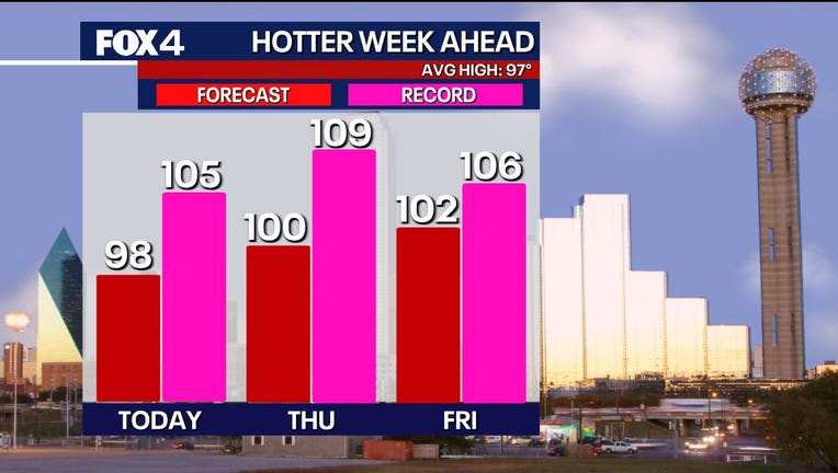
As the high-pressure system builds overhead Tuesday and Wednesday, the air will continue to dry out and heat up under generally sunny skies. These days are shaping up to be the hottest of the summer so far in North Texas. While specific temperatures can vary, the odds of reaching triple digits increase significantly on Tuesday and become most-likely Wednesday and Thursday, with temperatures expected in the low 100s.
7-Day Forecast 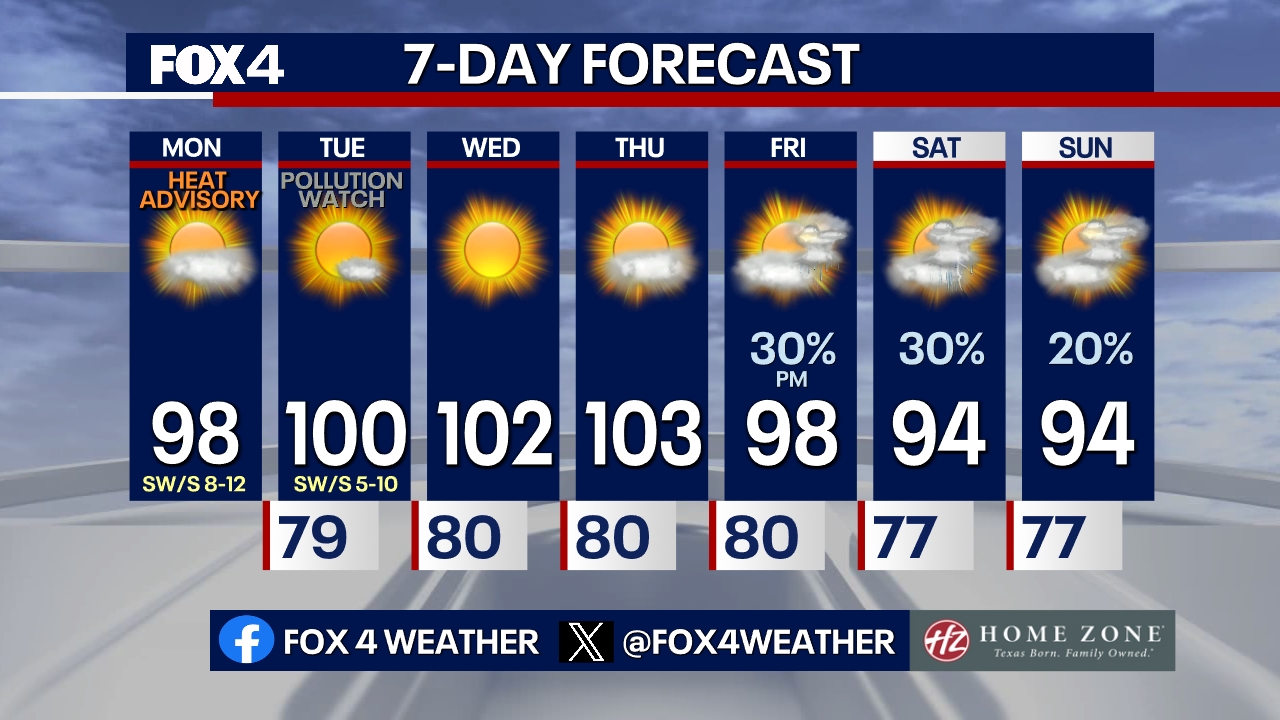
Showers and storms are possible on Friday afternoon, with the potential for gusty winds.
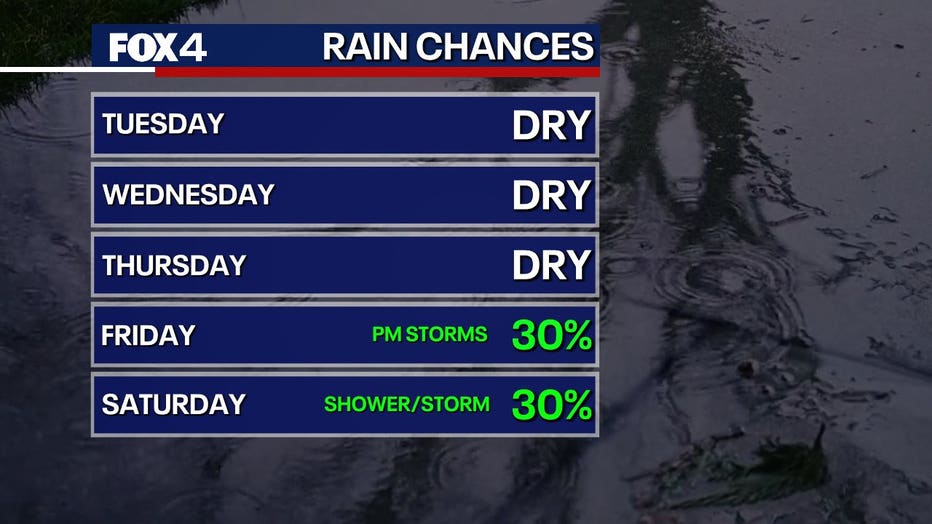
Temps will slowly drop in North Texas this weekend, bringing some relief as we kick off August. There will be possible showers and storms this weekend, with the strongest ones potentially packing gusty winds and heavy rain. Something different is definitely on the way!
The Source: Information in this article comes from the National Weather Service.
WeatherWeather ForecastDallasFort Worth