August 8, 2025, 10:30 AM HST
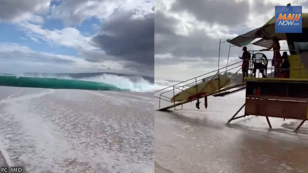 South swell. File PC: Maui Department of Fire & Public Safety.
A large south swell will gradually fill in on Friday and peak on Saturday near warning thresholds, according to the National Weather Service. Peak afternoon high tides, combined with elevated water levels running about a half a foot higher than predicted and a large south swell filling in, will lead to minor flooding along shoreline and low-lying coastal areas through Saturday. Water levels should fall below thresholds during peak afternoon high tides Sunday.
For the High Surf Advisory, large breaking waves of 7-10 feet are expected on Friday rising to 10 to 14 feet on Saturday. The advisory is in effect from 6 a.m. today to 6 a.m. on Monday.
For the Coastal Flood Statement, isolated minor coastal flooding is expected. The statement is in effect through late Sunday night for portions of Kahoʻolawe, Kauaʻi, Lānaʻi, Maui, Molokaʻi,
Niʻihau, Oʻahu and Hawaiʻi Island.
ARTICLE CONTINUES BELOW AD
The public can expect flooding of beaches that are normally dry, minor coastal erosion, and saltwater inundation. Strong breaking waves and strong currents will make swimming dangerous.
As a precaution, the public is asked to avoid driving through flooded roadways. If you are forced to drive through salt water, be sure to rinse your vehicle with fresh water. Move electronics, vehicles or other valuables to higher ground. Monitor vessels to ensure mooring lines don’t get too tight and watch out for overwash around boat ramps. Secure canoes or other watercraft stowed on beaches.
The public should heed all advice from ocean safety officials. The NWS reminds the public: “When in doubt, don’t go out.”