HOUSTON – A tropical wave (Invest 97L) off the African coast should become the season’s first hurricane next week. It is extremely far from the US, but in about 10 days, it could become a concern.
The National Hurricane Center is also monitoring a tropical wave (Invest 96L) in the middle of the Atlantic that is struggling to stay organized.
Hit or Miss Storm Chances this Week 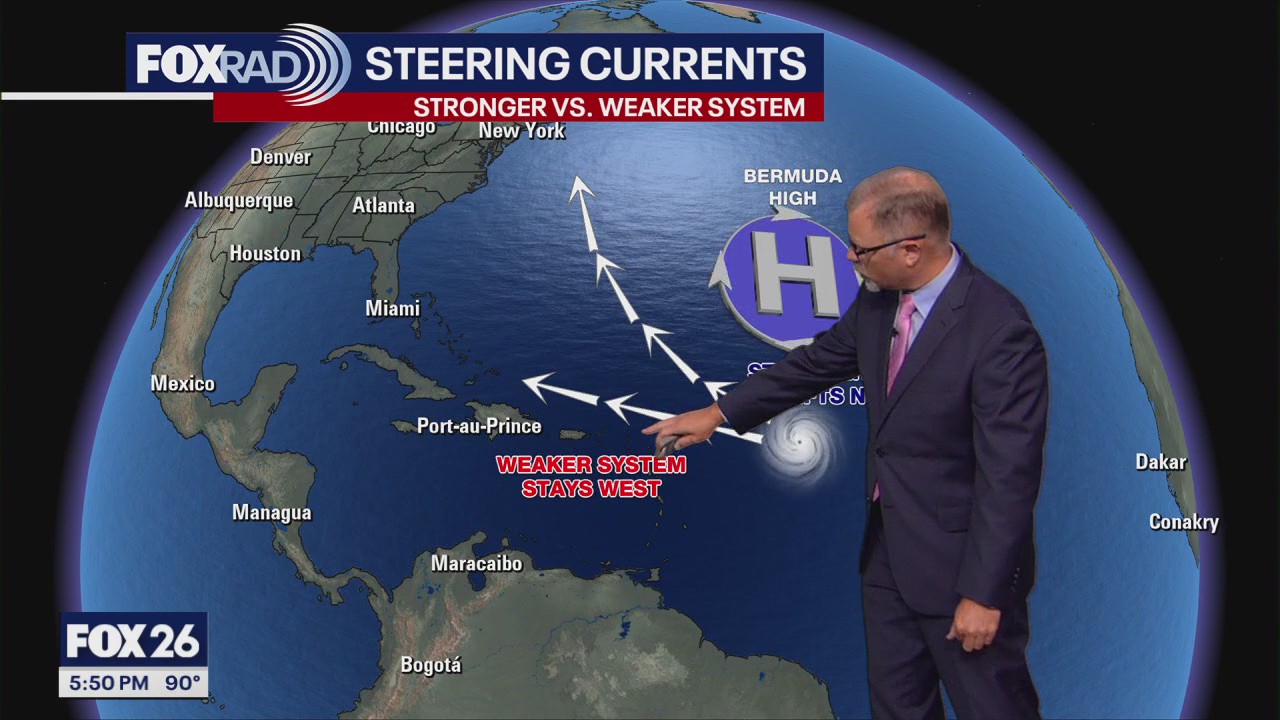
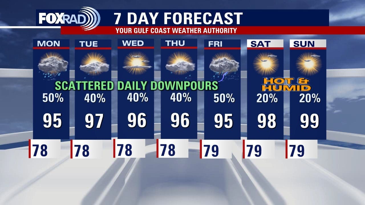
Storm coverage this week should be more than what we saw last week.
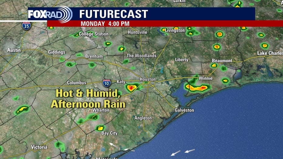
The upper-level wind flow is going to pull in some Gulf moisture and daytime heating should lead to scattered downpours. A few could produce lots of lightning and possibly some gusty winds.
The highest likelihood of storms to move through will be between about noon and 7 p.m. each day this week.
First Week of School Weather 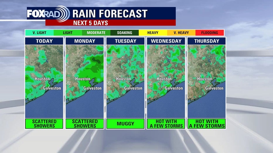
August heat and humidity will keep temperatures slightly above average with heat index values of up to 105.
A daily chance of isolated showers and a few storms will continue as well.
Always remember when thunder roars, head indoors.
 Latest on the Tropics
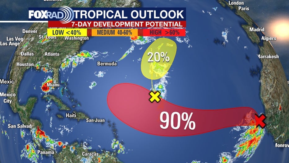
A tropical wave (Invest 97L) which moved off the African coast, has a better chance of becoming the season’s first hurricane next week. It is extremely far from the US, but in about 10 days, it could become a concern.
We will likely see ‘Erin’ form by the middle of this week.
We are also monitoring a tropical wave (Invest 96L) in the middle of the Atlantic that is struggling to stay organized, due to dry air getting wrapped into the system.
We will continue to monitor the latest weather models and bring you updates daily on FOX Local.
The Source: Information in this article is from the FOX 26 Houston Weather Team.
