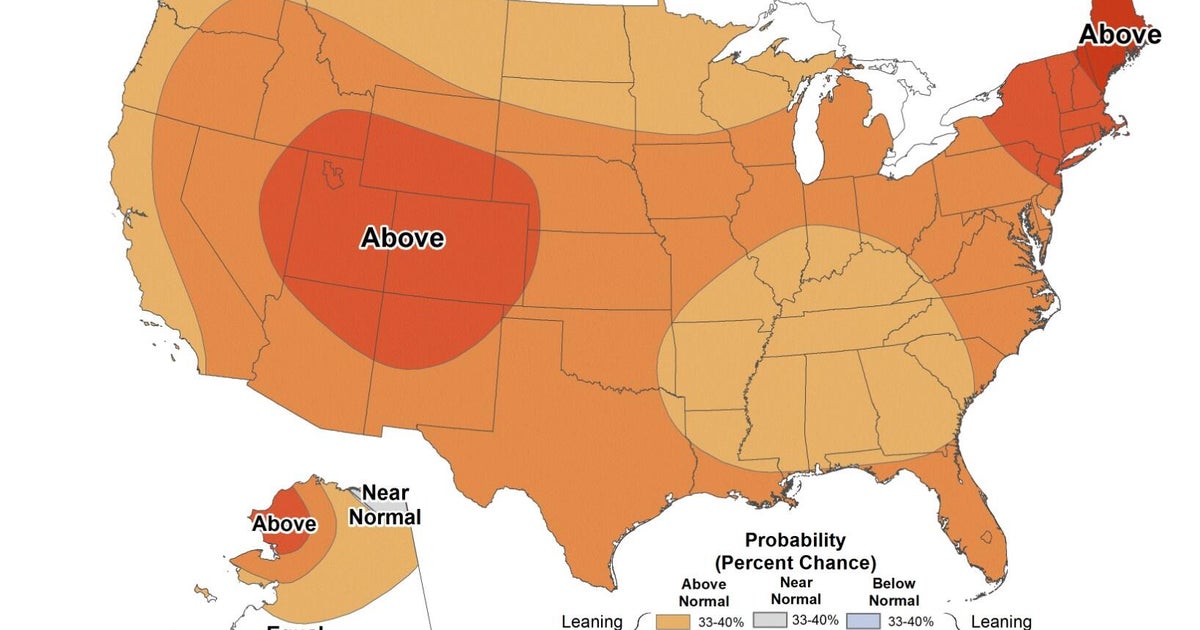
As we move into the fall months, the NOAA Climate Prediction Center is forecasting above-average temperatures and near-normal rainfall for the Chicago area.
Typically, fall in Chicago sees a steady drop in temperatures, from an average high of 75.5 degrees Fahrenheit in September to around 48.4 degrees Fahrenheit by November.

CBS
Rainfall remains consistent early in the season, with both September and October usually seeing over three inches of precipitation.

CBS
By November, that amount drops slightly to about 2.5 inches.
The first signs of snow also tend to arrive in the fall — with Chicago averaging about 0.2 inches in October and 1.8 inches in November — but with warmer-than-normal temps expected, snow may once again be delayed.
NOAA defines “meteorological fall” as the period from Sept. 1 through Nov. 30.
Looking ahead to winter, defined by NOAA as Dec. 1 through Feb. 28, Chicago could see a wetter-than-normal season, with temperatures expected to remain near average.

CBS

CBS
This winter outlook is influenced by the potential development of a La Niña pattern, which occurs when cooler-than-average sea surface temperatures are observed in the eastern Pacific Ocean near the equator.

CBS
La Niña shifts global weather patterns, and for the Midwest, including Chicago, it typically brings a more active jet stream over the Great Lakes. This can result in more frequent storms and above-average precipitation for the region, while much of the southern U.S. tends to remain drier than usual.

CBS
On average, Chicago receives around 38 inches of snow each season, with January standing out as both the coldest and snowiest month.

CBS
Highs in January generally stay in the low to mid-30s, while lows often dip into the teens and 20s.

CBS
While near-normal temperatures are expected this winter, the influence of La Niña could still bring more snow and precipitation overall, especially if the pattern strengthens in the coming months.