JACKSONVILLE, Fla. — Dry morning commute and bus stop forecast.
- Temperatures in the mid to upper 70s.
- Tracking afternoon highs in the mid 90s inland and near or just about 90 degrees along the coast.
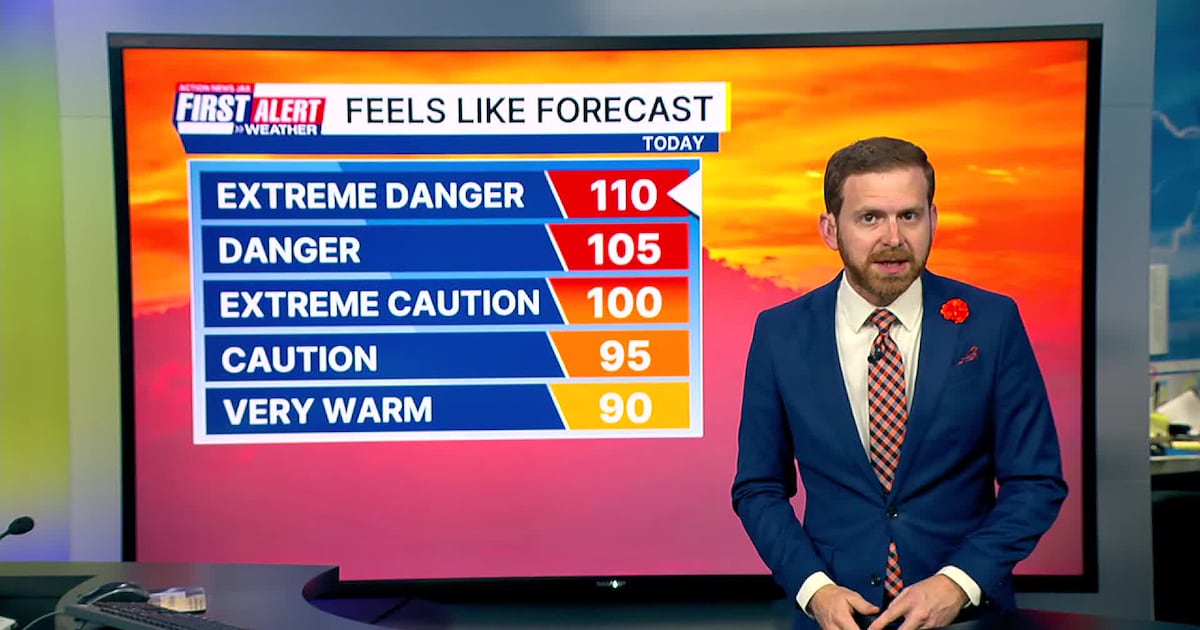
- Feels like temperatures will be 108-112 this afternoon.
- Heat advisory in effect from 11 a.m. – 7 p.m.
- An isolated late afternoon shower and storm will develop and spread east.
- The heat continues tomorrow as highs remain in the mid 90s and feels like temperatures remain at 107-110.
- A few more neighborhoods see rain and storms on Saturday afternoon.
TROPICS:
- “Erin” is now organizing & strengthening over the Central Atlantic. Not much change in the forecast in what is expected to become at least a Cat. 3 hurricane but missing Puerto Rico to the north & staying well east of Florida next week reaching Jacksonville’s latitude about early Wed. resulting in some rough seas & surf at area beaches next week.
- Also – a tropical wave over the SW Gulf / Bay of Campeche has flared up but will move into Mexico today.
- Always more: “Talking the Tropics With Mike”.
TODAY: Partly sunny, HOT and humid. Isolated late afternoon shower/storm. HIGH: 96 (Feels like 108-112)
TONIGHT: Partly cloudy. Warm and humid. LOW: 78
SATURDAY: Partly cloudy with a few afternoon storms. 78/94
SUNDAY: Partly sunny with an isolated afternoon storm. 76/92
MONDAY: Partly sunny with a few afternoon storm. 75/93
TUESDAY: Mostly sunny with an isolated shower south. 74/93
WEDNESDAY: Mostly sunny. 73/92
THURSDAY: Partly sunny with an isolated shower/storm. 74/94
>>> STREAM ACTION NEWS JAX LIVE
[DOWNLOAD: Free Action News Jax app for alerts as news breaks]
[SIGN UP: Action News Jax Daily Headlines Newsletter]
Click here to download the free Action News Jax news and weather apps, click here to download the Action News Jax Now app for your smart TV and click here to stream Action News Jax live.