ILLINOIS — A “hot and humid” pattern will settle into the Chicago area this weekend, continuing into the work week, according to the National Weather Service.
Peak afternoon heat index values up to 110 degrees are expected Saturday through Tuesday, the weather service said. In addition to the heat, there will be clusters of storms possible Friday night through Tuesday.
“Episodes of storms are also probable across the general region, though many hours and areas will stay dry,” the weather service said on its Facebook.
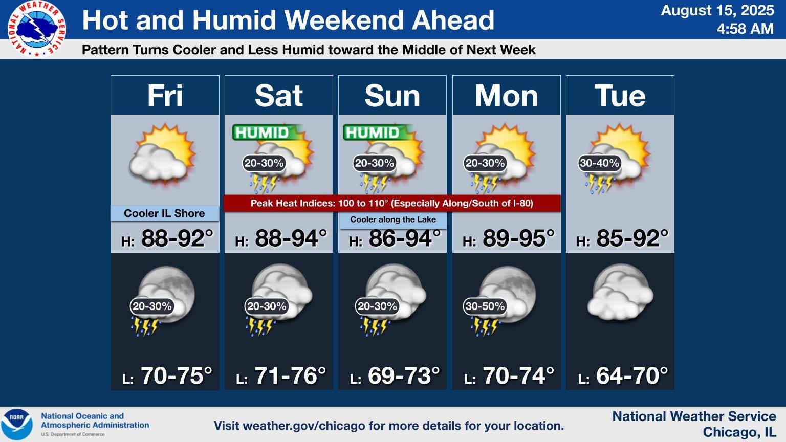
Daytime hours are expected to be “hot and humid, but dry” on Friday and peak heat indices could approach 100 degrees in parts of the area.
If storms move into the area on Friday night, storms could cause localized wind damage. The weather service said that the chance of storms is currently only 20 to 25 percent.
The weather pattern will start to trend cooler and less humid by Wednesday, according to the weather service.
FRIDAY: Mostly sunny, with a high near 91. Southwest wind around 5 mph.
FRIDAY NIGHT: A 20 percent chance of showers and thunderstorms after 1 a.m. Partly cloudy, with a low around 73. Southwest wind around 5 mph becoming calm in the evening.
SATURDAY: A 20 percent chance of showers and thunderstorms. Partly sunny, with a high near 93. Heat index values as high as 104. South wind 5 to 10 mph, with gusts as high as 15 mph.
SATURDAY NIGHT: A 30 percent chance of showers and thunderstorms, mainly after 1 a.m. Mostly cloudy, with a low around 74. South southwest wind 5 to 10 mph becoming southeast after midnight.
SUNDAY: A 30 percent chance of showers and thunderstorms, mainly after 1 p.m. Mostly sunny, with a high near 92. East wind 5 to 10 mph.
SUNDAY NIGHT: A 20 percent chance of showers and thunderstorms before 1 a.m. Partly cloudy, with a low around 73.