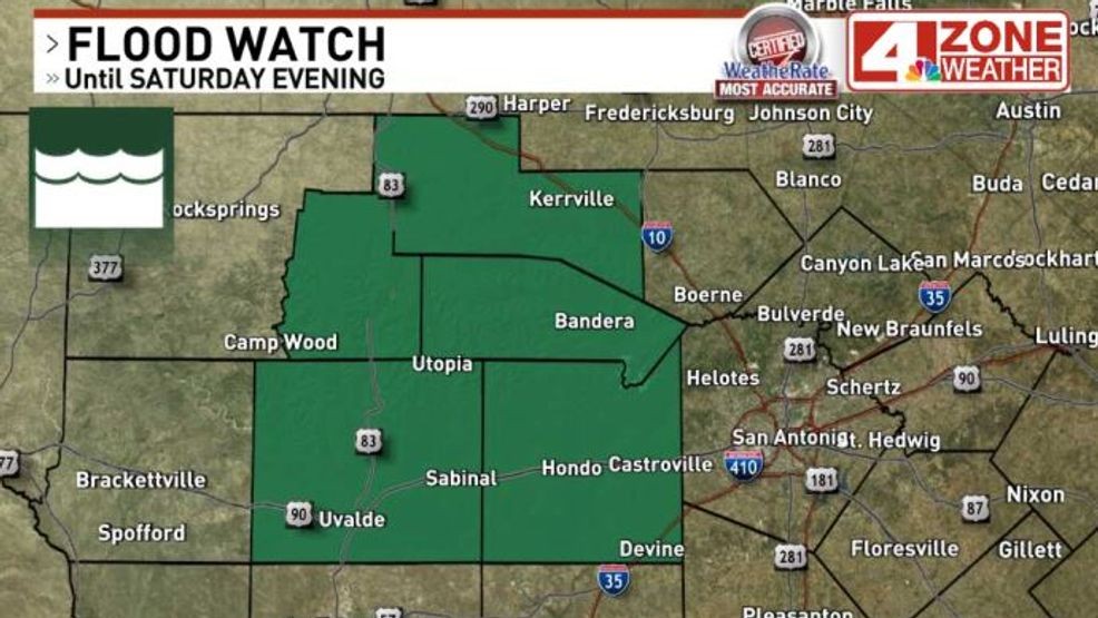
SAN ANTONIO – The National Weather Service has issued a Flood Watch for a handful of counties just west of Bexar County through Saturday evening. Isolated spots in watch area could see over 3″ of rain from thunderstorms.
The remnant mid level circulation of Invest 98L is slowly moving north tonight and already developing some showers in our southern tier counties. Eventually, a few thunderstorms will develop too through the night. The areas of rain we see will be closely tied to the track of the remnant circulation which has the best lift in the atmosphere to develop showers and storms. The expected track will be west of Bexar County through noon Saturday. This is the reason for the counties in this watch.
Through Saturday morning, we could see storms develop with high rainfall rates possibly 3″ per hour or more. The bulk of the data suggests high end rainfall totals of 2″ – 3″ are possible but with an outside chance of higher amounts, the Flood Watch covers this potential and is a good precautionary move.
Areas further east from the watch or to the west will see much less rain and in some cases, possibly no rain at all. It’s a very narrow zone following the track of the mid level circulation that has the highest potential.
Later in the day Saturday, skies turn partly sunny with only a 20% isolated rain chance through Saturday evening as the circulation moves north of the area.