PHOENIX (AZFamily) — An Extreme Watch has been issued for Wednesday, Thursday, and Friday. Areas of moderate to major heat risk will move into the Valley during this time.
Please try to limit your time outdoors from late mornings through early evenings. In anticipation of this heat risk late last week, we issued First Alert days for this Wednesday, Thursday and Friday to give you an early heads up.
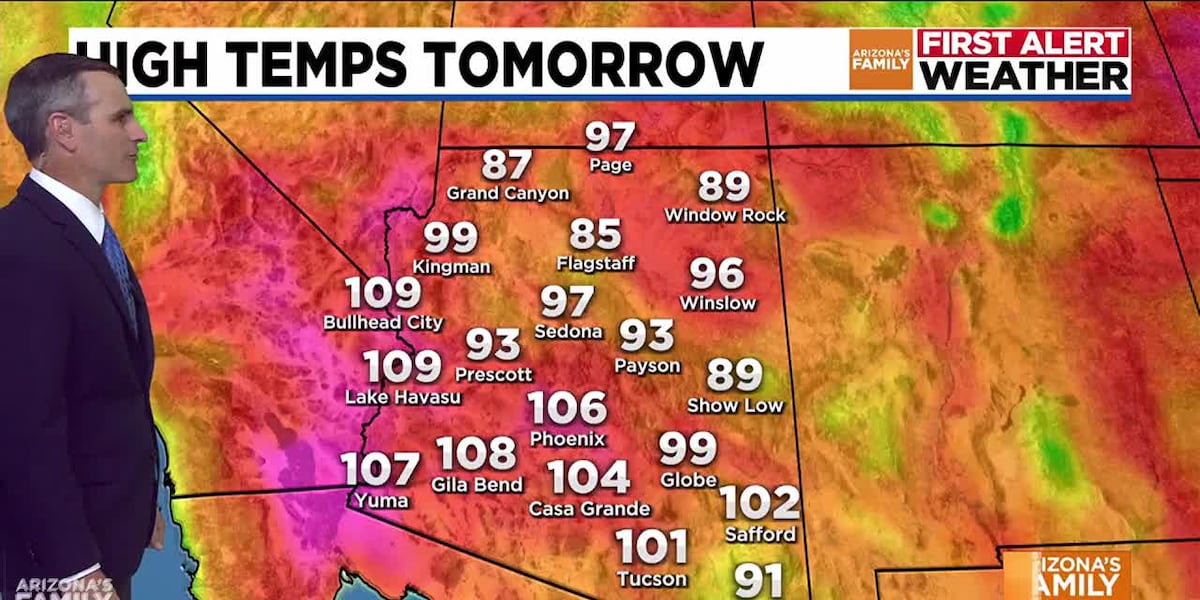
Low temperatures will drop to around 85 degrees into early Monday morning. Additionally, some clouds are possible overnight through Monday morning in the eastern part of the Valley. Highs will remain around normal on Monday, with a forecasted high of 106. As a ridge of high pressure starts to build, temperatures are expected to warm up to 109 by Tuesday.
Highs of 110 to 113 degrees are forecasted for Wednesday through Friday. The record for Thursday is 114 degrees, and 113 degrees for Friday. It’s possible we will get close to or break those records.
Some moisture starts to move back in by mid-week, which will give us a slight chance of rain in the Valley late in the week through the weekend. Stay tuned, as we will update the timing as we get closer to those days.
See a spelling or grammatical error in our story? Please click here to report it.
Do you have a photo or video of a breaking news story? Send it to us here with a brief description.
Copyright 2025 KTVK/KPHO. All rights reserved.