 Houston weather: Scattered downpours expected Thursday
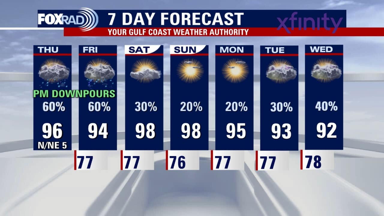
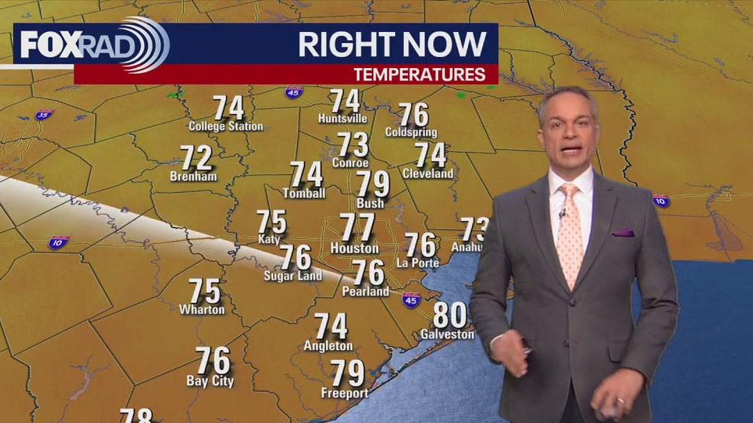
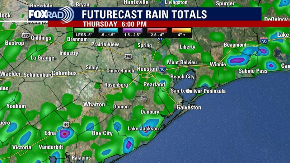
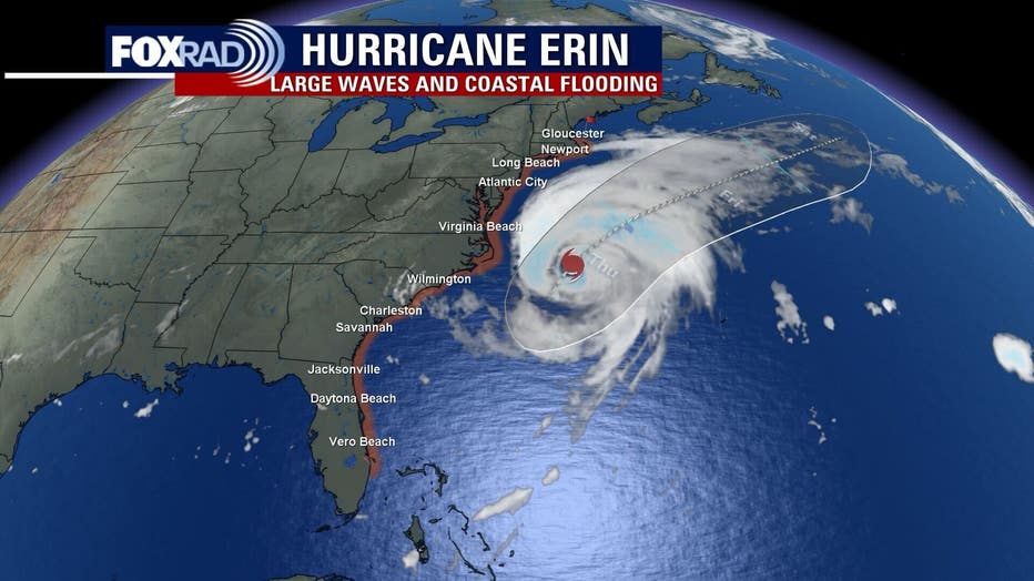
There is a low flood risk because of the chance of some scattered downpours on Thursday. Temperatures will be in the mid-90s in the afternoon. Hurricane Erin is not making direct landfall in the U.S., there is a chance of large waves and some coastal flooding is possible from Florida up to North Carolina.
HOUSTON – There is a low flood risk because of the chance of some scattered downpours on Thursday. Temperatures will be in the mid-90s for the afternoon.
Watch for storms again today and Friday
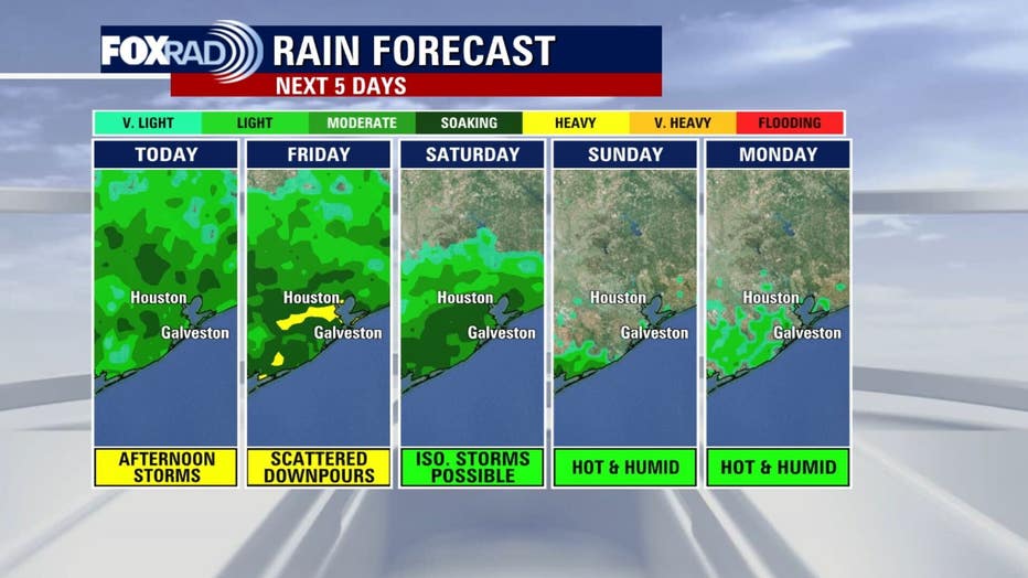
Our overall weather pattern is unchanged compared to the last few days, so expect more rounds of mostly afternoon and evening storms to move in from the north today and tomorrow. A few could be on the heavy side, so 2 inches of rain is possible and, if it falls quickly enough, it could cause some brief street flooding. Otherwise, look for hot and humid weather.
 Weekend likely to be drier, hotter
Models are mixed on when higher pressure will build in, but it looks like through the day on Saturday, we should turn toward a sunnier pattern with far fewer storms. Look for upper 90s this weekend with some lingering storms possible on Saturday. The heat index could reach 105.
 Hurricane and two tropical waves in Atlantic
The season’s first hurricane, Erin, reached major status this week, but it is now a large category 2 with maximum winds close to 100 mph. It is well offshore of North Carolina and Virginia and will not make a direct impact.
We’re watching two other tropical waves in the Atlantic.
One has a high chance to becoming a tropical storm, but it is not expected to come anywhere near us. A second wave, much farther away in the eastern Atlantic, could develop next week, so we’ll watch it longer term, but for now, we’re in good shape along the Texas Gulf Coast.
The Source: Your Gulf Coast Weather Authority