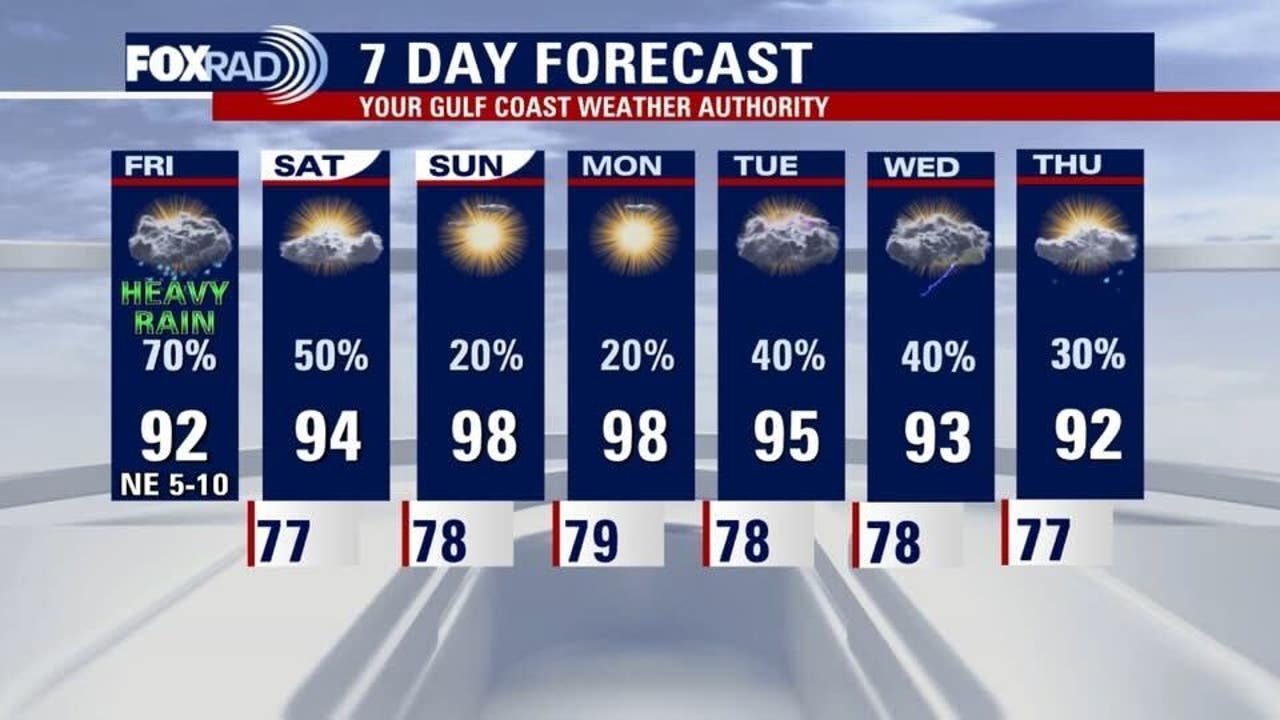
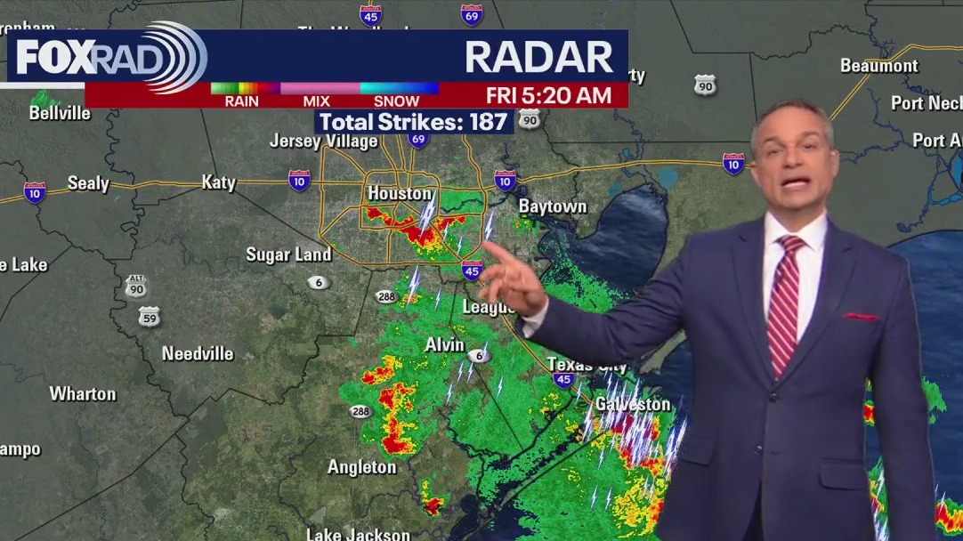
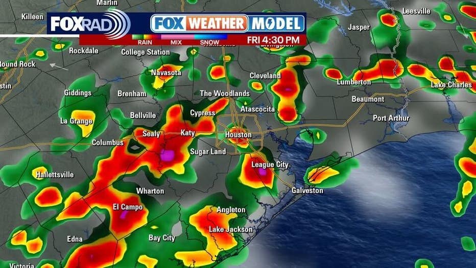
HOUSTON – There is a FOX 26 Storm Alert for late this afternoon as scattered, heavy storms are expected between 2–9 p.m. Otherwise, Friday is mostly cloudy and muggy with highs in the low to mid 90s.
More heavy downpours
The Houston area is under an atmospheric feature called an upper-level trough – basically we’re in between high pressure systems and the point where moisture comes together has been right on top of us.
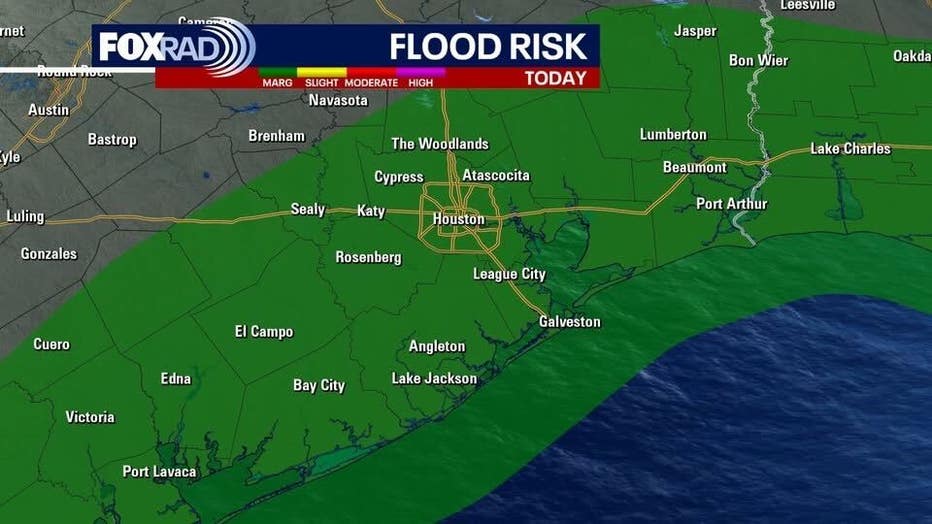
This resulted in more than 3″ of rain in Fort Bend County on Thursday and could bring similar amounts to a few spots again today.
As a result, we’re using our “Fox 26 Storm Alert” to advise you to be weather aware and to check in with us for updates on Fox Local and our weather app if the expected downpours materialize.
 Gradual clearing this weekend
Models have been mixed on Saturday, but are leaning toward at least scattered showers and a few storms, so watch for that, especially from Houston southward.

Otherwise, look for highs in the mid 90s on Saturday and probably some upper 90s on Sunday with only isolated rain.
Hurricane, tropical waves in Atlantic
Hurricane Erin is quickly becoming “extra-tropical” as it moves away from the US East Coast and becomes a cold weather windstorm in the north Atlantic. It may bring wind and rain to Iceland and Ireland early next week.
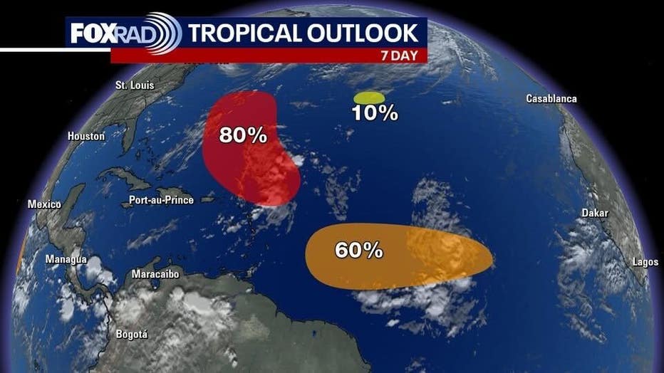
Elsewhere, a tropical wave could become Fernand and will follow a similar path to Erin – avoiding any U.S. landfall. It’s likely to be a much smaller system.
Behind that, another wave should be slow to develop as it moves toward the Caribbean. Models are not showing it doing much just yet, but it’s one to watch longer term.
The Source: Your Gulf Coast Weather Authority