
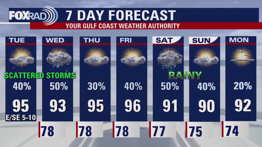
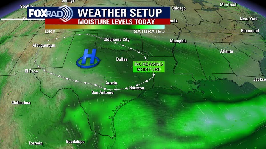
HOUSTON – A ridge of high pressure has weakened and moved into West Texas, so our chances for a daily round of afternoon rain is back in the forecast.
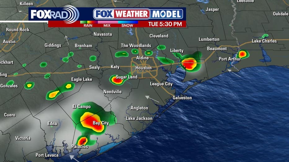
Watch for pop-up showers and storms today and tomorrow, then possibly less on Thursday, followed by the chance for heavier rain late Friday into the weekend.
 Much of the country cooler, not here
Temperatures this morning dropped to near 50 degrees in parts of the Midwest and Great Lakes, but our only hope for “cooler” air could arrive briefly this weekend or early next week. It’s nothing to get too excited about, but the temperature could drop about three degrees for a day or so.
In the meantime, expect near-average temperatures locally with lows in the mid 70s and highs in the mid 90s.
Tropics remain quiet for now 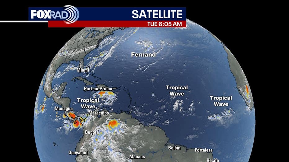
Tropical Storm Fernand is not going down in the history books as anything remarkable. It should fizzle later today and tomorrow as it heads into the colder water and harsh jet stream current in the north Atlantic.
Elsewhere, there are a few weak tropical waves including one in the Caribbean that are unlikely to organize over the next few days.
The Source: The information in this article comes from the FOX 26 weather team.