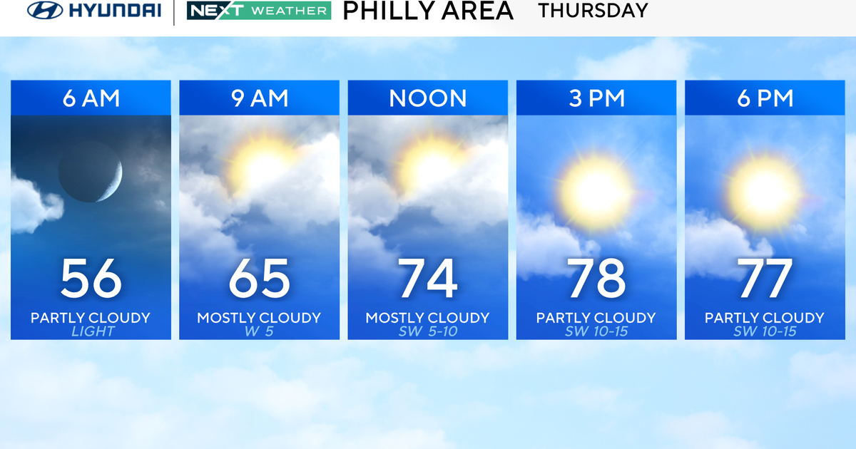
Clouds will stream in from the southwest overnight and give way to partly sunny conditions to start off Thursday morning in the Philadelphia area.
Temperatures start in the 50s to near 60 degrees Thursday morning, but some spots may quickly dip into the 40s in our western areas, especially in the Poconos. With the very dry air in place, temps will climb back into the upper 70s Thursday afternoon, even hitting 80 in spots around the Philly area.
While high pressure will be the dominating weather feature over the next couple days, by Thursday night, a cold front will start to approach the region from the northwest.

CBS News Philadelphia
The front on Thursday evening and Friday may bring a stray shower or two, but no significantly impactful weather is expected. The chance for rain is down to about 10%, so I wouldn’t bet on getting any moisture. The Drought Monitor will be released Thursday, and it’s likely more of our area will bump back up to “abnormally dry.”
Hard to believe Labor Day weekend is Saturday and Sunday. Labor Day itself is on Monday, which is the actual start of meteorological fall. If you are not ready for summer to end, don’t worry because the official start of fall is still four weeks away on Sept. 22.
Right now, the forecast looks great for the holiday weekend across the entire region. High temperatures will still be a little cooler than normal, but plan on plenty of sunshine and dry conditions.

CBS News Philadelphia
Looking ahead to next week, no major weather systems are in the near future, and the tropics remain eerily quiet with only the remains of Fernand moving up into the north Atlantic.
Here’s your 7-day forecast:

CBS News Philadelphia
Thursday: Decreasing clouds. High 80, Low 55.
Friday: A stray shower? High 79, Low 63.
Saturday: Sunny skies. High 77, Low 55.
Sunday: Mostly sunny. High 80, Low 56.
Monday: Mostly sunny. High 81, Low 57.
Tuesday: Partly cloudy. High 82, Low 58.
Wednesday: Partly cloudy. High 80, Low 58.
More from CBS News