FORECAST HIGHLIGHTS
-
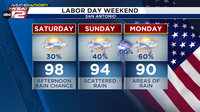
SATURDAY: Isolated afternoon storms
-
SUNDAY: Scattered storms likely to start in the afternoon then come and go through the night
-
LABOR DAY: Scattered storms
-
IMPACTS: Quick 1″-3″ from any storm/downpour … localized street flooding
FORECAST
STILL HOT SATURDAY, AFTERNOON ISOLATED STORMS
A cold front will stall north of San Antonio on Saturday. This will keep us hot and help to touch off a few storms during the afternoon starting in the Hill Country, then drifting south toward San Antonio and other areas. Like today, the best chances for storms will be along and north of I-10.
FRONT FOR SUNDAY INTO MONDAY
Rain chances will build through the weekend, peaking in intensity from Sunday into early Monday. While it won’t be a total washout, locally heavy downpours could lead to isolated flash flooding, especially in parts of the Hill Country and southern Edwards Plateau. Lingering rain is possible through Monday afternoon, but cooler air will follow, with highs dropping to near 90°.
A quick 1″-3″ is possible from any downpour throughout the holiday weekend. (Copyright 2024 by KSAT – All rights reserved.)
Locally heavy rain is possible with rainfall amounts ranging from 1 to 3 inches. Abundant moisture will fuel afternoon and evening thunderstorms, especially across the Hill Country, Edwards Plateau, and along the I-35 corridor. While widespread flooding isn’t expected, slow-moving storms and repeated downpours could lead to urban and small stream flooding, prompting a marginal risk (level 1 of 4) for flash flooding across the region.
San Antonio extended forecast. (Copyright 2024 by KSAT – All rights reserved.)Daily Forecast
KSAT meteorologists keep you on top of the ever-changing South Texas weather.
QUICK WEATHER LINKS
Copyright 2025 by KSAT – All rights reserved.
