- A Wind Advisory is in effect for coastal Duval and St. Johns counties until 5 p.m. Monday. Winds are occasionally gusting above 30 mph.
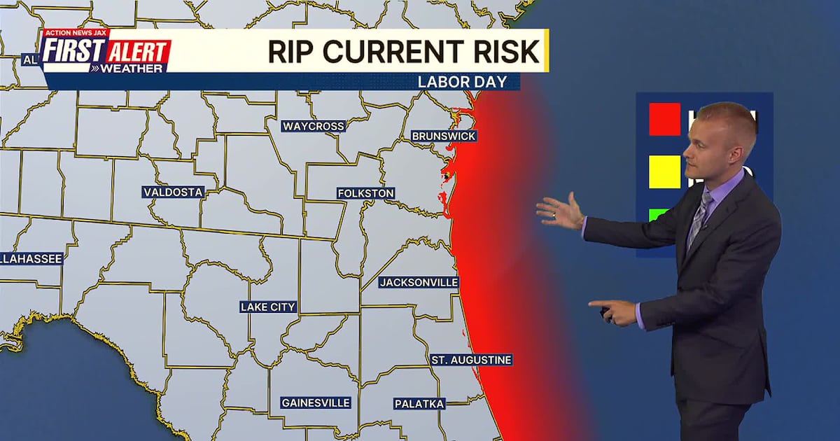
- The combined gusty winds and wind direction from the northeast is producing rough and dangerous seas & surf. Wave heights this morning at offshore buoys (7-8 ft.) are higher than they were with Hurricane Erin’s closest approach! Thus, a high risk of rip currents is in effect at all local beaches.
- The onshore wind is producing occasional showers moving inland, most frequently south of Jacksonville. This will continue at times through Labor Day with plenty of clouds.
- North of Jacksonville and especially into Georgia, there will be more sunshine making for a pleasant holiday.
- Temperatures area-wide today will be cooler than average in the 80s.
- We gradually warm up through this week, back into the 90s by Friday.
JACKSONVILLE, Fla. — TROPICS:
- No active storms.
- A tropical wave just emerged off the coast of Africa and could develop in the long-range over the open ocean.
- The next name is Gabrielle.

TODAY: Partly to mostly cloudy with a few breezy showers, mainly in north Florida. Dry and nice in GA. HIGH: 84
TONIGHT: Partly cloudy with a few coastal showers. LOW: 71
TUESDAY: Partly cloudy and breezy with a few showers. 71/86
WEDNESDAY: Partly cloudy with a few showers. 70/87
THURSDAY: Partly cloudy with a few showers. 71/89
FRIDAY: Partly to mostly sunny and warmer, isolated shower. 70/90
SATURDAY: Partly to mostly sunny and hot, isolated shower. 71/94
SUNDAY: Partly cloudy and hot with a few showers. 73/94

WATCH THE FORECAST | DOWNLOAD THE APPS
Follow Action News Jax Meteorologists on Twitter for updates:
Mike Buresh | Garrett Bedenbaugh | Corey Simma | Trevor Gibbs
ALLERGY TRACKER: See what the pollen counts look like in our area
LISTEN: Mike Buresh ‘All the Weather, All the Time’ Podcast
INTERACTIVE RADAR: Keep track of the rain as it moves through your neighborhood
SHARE WITH US: Send us photos of the weather you’re seeing in your area ⬇️