There is no longer a severe thunderstorm watch in effect, but showers will continue into Sunday.
At this point, the only weather threat left on the table is flash flooding, mainly in spots that have already seen a lot of rain.
A few areas southeast of I-95 could still pick up an inch or two overnight, so low-lying neighborhoods and poor drainage spots are worth keeping an eye on.

CBS News Philadelphia.
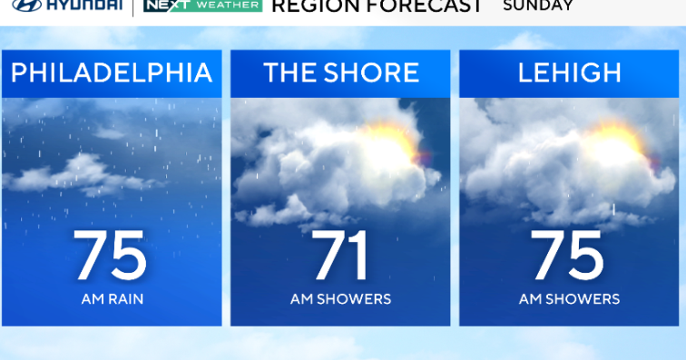
Through Sunday, clouds will hang tough, and so will a few lingering showers, especially in the morning. As the day wears on, the system will finally push east and allow drier air to filter in.
With the cooler air mass behind the front, highs will be knocked back into the low and mid-70s. It’ll feel noticeably different compared to the warm, humid stretch we just had.

CBS News Philadelphia.
By Sunday night, high pressure builds in, and we get a break.
Monday and Tuesday bring a quieter setup with partly sunny skies and comfortable highs in the 70s.
A coastal low may swing close enough by midweek to throw extra clouds our way and perhaps a few showers along the coast, but overall, the start of the week trends calmer and drier.

CBS News Philadelphia.
Here’s your 7-day forecast:

CBS News Philadelphia.
Sunday: A.M. showers. High 75, Low 64.
Monday: Sunny and mild. High 76, Low 55.
Tuesday: Partly cloudy. High 77, Low 55.
Wednesday: Partly cloudy. High 77, Low 59.
Thursday: Sunny skies. High 82, Low 58.
Friday: Beautiful. High 80, Low 60.
Saturday: Gorgeous. High 78, Low 57.
More from CBS News